Baigup Wetland Interest Group
Baigup Wetland Interest Group (BWIG) began in late 2012 as a virtual community network of people who care about Baigup Wetlands. Baigup is a valuable area of natural remnant vegetation lying across the border of Maylands and Bayswater on the Swan River flood plain. Our aim is to see Baigup protected and preserved into the future as an important natural resource for wildlife, the health of the Swan River and for human recreation, wellbeing and education.
A major objective is to encourage community interest by building awareness of Baigup’s history, natural assets, and management challenges through community activities and education. An electronic newsletter is issued four times a year (see below for past copies and a registration button). Additional notices are also sent out to local residents when weeding and planting days or other activities are scheduled. The group also maintains a Facebook page. We work with reserve managers and volunteers from various organisations to restore the Wetlands to a level of biodiversity capable of providing habitat or refuge for as wide a range of birds, animals, and terrestrial and aquatic invertebrates as possible while at the same time maximising the amenity of this beautiful location for City of Bayswater residents and other visitors.
Baigup Wetlands

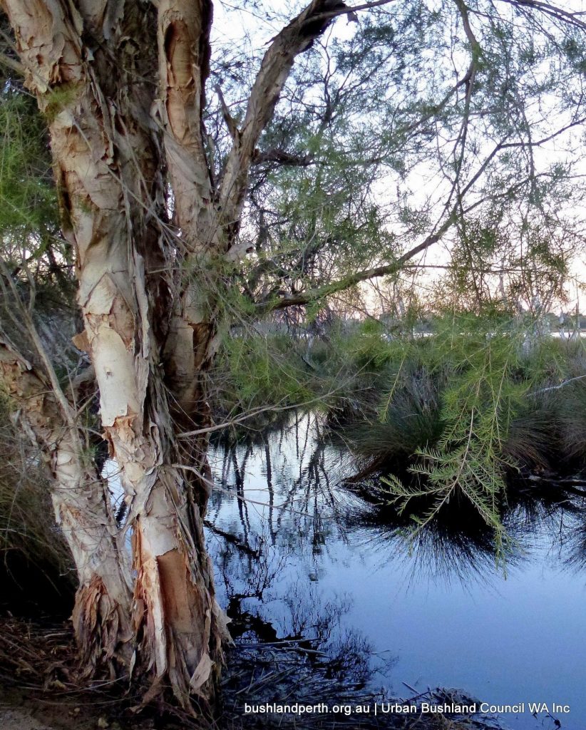
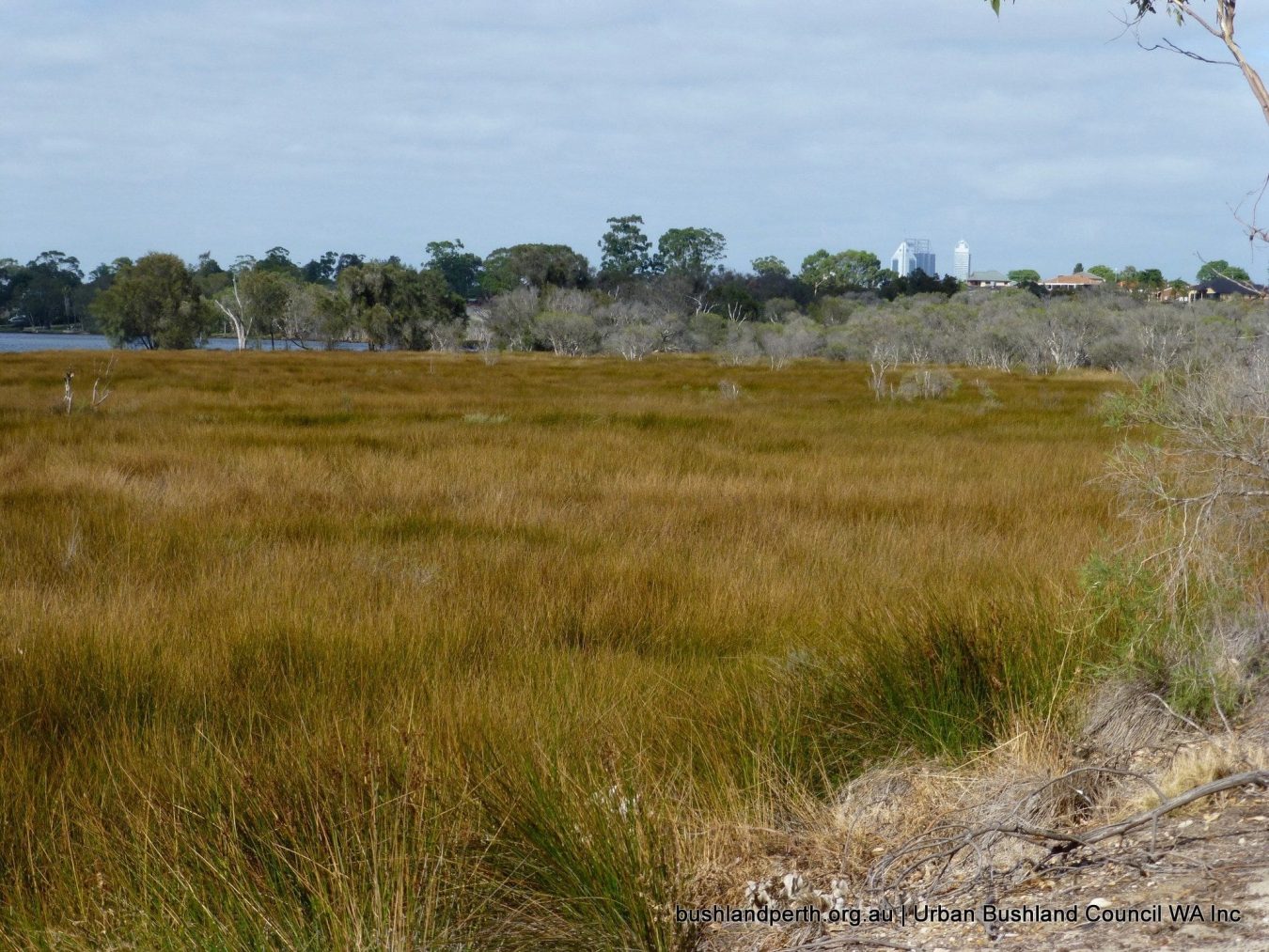
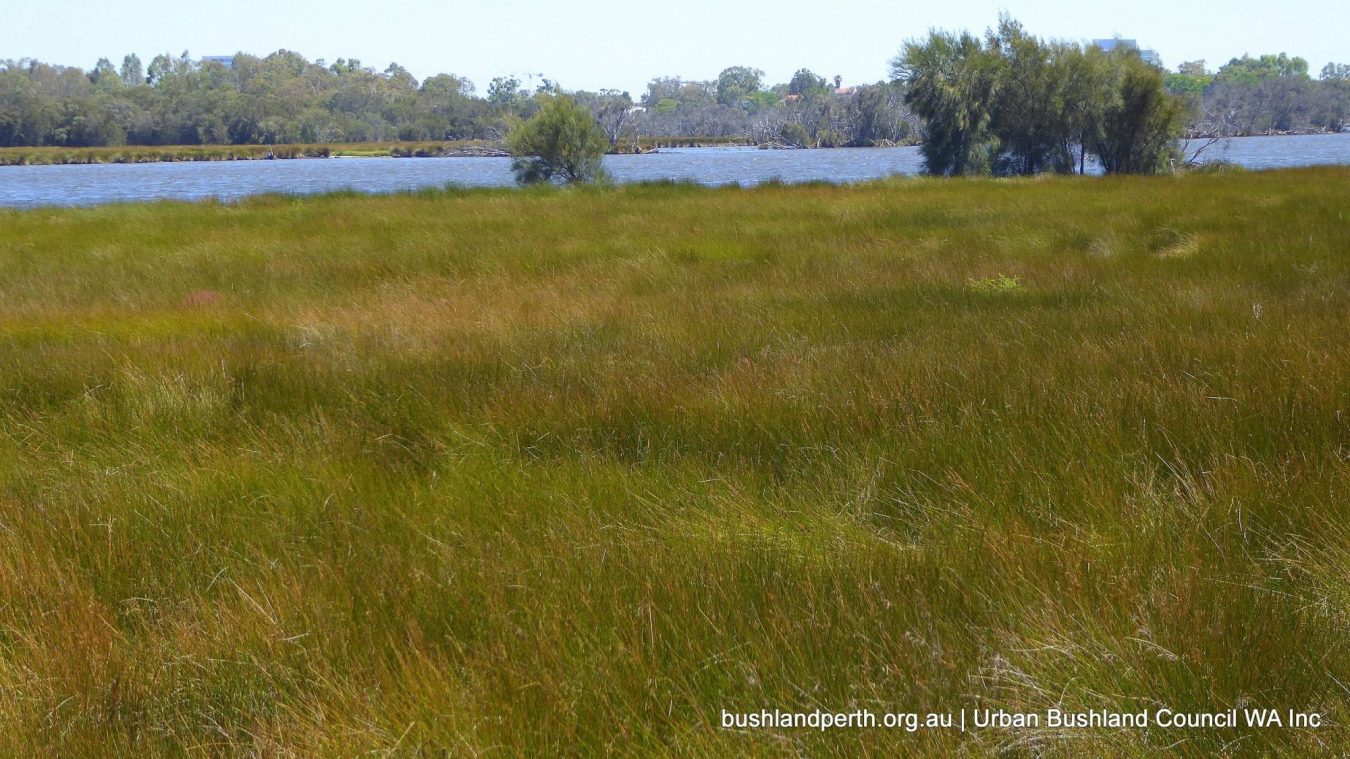
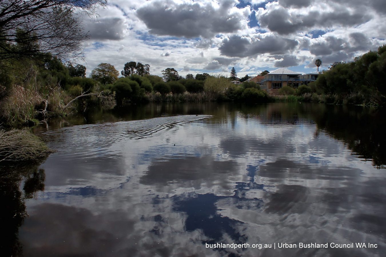
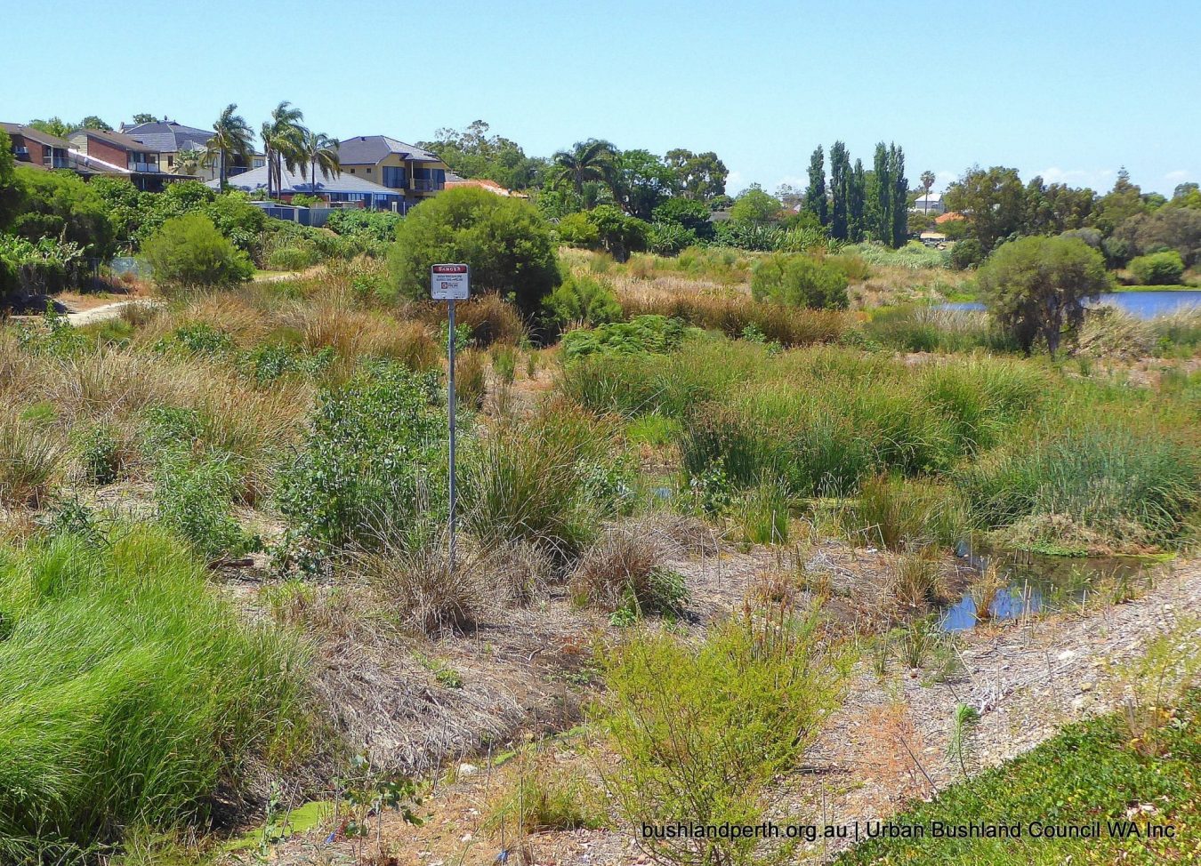
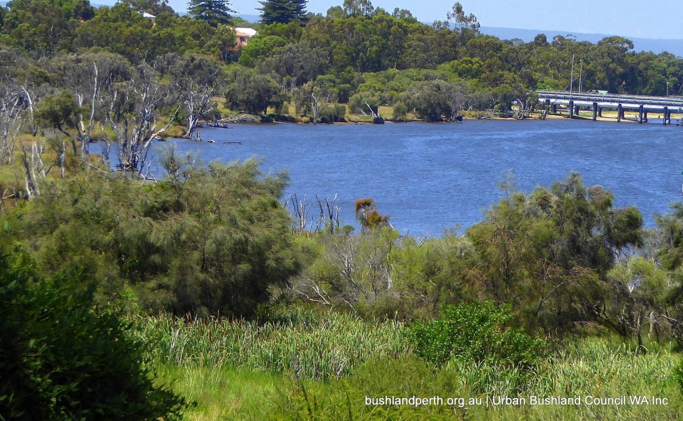
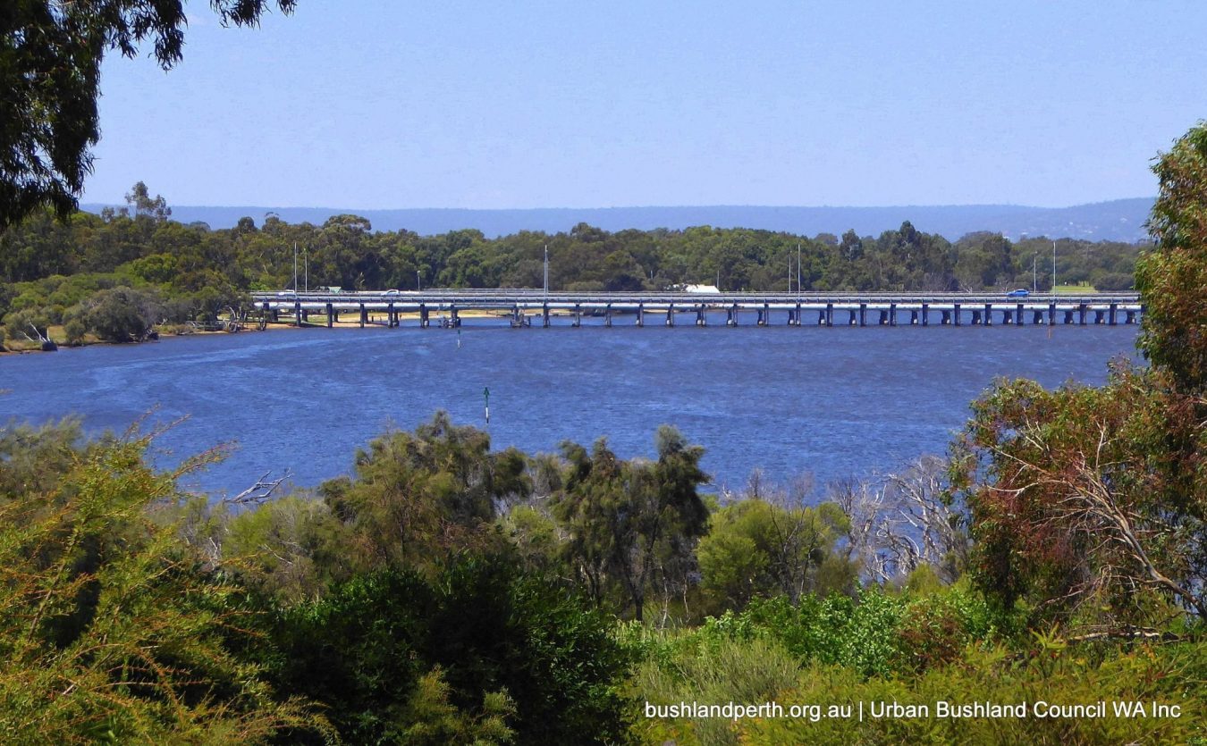
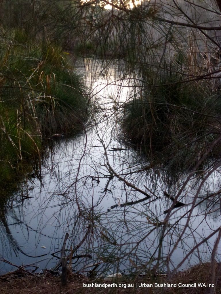
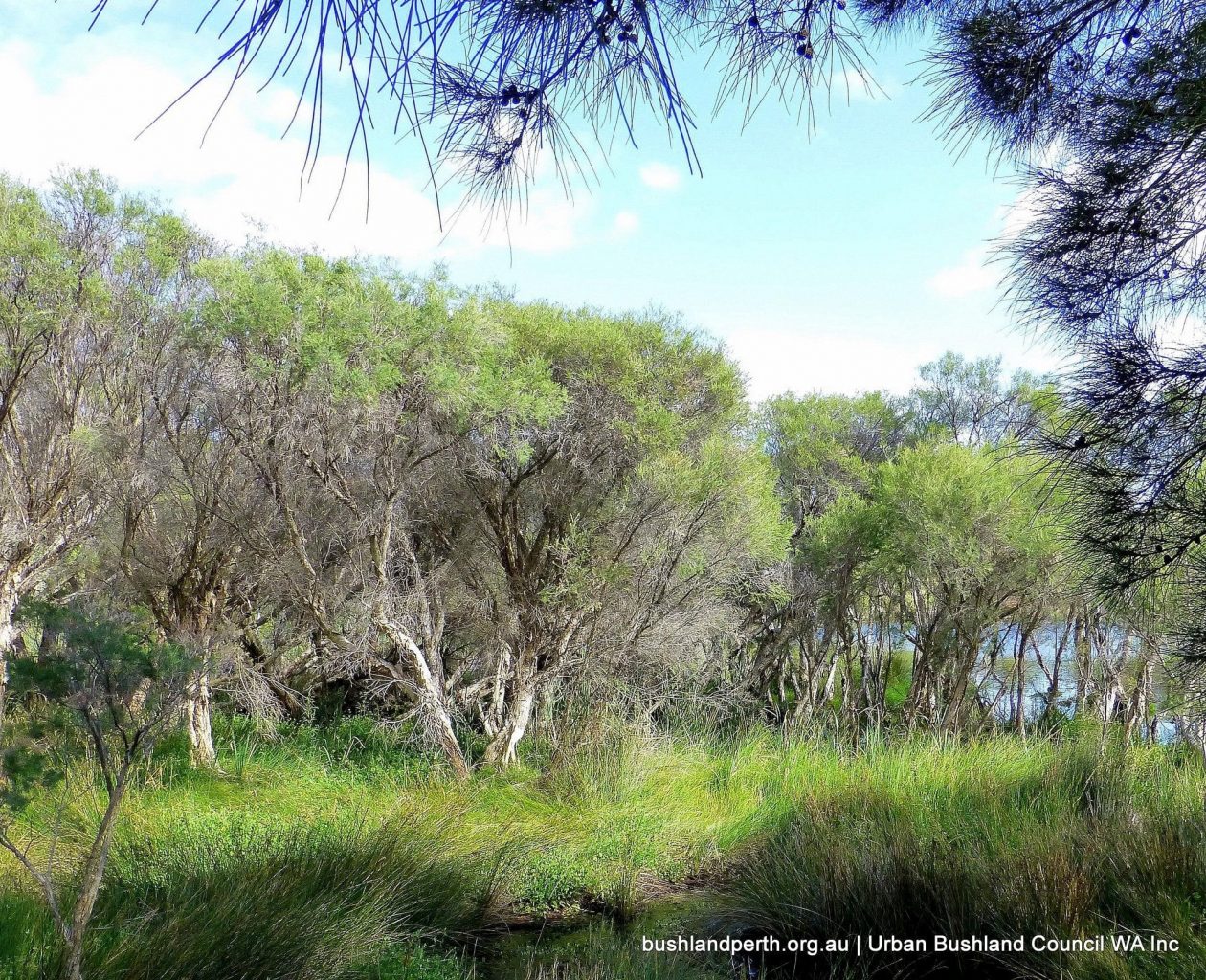
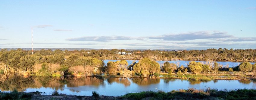
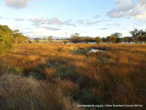
Baigup Wetlands covers 16.4 ha in total. It extends about 1km downstream from Garratt Road Bridge in Bayswater to below the juncture of Kelvin Street and Swan View Terrace in Maylands. It features extensive near pristine sedge plains along the river where endemic Juncus kraussii dominates with an over-story in some sections of remnant Freshwater Paperbarks (Melaleuca rhaphiophylla) and Flooded Gums (Eucalyptus rudis). Extensive wetlands, including freshwater swamps, tidal marshlands, acid/saline scalds and two constructed lakes, as well as the river, attract a variety of birds year round.
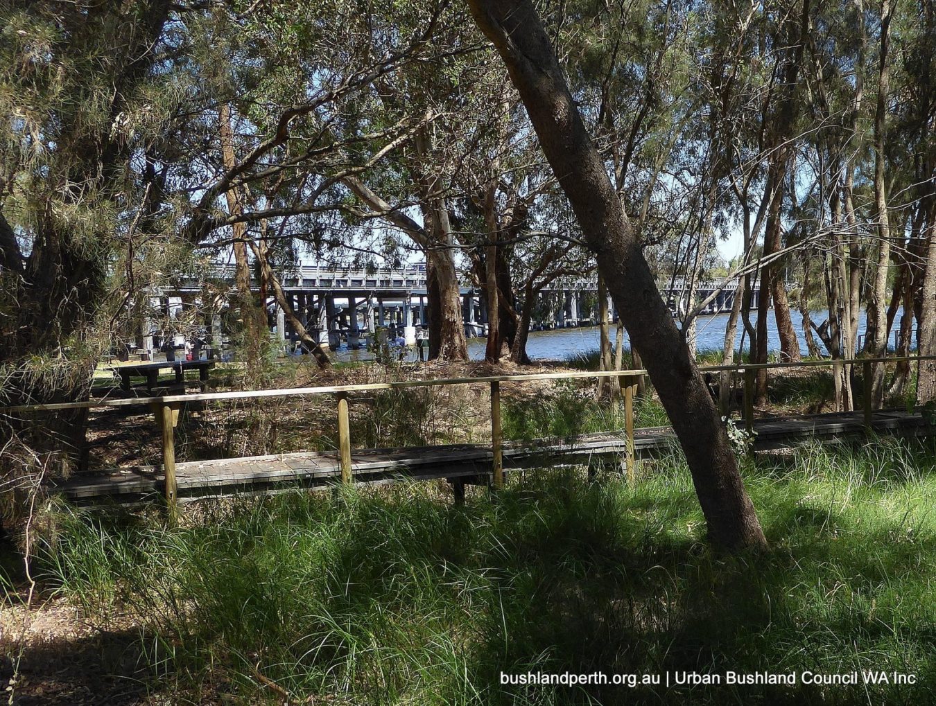
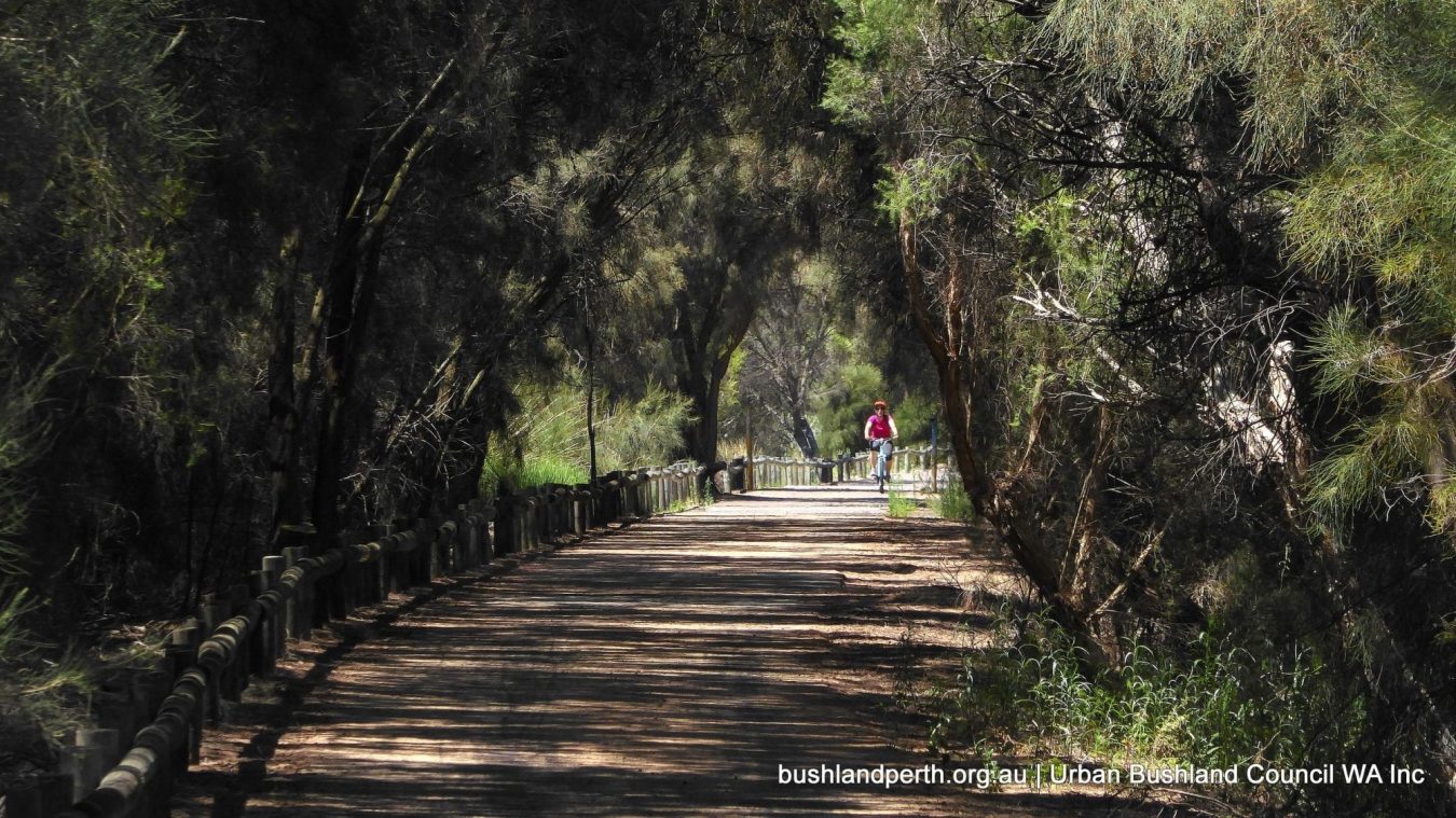
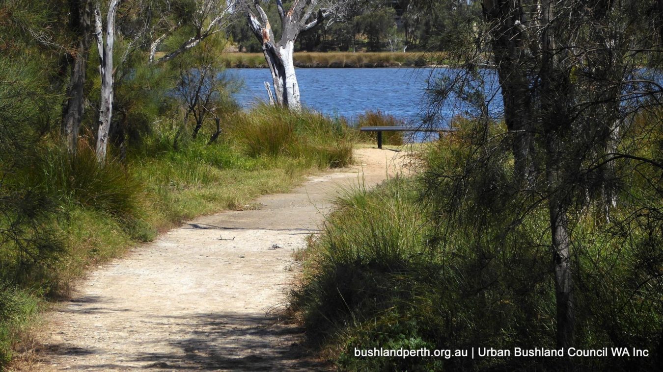
A high use dual purpose sealed walkway/cycle path runs longitudinally through the reserve more or less parallel with the river.
The Maylands section of Baigup (5.2 ha) is a Crown Reserve managed by City of Bayswater (COB). The Bayswater section (11.2 ha) is mostly freehold land owned by the Western Australian Planning Commission. This portion is currently managed by the Department of Planning, Lands and Heritage (DPLH). A small area of Unallocated Crown Reserve near the river, plus the Swan Lake Main Drain easement which runs from Stone Street at the back of the reserve to the river, are also included in the Bayswater section.
A pdf copy of the current 2014-2024 Management Plan can be accessed here.
Baigup Wetlands is listed nationally as an increasingly rare example of a Temperate Coastal Saltmarsh Threatened Ecological Community (TEC). It is also part of Bush Forever Site 313 which includes both sides of the river from the end of Maylands Peninsula to Garratt Road Bridge. Being part of the Swan River floodplain with its rich and ancient cultural heritage, Baigup is also a recognised site of continuing significance for the Noongar people of Western Australia’s Southwest (see more below).
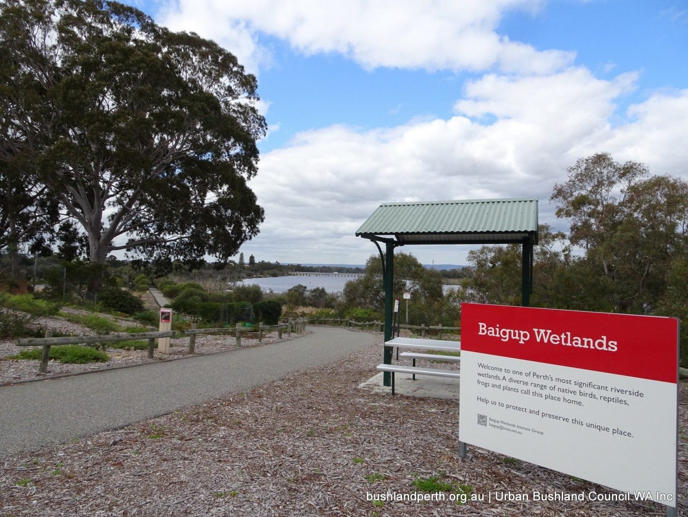
Access
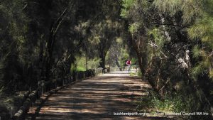
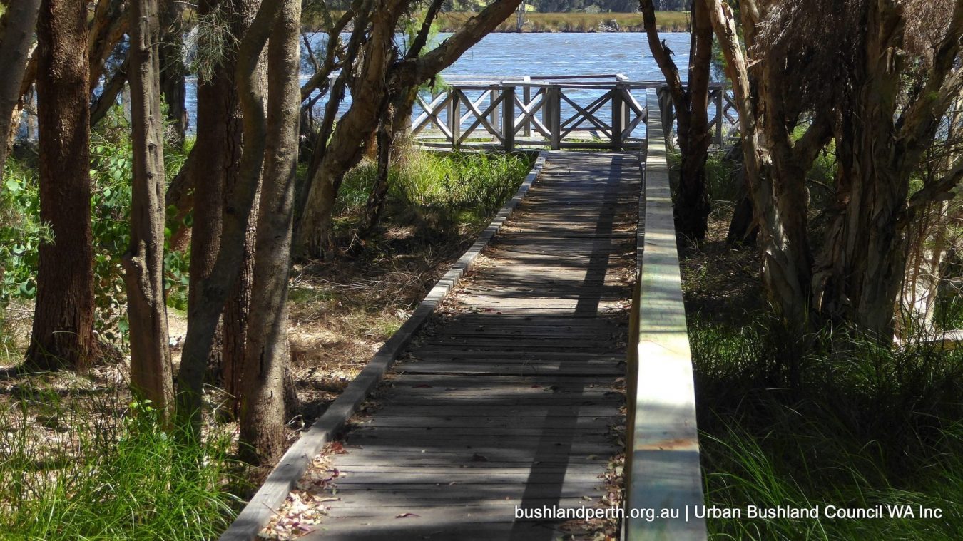
Access into Baigup is via a wheelchair accessible sealed walkway/cycle path which runs longitudinally through the reserve parallel to the river. Parking, toilets, children’s playgrounds and picnic facilities are available in Hinds Reserve at the end of Milne Street in Bayswater. A short walk under Garratt Road Bridge brings you into the Wetlands. The Maylands entrance at the foot of Kelvin Street is best approached walking or cycling as there is limited parking in surrounding streets at that end.
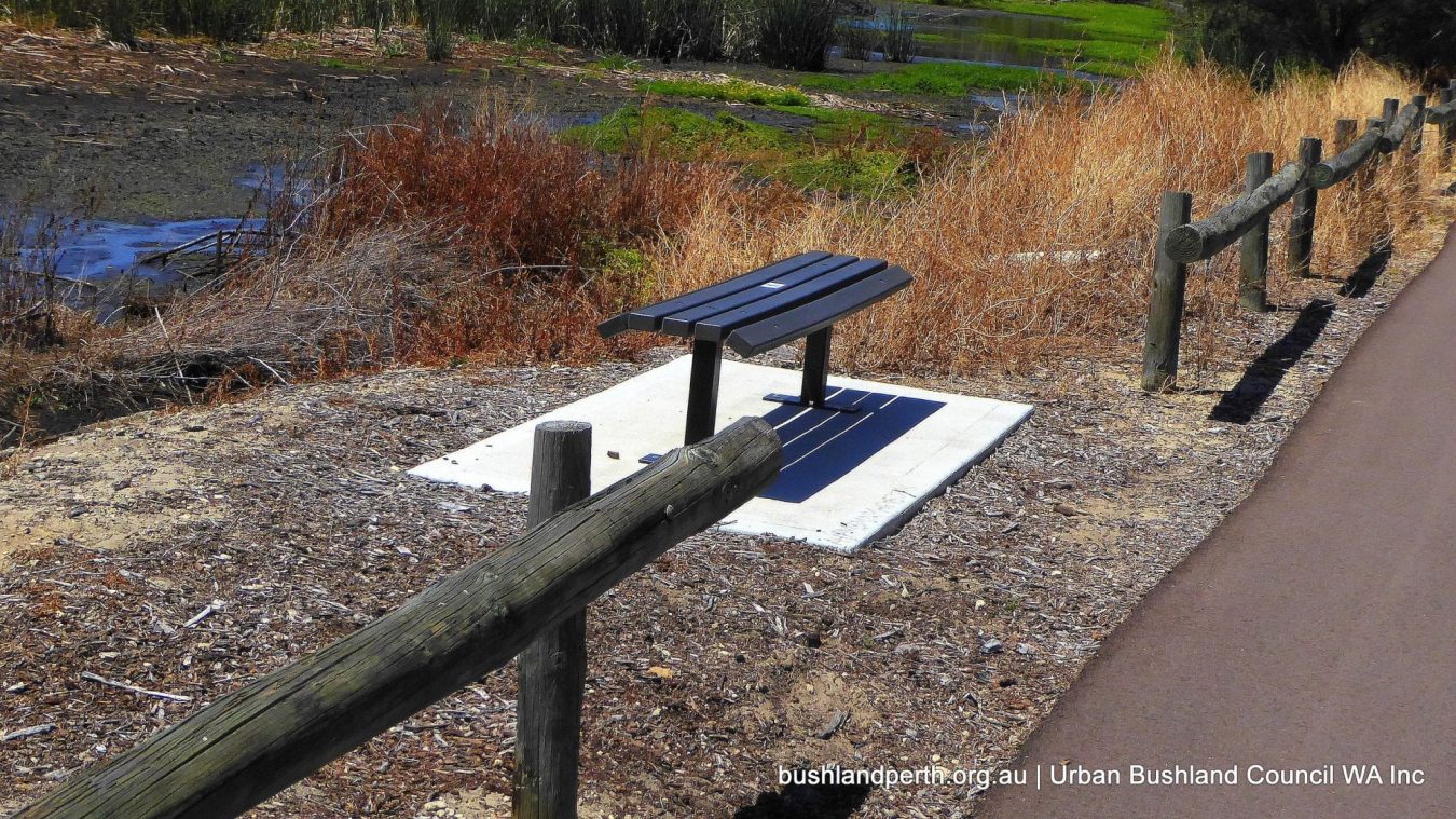
Rough limestone tracks provide further access for able bodied walkers around the back of the reserve below the houses in Stone Street and Garratt Road and also down to the river to a spot locally known as Judy’s Seat. The remnants of an old fishing seat made of sleepers can still be seen near the new bench which provides a convenient half way spot for bird watching, contemplating the river, or fishing.
Whadjuk Noongar Heritage
The original riverside swamps provided Noongar people with a rich and varied supply of food, including marsupials, fish, crustaceans, shellfish, birds, eggs, and a wide range of plant based foods. Aboriginal people typically spent the summer months camping on higher ground above the river and enjoying the abundant resources of areas like this along the river. In cooler weather they moved inland and toward the coast as the river typically filled and spread extensively following winter rains. Like Indigenous Australians everywhere, Whadjuk Noongar actively managed the land by systematically burning small areas of their land at different intervals of time depending on vegetation type, seasons, and management objectives, e.g. to provide fresh pickings for kangaroos, to control the spread of particular plant species, etc.
The result was a mosaic of different ecological niches, carefully sustained to provide the conditions for different plants and animals to thrive and to ensure accessibility and availability at predictable times through the year. All this changed when the Swan River Colony was established in 1829. European land allocations were made very early along the river which for many decades to follow provided the most efficient access to what is now Perth. The original owners were generally forcibly moved off their land into the degradation and danger of rough camps on the fringes of new settlements or equally unhappy displacement into the lands of neighbouring Noongar groups north, south and east.
The name Baigup means ‘place of rushes’ in in one of the many original dialects of the Noongar language. For insights into the continuing values of Baigup for Whadjuk Noongar today, the video Baigup Biidii – Path to Place of Rushes is very informative. The Audio Trail Baigup Biddi is accessible via the Geotourist app as you walk through the reserve, or on the web. Audio from the video is paired in this case with photos taken by Baigup Wetland Interest Group members. QR codes at intervals along the walkway also provide additional information about Baigup via Western Australia’s Virtual Trail network.
European and Chinese uses of the land

After Europeans appropriated the land along the river during the 1800s, the dryer parts were used to pasture cattle and goats. From the late 1800s until at least the 1930s some sections of what is now Baigup were cultivated by Chinese market gardeners who lived in Mary Street (now Stone Street) above the reserve. Home owners in Stone Street continued to maintain private vegetable gardens, fruit trees and goat pastures on the river flats into the mid 20th Century.
Market gardening may have continued alongside Garratt Road until the second bridge was built to create a dual road across the river in 1972. Old aerial photographs show remnants of irrigation channels until the 1970s. The original bridge linking Bayswater and Ascot on the upstream side was built in 1935. Baigup wetland is unusual along this stretch of the Swan River in that it has never been used as an official landfill site, although dumped building rubble is found in several locations.
The current status of the land
City of Stirling made the Maylands section of Baigup a Crown Reserve before the suburb was absorbed into City of Bayswater in the late 1980s. Answers to Questions in State Parliament in October 2016 included the information that the then Department of Planning had taken back interim management of the Bayswater section. The Answers also stated that: “Resolution of management of all Bush Forever sites is intended to be resolved as part of the Strategic Assessment of the Perth and Peel Regions” and: “The WAPC [previously] leased the land to the City of Bayswater with the intention that the land would be added to Crown Reserve 24708 [the Maylands portion]… together with the vacant Crown land [near the river]. The whole of the wetlands would then be placed under the management of the City of Bayswater.” Our group has received verbal confirmation that this is still the intention once unresolved issues between COB and DPLH have been resolved. The whole of Baigup Wetlands will then become a Class A Nature Reserve vested in the Crown.
Dramatically changed hydrological regimes and vegetation patterns
Any privately owned land in what is now Baigup Wetlands was resumed by the Government in the 1980s, first to allow for a major gas pipeline to be installed through the swamp in 1986 and then deep sewerage along the back of the reserve in 1989. When domestic uses of the land ceased, massive invasion of perennial and annual weeds occurred and remain a major and continuing challenge for the land managers to this day.
Extensive stands of Bullrushes (Typha orientalis) and Pampas Grass (Cortaderia selloana) at the Maylands end were regularly fired by local residents (when the wind was blowing toward Ascot and Belmont, it is said) to reduce the associated fire hazard.
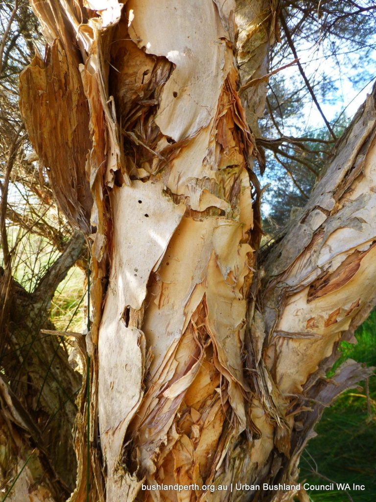
However, frequent fires of the intensity generated by these plants undermined the integrity of healthy clumps of Freshwater Paperbark (Melaleuca rhaphiophylla) and Western Australian Swamp Sheoak (Casuarina obesa). Mature trees were damaged or killed along with seedlings and any natural understory that had persisted in the wetter areas from pre-European times. Today there are relatively few such species although the delightful perennial Slender Myoporum (Myoporum caprariodes) and Centella/Gotu Kola/Asiatic Pennywort (Centella asiatica) along with seasonal Creeping Brookweed (Samolus repens) and Sea Celary (Apium prostratum) are four plants that persist and continue to delight those prepared to look for them. Unfortunately, C. obesa has been extensively replaced by the weedy C. glauca a weedy swamp sheoak that spreads by suckering.
Fires have also occurred in the sedge plains, the most recent major instance in late December 1992. Such fires can be especially problematic if the peat in which the dominant Juncus kraussii grows catches fire. It can smoulder for weeks with the potential to release naturally occurring heavy metals into the atmosphere in the smoke. Acid saline scalds at the eastern end of the reserve can also be exacerbated for years after such fires, creating a range of further problems.
In addition to the effects of decreased rainfall and reduced annual flooding in recent decades, the most important persisting local impact on water movements and associated vegetation complexes is the result of retaining the original gas pipeline access track as the current high use sealed path through the reserve. This artificial causeway has, over the last 30 years, created dramatically different hydrological regimes on either side.The river side of the path is strongly saline, while some sections of the landward side, particularly at the Maylands end, are high quality fresh water wetlands.
Although 11 culverts under the path allow some passage of water in and out of the landward side of the reserve, these could never replicate the natural tidal regime. They were in fact further modified in the mid 2000s in an attempt to hold fresh water over the acid/saline scalds.
The purpose of this intervention is to reduce the spread of the scalds, reduce Salt Marsh Mosquito problems and reduce the potential for sulphuric acid generation with associated offensive odours in the vicinity of housing. Over the last 10 years it has became clear that the culvert intervention had never been given a chance to work properly because the locations of three of the original culverts had been lost and modifications to some of the culverts were not high enough to achieve the desired result. BWIG applied in 2017 for a State Government Community Rivercare Project grant to remedy this situation.
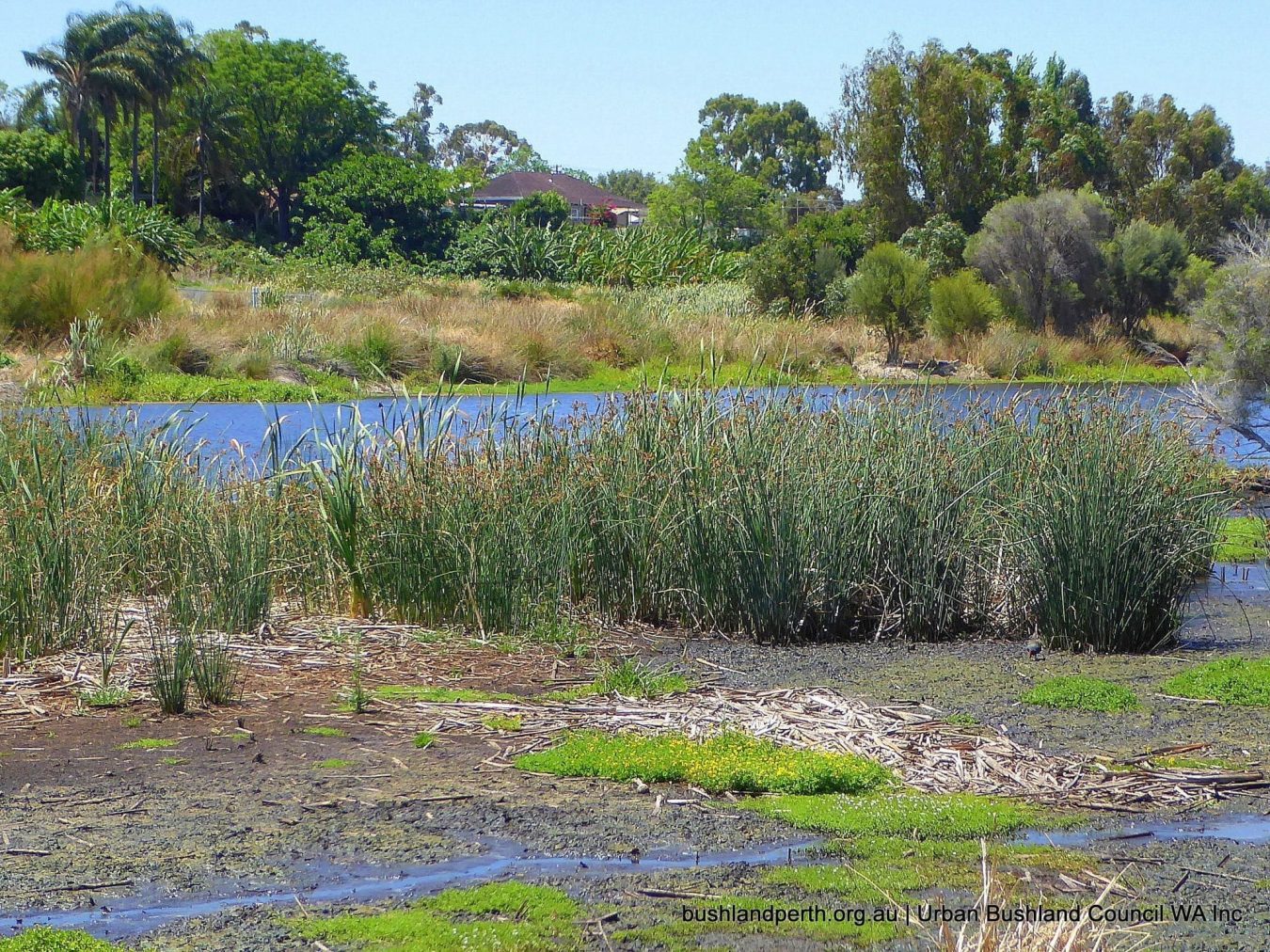
Two valuable constructed lakes
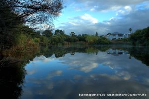
The lake known as the Primary Lake on the Bayswater side of Baigup was constructed in 2000 in an early attempt to create a nutrient stripping environment to clean storm water entering the Swan River via the Swan Lake Main Drain. The Secondary Lake in the Maylands Crown Reserve was constructed in 2001, partly to provide visual amenity for local residents but also in an attempt to reduce the fire hazard associated with the large expanses of perennial weeds mentioned above.
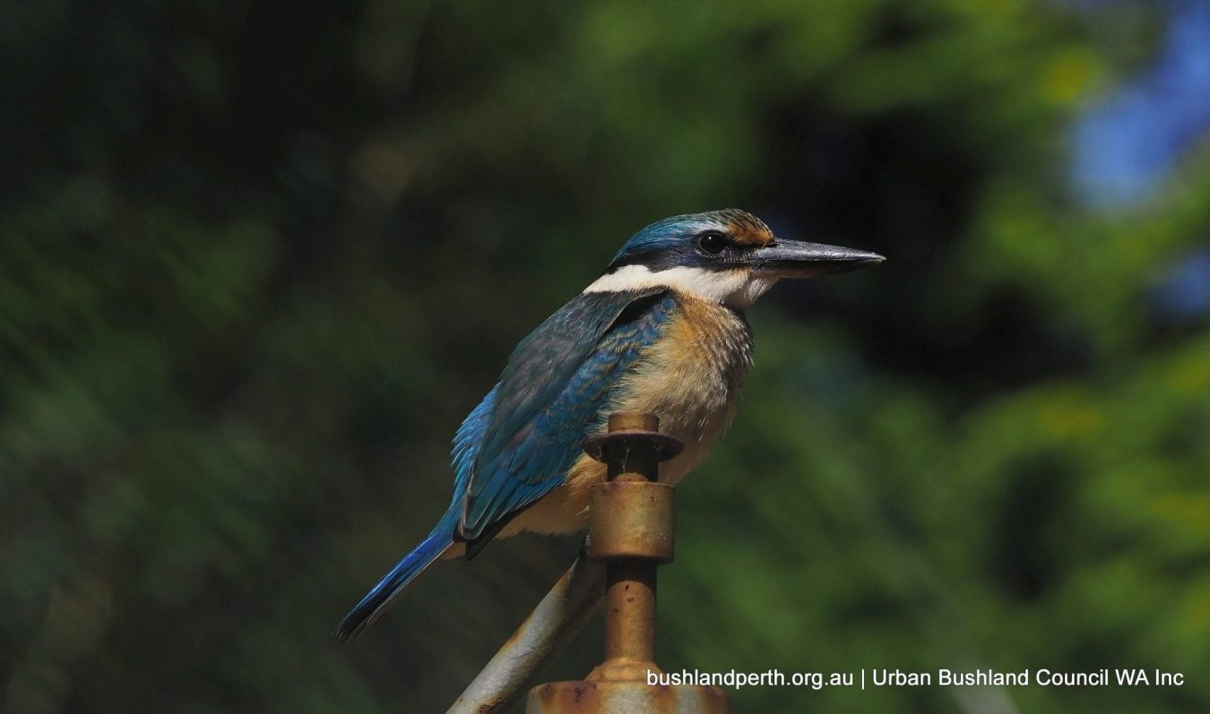
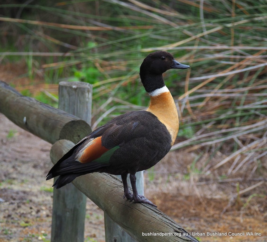
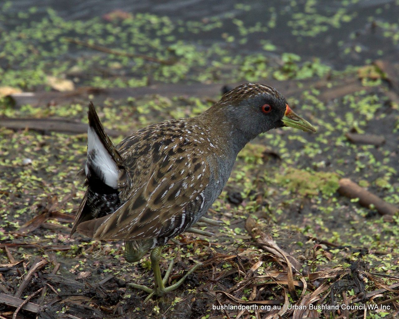
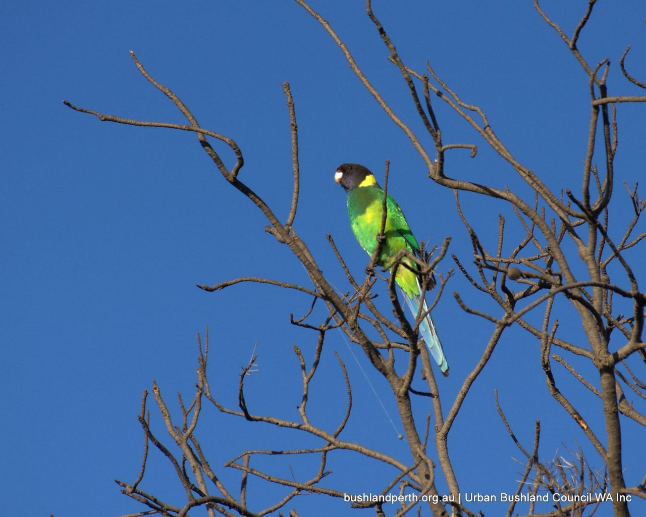
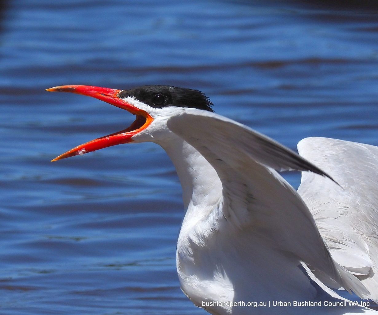
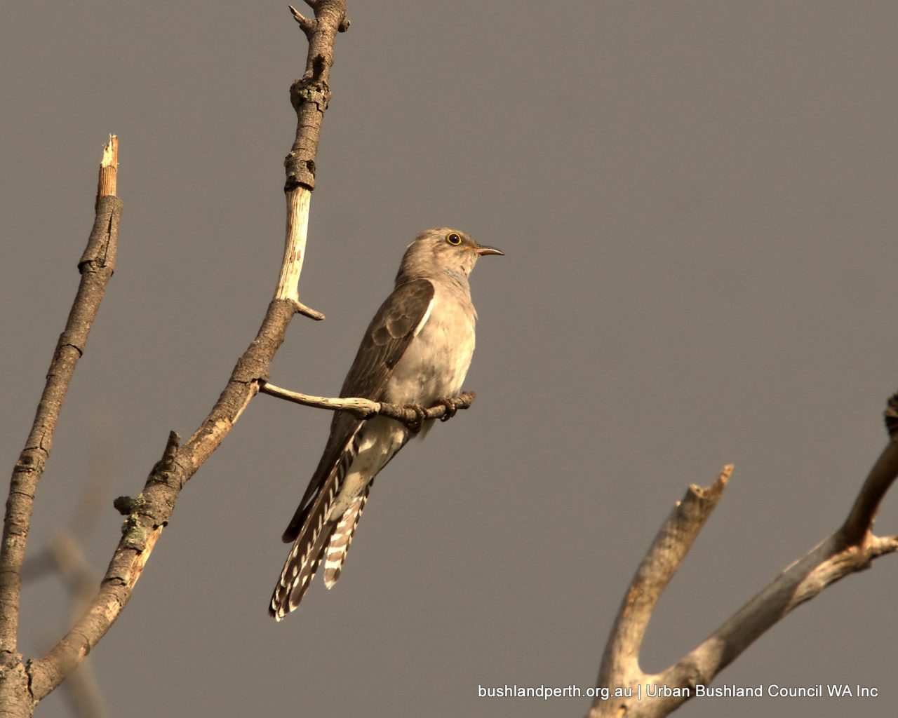
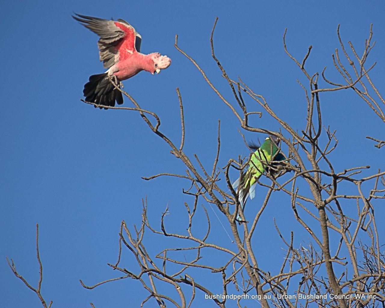
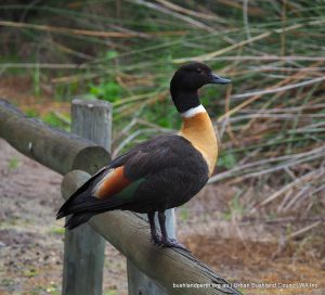
These lakes and their surrounding swamps and marshes, together with the river and its shoreline, attract many species of bush and waterbirds. The Baigup Wetlands database at BirdLife Western Australia lists 96 species identified in and around Baigup since mid 2012. Long-necked Turtles (Chelodina oblonga) also live and nest at Baigup where unfortunately dogs off leash and foxes are a hazard for eggs, young and adults alike. It is also likely that the elusive Native Water Rat (Hydromys chrysogaster) also known by an Eastern States name: Rakali, still frequents the area as it has been observed both up and downstream of Baigup Wetlands.
Should the sealed path be removed?
The answer is almost certainly ‘No’. Human intervention since Europeans took over this area has today created an interconnected set of varied and very interesting ecological complexes and habitat niches that function well for the most part, although Baigup as a whole is very different from what existed when Whadjuk Noongar lived a healthy life off the land along the Swan River. Many of the European interlopers failed at first because they could not, or would not, learn from the people they forced out. Land managers today are still learning how best to work with the unique characteristics of the Western Australian natural environment. A new situation has evolved over the almost 200 years since 1829, both because of, but also in spite of, human intervention.
Baigup cannot return in this era to what it was before 1829, but it now provides an essential staging post for birds that move up and down the river along the wildlife corridor from the hills to the sea. Birds also fly in annually or move across the suburbs toward the Swan River through whatever natural vegetation corridors they can find. The wetlands, the swampy woodland remnants, the marshy sedge plain, and emerging pockets of Samphire provide an mostly secure sanctuary for the many forms of wildlife that call Baigup home.
For humans who live nearby or visit from other places, Baigup is appreciated as a place of relaxation, respite and spiritual replenishment as well as a splendid venue for recreational activities like walking, running, cycling, bird watching, fishing on the river, and learning about our natural environment.
Contact
Secretary, Baigup Wetland Interest Group.
PO Box 39 Maylands WA 6931.
Email: [email protected]
Resources
Baigup Wetland Reserve Fauna Survey Report
Baigup Local Residents Fauna Survey Report
Baigup Wetland Reserve Management Plan 2014 – 2024
Links
Explore our Virtual Trail: http://trailswa.com.au/trails/baigup-wetland/about
See Baigup Biidii – Path to Place of Rushes video: https://www.youtube.com/watch?v=7VBDoSea9hE
And Geotourist Baigup Biddi audio trail: http://geotourist.com/tours/1426
(Photocredit – head image by courtesy of Jan Duifhuizen).
Baigup Wetlands – an Urban Treasure
Baigup Wetlands is an Urban Treasure.