Bold Park, 437 ha, is the largest remaining bushland remnant in the urban area of the Swan Coastal Plain. It includes Reabold Hill, the highest natural point on the Swan Coastal Plain. It is located close to the coast and has a a raised boardwalk that passes through the bushland to a viewing platform at the summit, offering 360 degree views over Perth.
The Park was established in 1936 and declared an A-class reserve in 1998 in recognition of its high conservation, landscape and recreation values.
Bold Park has an impressive biodiversity, with over 1000 native and non-native species of flora, fauna and fungi identified. It is a Bush Forever site.
Over 300 different local native plants are found within the park boundaries, including a number of priority and regionally significant species. Despite its proximity to the city, there is an abundance of wildlife including birds, reptiles, amphibians and invertebrates. An array of almost 300 species of macrofungi has been documented through survey work.
The Park is located off Oceanic Drive in Floreat, ten km from Perth. Details re access and walking trails are available here.
Vegetation.
Bold Park has a diverse range of plant communities, including coastal heaths not well represented elsewhere. Tuart-banksia woodlands occupy most of the bushland. These woodlands and limestone heaths provide extensive habitats for wildlife, including hundreds of species of insects.
The Park creates a link between the coast and the remnant vegetation found in Commonwealth land (Campbell Barracks) to the south-west; Perry Lakes, Wembley Golf Course and Herdsman Lake to the north; Shenton Park Bushland and Kings Park to the east; and the Cottesloe Golf Course and Lake Claremont to the south. These linkages provide important corridors to assist animals move between areas.
Zamia Trail.
The Park’s Zamia Trail, 5 km long and from which lesser tracks diverge, offers superb views to Perth and across to Rottnest Island, takes visitors through the Park’s habitats and landscapes.Download the Zamia Trail.
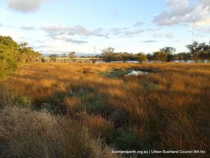
Major wetland remediation works were effected through 2015. The Reserve was closed during these works but the rehabilitated wetland was re-opened in November 2015. see project details below. These works have been extremely succesful; the growth of the plantings is nothing short of amazing. Eric Singleton Reserve is now a fully functional ecosystem.The birds are back!
Eric Singleton Reserve Snapshot
Eric Singleton Reserve is a constructed urban wetland located in Bayswater, approximately 8kms from the city and is very easy to get to. It lies at the end point of the now highly modified Bayswater Brook as the latter enters the Swan River.
It was named after a local bird enthusiast and long time resident in the area, Eric Singleton. Eric was successful in having the wetlands officially recognised in the 1970s. It is one of a network of wetland reserves in the City of Bayswater.
The Sanctuary is home to many birds including ducks, pelicans, white faced herons, swallows, honeyeaters, reed dwellers and hawks. A list of birds seen at ESBS can be found here.
Take a leisurely stroll around the lake. The Eric Singleton Bird Sanctuary is adjacent to several parklands including the Riverside Gardens and is a good place from which to explore further afield.
Walk down to the banks of the Swan River along Strand Street through Riverside Gardens and you will see a cycle path to Guildford. Cycling to Guildford makes a great day trip to explore Perth and surrounds”.
Picnic facilities at Riverside Gardens are excellent with plenty of picnic tables, BBQs and shady gazebos along the grassed areas. On the opposite side of the Swan River are the Ascot Racecourse and the adjoining suburb of Redcliffe. The dog beach is always a popular spot for locals and their pooches. Note: Riverside Gardens is dog friendly. However, the Eric Singleton Bird Sanctuary is a ‘no-dog’ zone.
The Restoration Project
The Sanctuary covers approximately 4 hectares. It was a seasonally wet depression which was drained in the 1950’s. Since then it has been dramatically altered to become a permanent wetland. The surrounding land was used for landfill between 1972 and 1981.
Like many Perth landfill sites, the site has now been landscaped into a public open space. Prior to the 2015 works, the ESBS wetland was artificially recharged, via a bore, with groundwater during summer in an attempt to maintain wetland functions. However, despite this, the ESBS wetland had limited ecological value and by 2014, before reconstruction it was characterized by:
• Unsustainable groundwater extraction;
• Poor ecosystem services and ecological value including a declining bird population;
• Formation of around 9,800m3 potentially monosulphidic sediments; and
• Poor wetland water quality with high levels of nutrients and heavy metals, pH and dissolved oxygen levels were routinely outside of healthy ranges.
The project objectives were to address both problems in a single project that both restored a degraded wetland and improved water quality entering in the Swan River from the Bayswater Brook Catchment. The result was a $3 million civil re-construction of the ESBS wetland which was the City’s keystone environmental project, completed in 2015 in partnership with the DPaW.
The project prevents 1.35 tonnes of nitrogen, 200 kg of phosphorous, and around 40 tonnes of sediment and other rubbish from entering the Swan River each year. This is approximately one third of the catchment’s target nutrient reduction.
170,000 native plants have been planted. In total 17 wetland and 9 dryland species endemic to the region were plants including Schoenoplectus validus (River Club Rush), Baumea articulata (Jointed Twig Rush) and Baumea juncea (Bare Twig Rush) and a combination of selected tree and shrub planting. Further infill planting will occur over future years.
Gobba Lake lies within walking distance, 400m, across an open grassed field, to the east of the Reserve (refer to Googlemap below) and is well worth a visit with its easy access surrounding path with a number of excellent bird viewing vantages.
Halliday House (located within 100 metres of the Reserve to the north) was converted by the Bayswater Historical Society into a historical museum and is a treasure trove on the history of the local Bayswater area.
Construction on Ellis House (best reached via a short drive to nearby A. P. Hinds Reserve) first began in 1912 and the weatherboard building originally served the area as a local dairy. In 1995 the City of Bayswater restored the property which today is open to the public as a community art centre and gallery. (Source – City of Bayswater).
Access
If coming by public transport, catch the train from Perth CBD to Bayswater train station. From Bayswater train station, head towards the parking area on the Whatley Crescent side. Walk along King William Street for around 1km, the main street of Bayswater till you reach Guildford Road. Cross Guildford Road and keep walking for approximately another 0.5km and you will reach the car park for the Reserve.
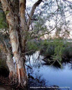
Baigup Wetlands is a very interesting, varied and complex site in its history, current state and potential. Approximately 1 kilometre in length, 200 metres wide and 16.4 ha. in area. it lies along the Swan River below Stone Street on the Maylands/Bayswater border. It is great birding location, with an abundance of both wetland birds and bush birds.
Baigup Wetlands is part of Bush Forever site No. 313 which includes both sides of the River from the east end of Maylands Peninsula to Garratt Road Bridge. It is also part of Precinct 9 (Ascot to Guildford) in the Swan Canning Riverpark. Baigup is registered in the Directory of Important Wetlands in Australia and is subject to protection under the Commonwealth Environment Protection and Biodiversity Conservation Act 1999. The Bush Forever site description is here.
Baigup Wetlands Reserve has been identified by the Swan River Trust as Priority 1 vegetation. The Reserve contains high value fauna habitat and is part of a regionally significant ecological linkage. The Reserve is used by the community for passive recreation but has been subject to a number of severe disturbance factors leading to environmental issues at the site, including acid sulphate soils and ponding water.
Birds
For a fairly small reserve, and only five kilometres from the Perth CBD, Baigup Wetlands holds an extraordinary variety of birds, both bush birds and waterfowl, with coastal birds thrown in. Over 100 species are recorded for the site and the regular quarterly surveys usually count between 40 and 50 species for each survey.
Many of these birds are represented in the two bird galleries below – all were photographed at the Wetlands:
Land Use
The Reserve was used historically by the Nyungar people who would have likely used the marshy river flats and camped on higher ground. After European settlement sections were used by market gardeners and for grazing of animals. In the 1970s the land was acquired as a road Reserve and for parks and recreation. Subsequently the road reserve was removed and the whole area is now reserved as Parks and Recreation in the Metropolitan Regional Scheme.
In 1986 the Dampier to Perth gas pipeline was laid through the Reserve and the raised track used during construction of the pipeline was subsequently paved as a footpath and cycleway. In the 1990s another track was created along the northern boundary of the Reserve to allow the laying of Water Corporation pipework. The Reserve had also been used as a receiving point for drainage, including road and property runoff.
The northern portion on the landward side of the path now retains significant freshwater from numerous springs and stormwater outlets and has become a woodland swamp. The southern portion on the river side of the dual-use path is still influenced by tidal flood from the Swan River and contributions from the stormwater overflows from the wetland, thus creating a brackish wetland system. Two artificial lakes were constructed in 2000 (the eastern Primary Lake) and 2001 (the western Secondary Lake) to enhance the aesthetic value of the Reserve while providing a permanent water habitat for fauna and flora.
Currently, the main purpose of the Reserve is conservation; however it is also used for recreation, including walking/jogging, cycling and canoeing. The foreshore of the Reserve is also used by recreational fishers.
Vegetation and Structure
Prior to European settlement the vegetation at the Reserve would likely have supported sedgeland in the low-lying floodplain with the more permanently wet areas supporting a Swamp Paperbark woodland with an understorey of sedges. A community of Flooded Gum would likely have occurred close to the river at either end of the Reserve where the floodplain narrows. In the upland areas of the Reserve there would likely have been a Marri-Banksia woodland.
The key vegetation element of Baigup Wetlands is the coastal salt marsh community which is listed under the Environment Protection and Biodiversity Conservation Act 1999 Act as a Threatened Ecological Community (TEC) ‘Subtropical and Temperate Coastal Saltmarsh’. Subtropical and Temperate Coastal Saltmarsh occurs within a relatively narrow margin of the Australian coastline within the subtropical and temperate climate zones. The physical environment for this community is coastal areas under regular or intermittent tidal influence. It typically is restricted to the upper intertidal environment.
This TEC was likely once present throughout much of the Swan River Estuary; however, it has probably declined in the area by over 50 %.
Access
The Reserve’s recreational facilities comprise:
A paved dual-use walking and cycling path that runs the length of the Reserve, west-east.
A limestone path in the centre of the Reserve that runs northwest-southeast from private properties down to the river.
A boardwalk at the eastern end of the Reserve that offers a scenic viewpoint.
Access is from the Kelvin Street/Swan View Terrace junction in Maylands (limited street parking only) or from A.P. Hinds Reserve (enter from car park at the end of Milne Street. A joint use walkway/cycle path runs from the car park, under Garratt Road Bridge and right through the reserve to Kelvin Street.
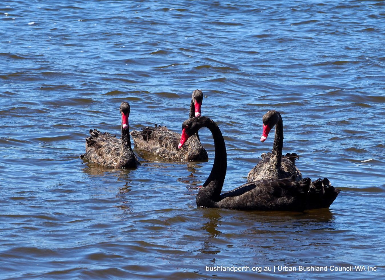
Black Swan. Occasionally seen on the River, also occasionally on the eastern lake. Photo: John Baas.
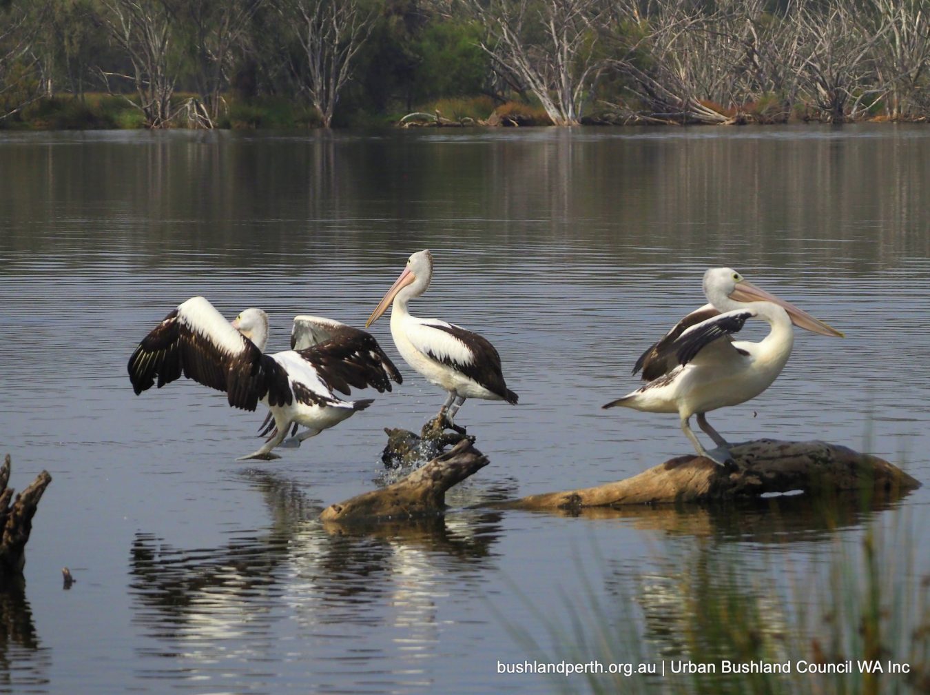
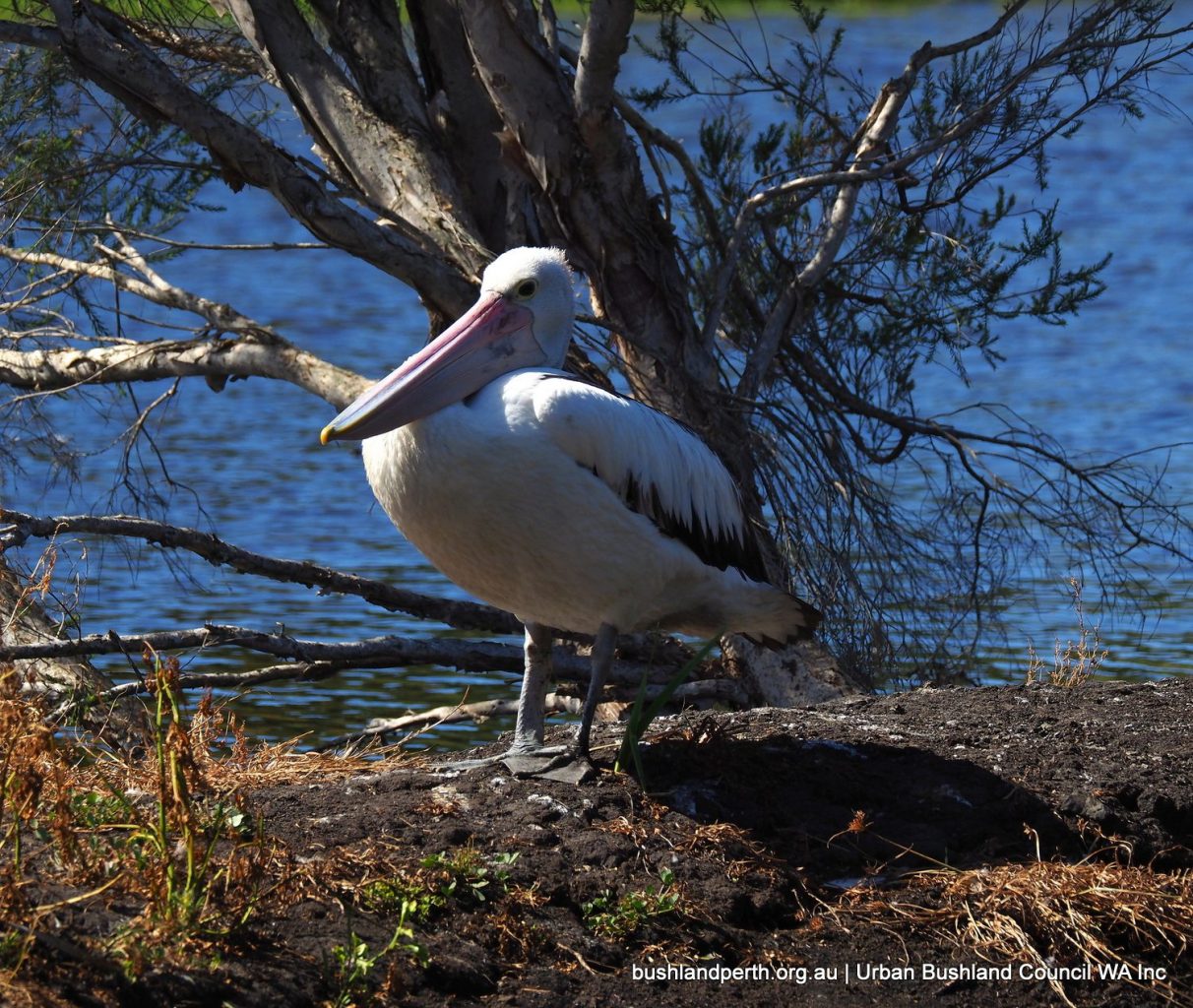
Australian Pelican. Commonly seen on the River; occasionally on the lakes. Photo: John Baas.
Australian Pelican; loafing at the western lake. Photo: John Baas.
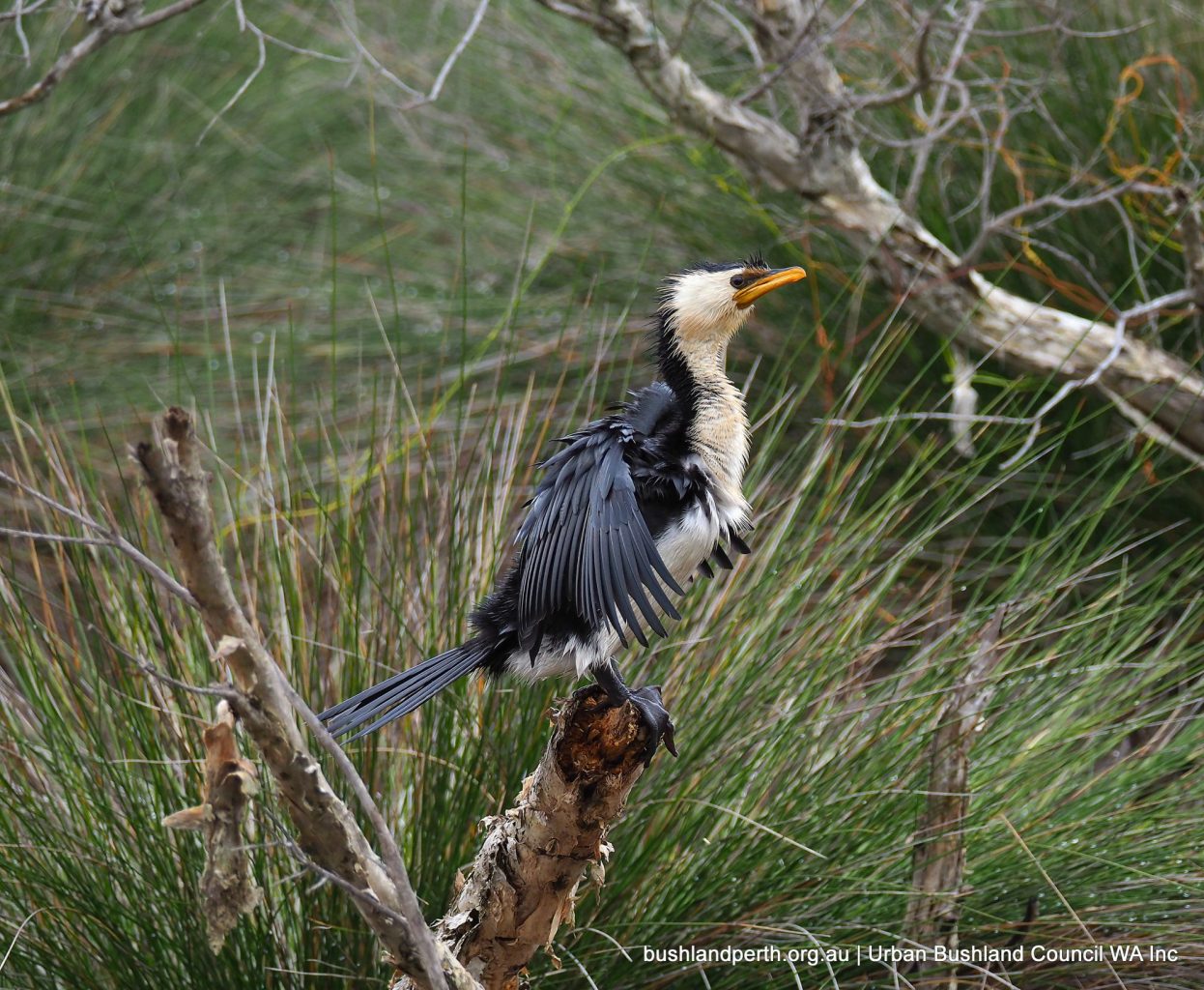
Little Pied Cormorant. Always present; River and lakes. Photo: John Baas.
Little Pied Cormorant. Photo: John Baas.
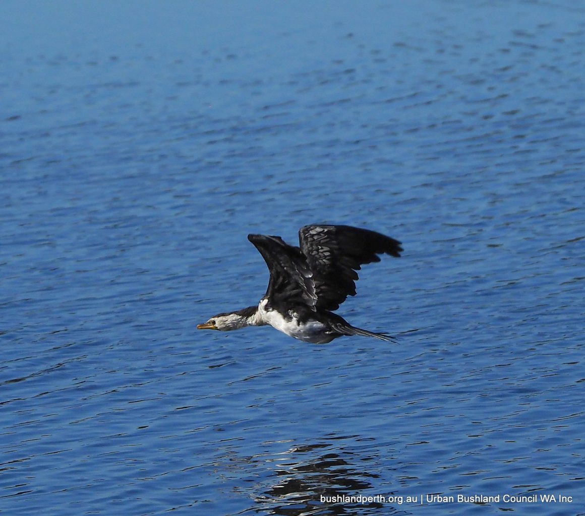
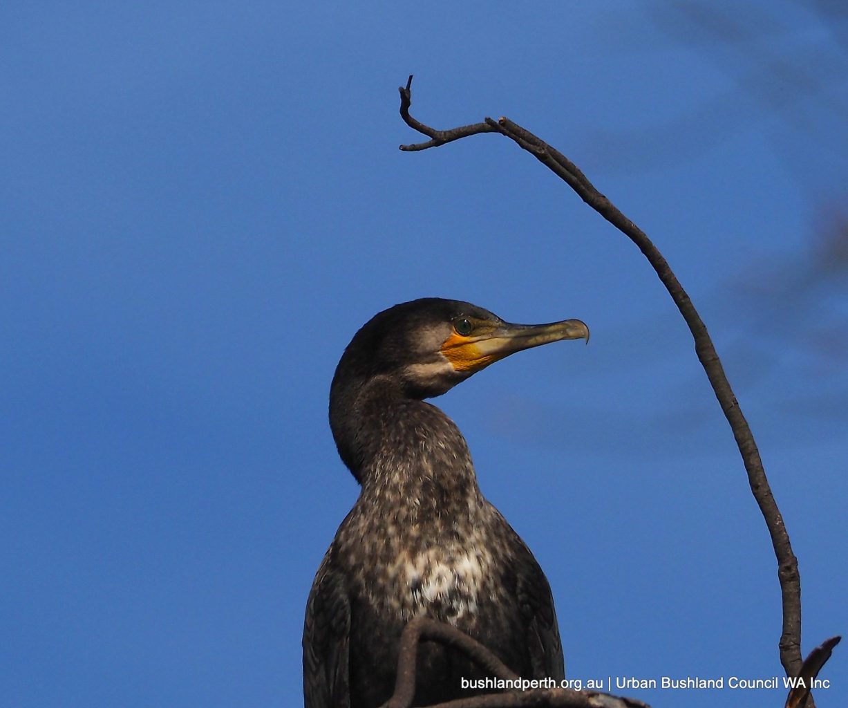
Great Cormorant is occasionally seen on high dead branches over the River. Photo: John Baas.
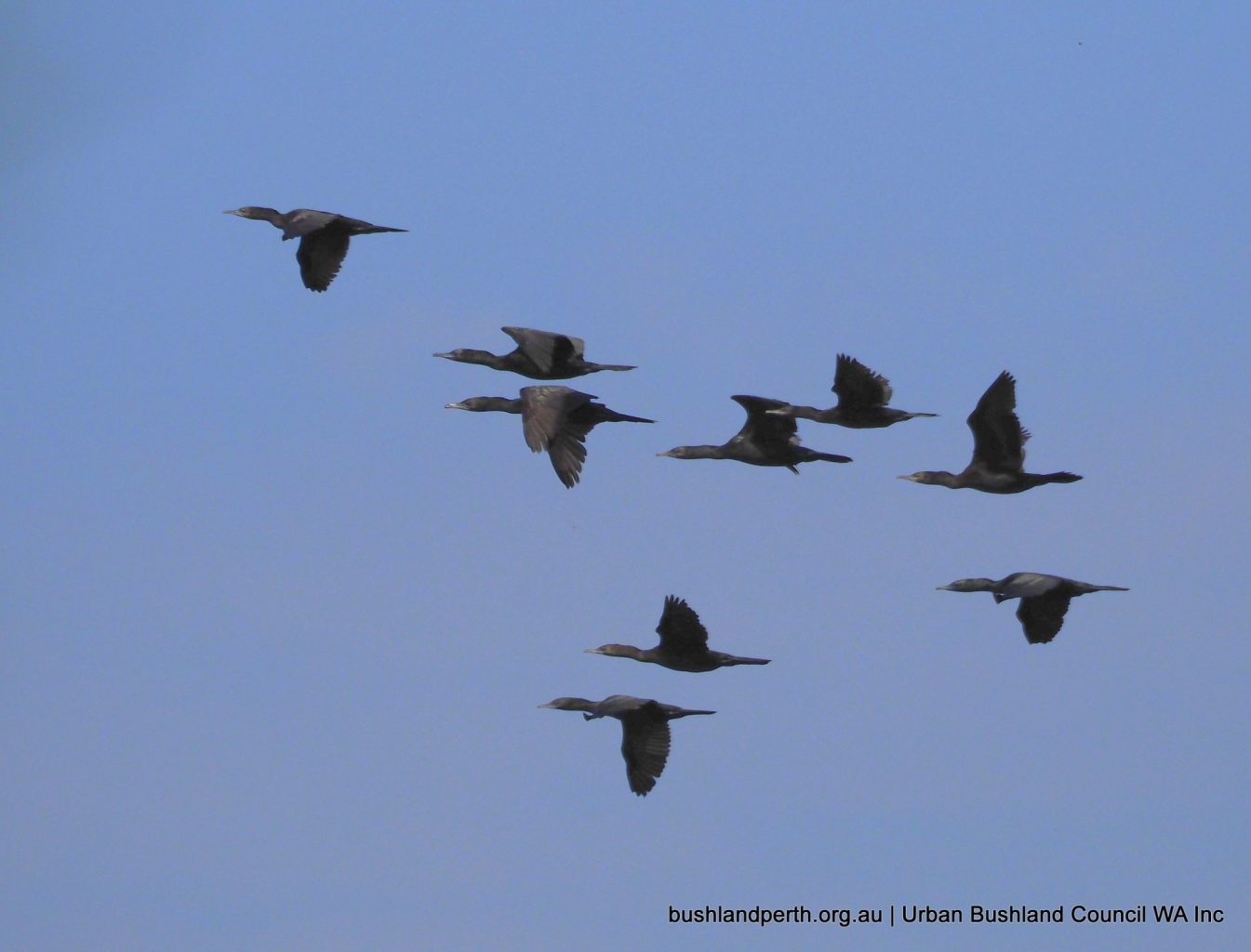
Little Black Cormorant. Rafts of these birds, often in the 100’s are common on the Swan River. The birds also sometimes perch in numbers on the shore She-oaks. Photo: John Baas.
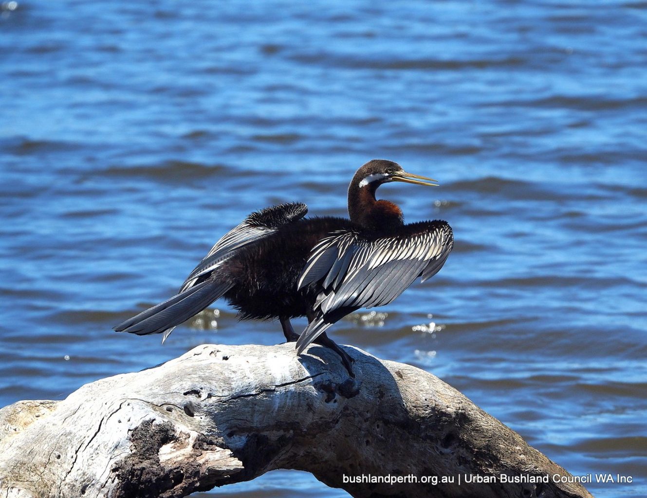
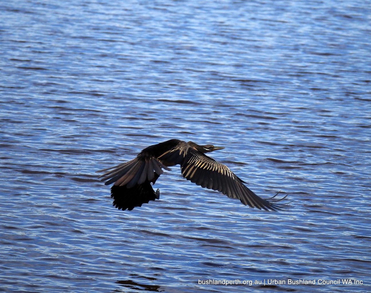
Australian Darter; common on the River. Photo: John Baas.
Australian Darter. Photo: John Baas.
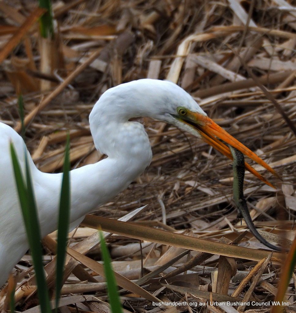
Great Egret with Glossy Swamp Skink. Photo: John Baas.
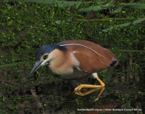
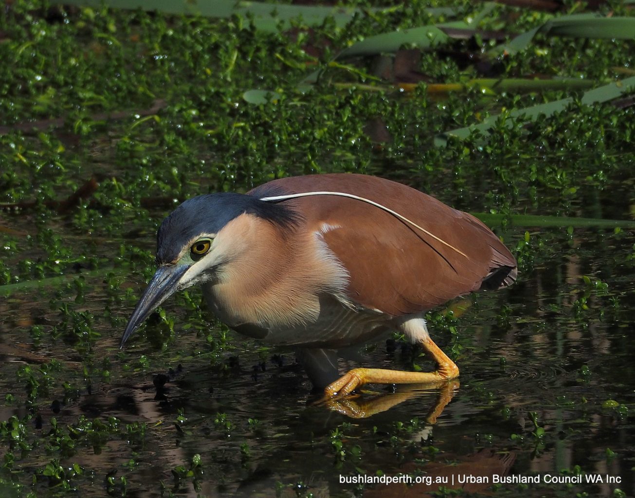
Nankeen Night-herons are often present but usually require searching for a sighting. Photo: John Baas.
Little Egret. Becoming more common in the metro; a chance at Baigup. Photo: John Baas.
White-faced Herons are reasonably common. Photo: John Baas.
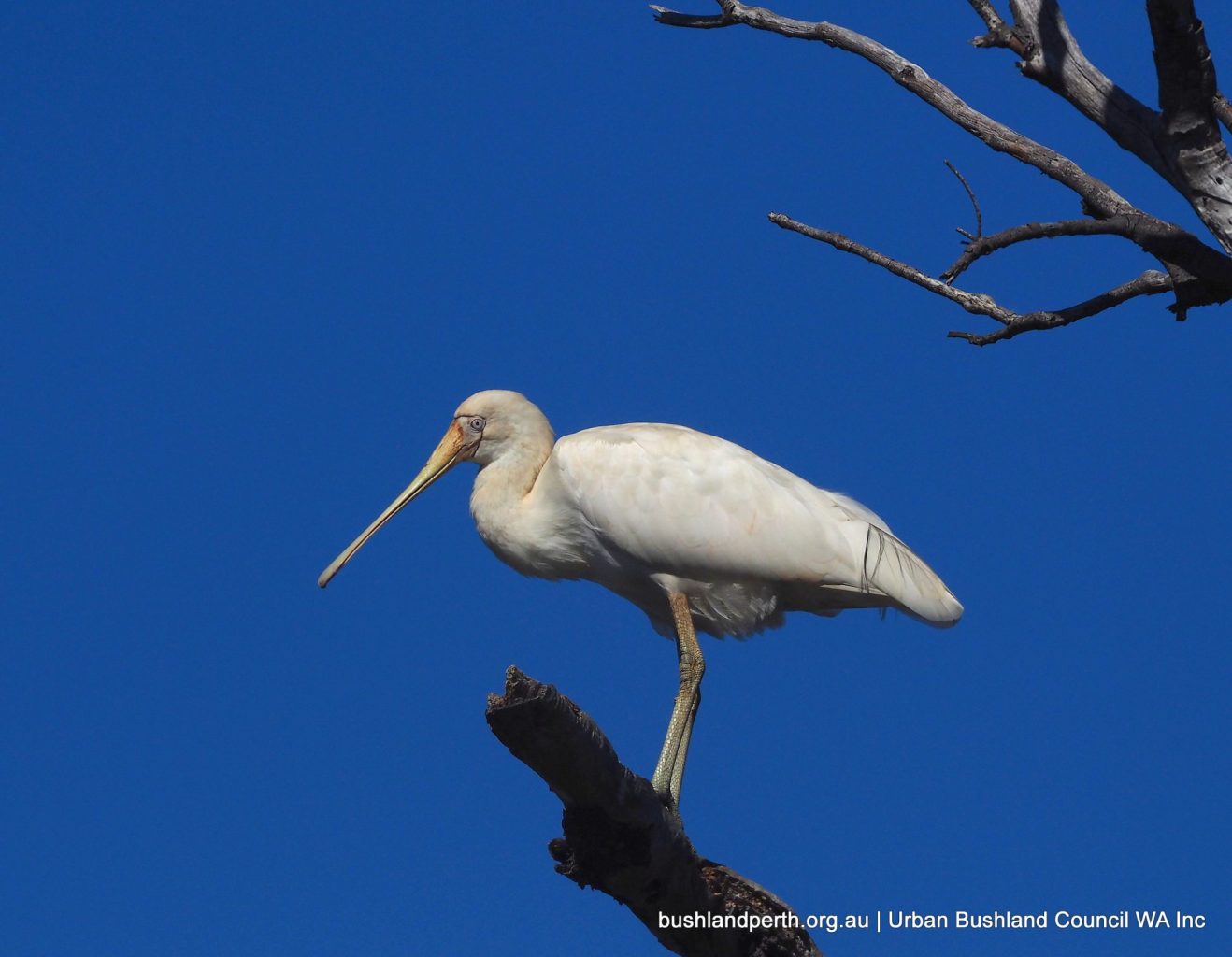
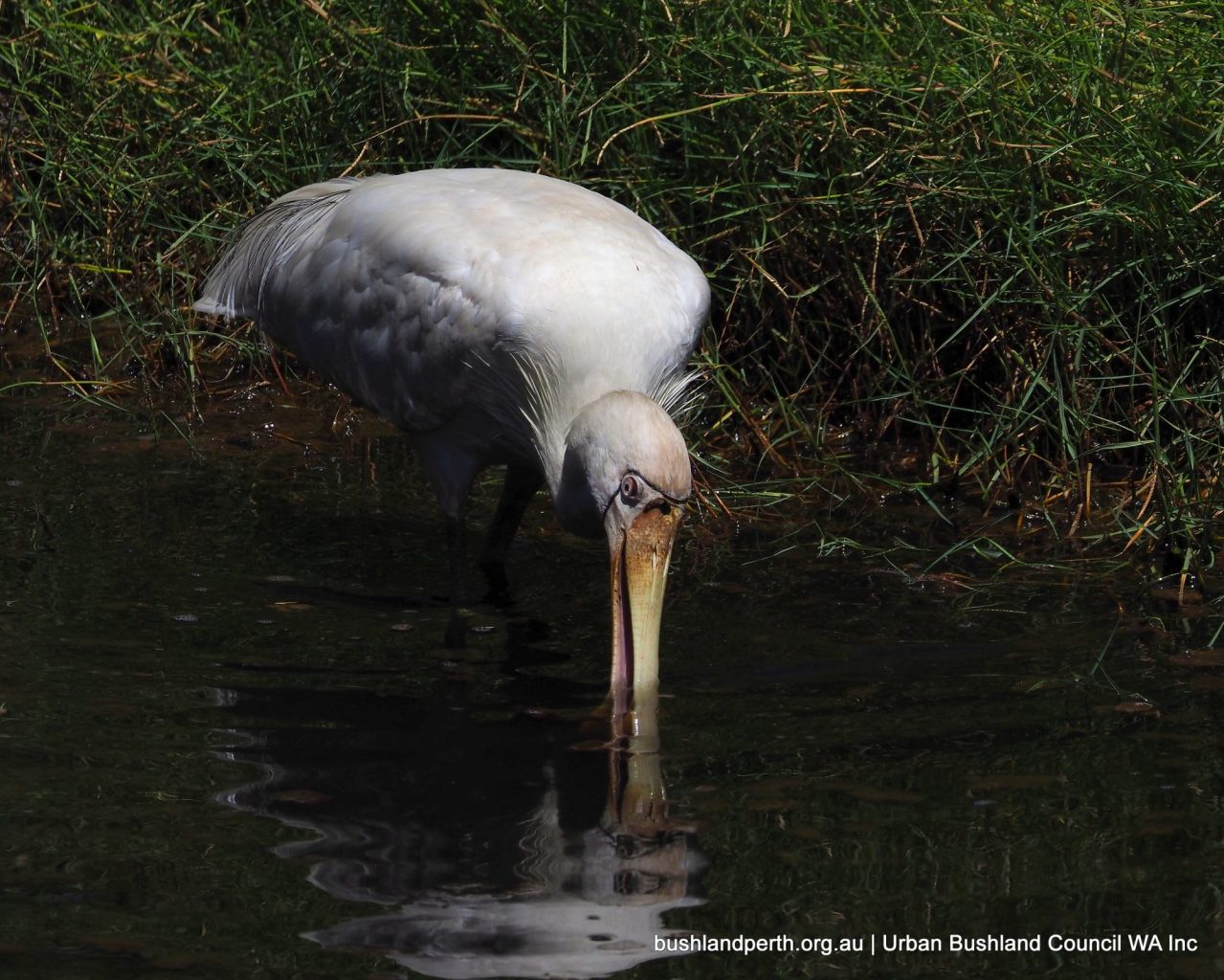
Yellow-billed Spoonbill. Often seen. Photo: John Baas.
Yellow-billed Spoonbill. Photo: John Baas.
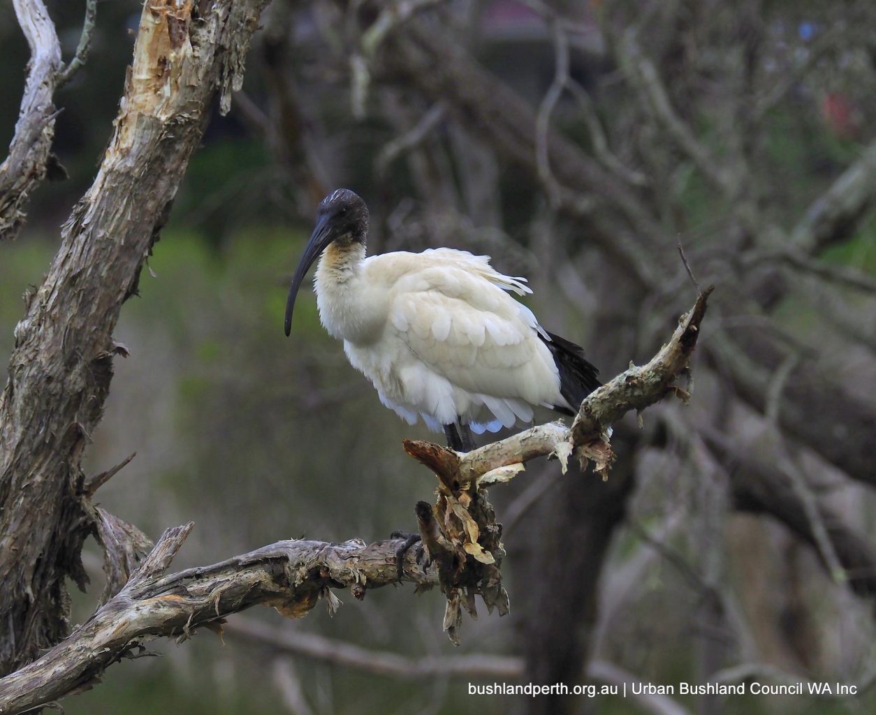
White Ibis – always present. Photo: John Baas.
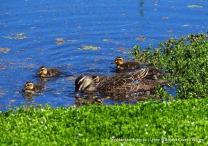
Pacific Black Duck – common. Breeds at Baigup. Photo: John Baas.
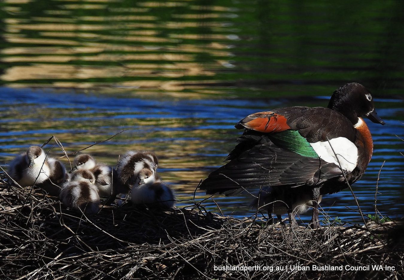
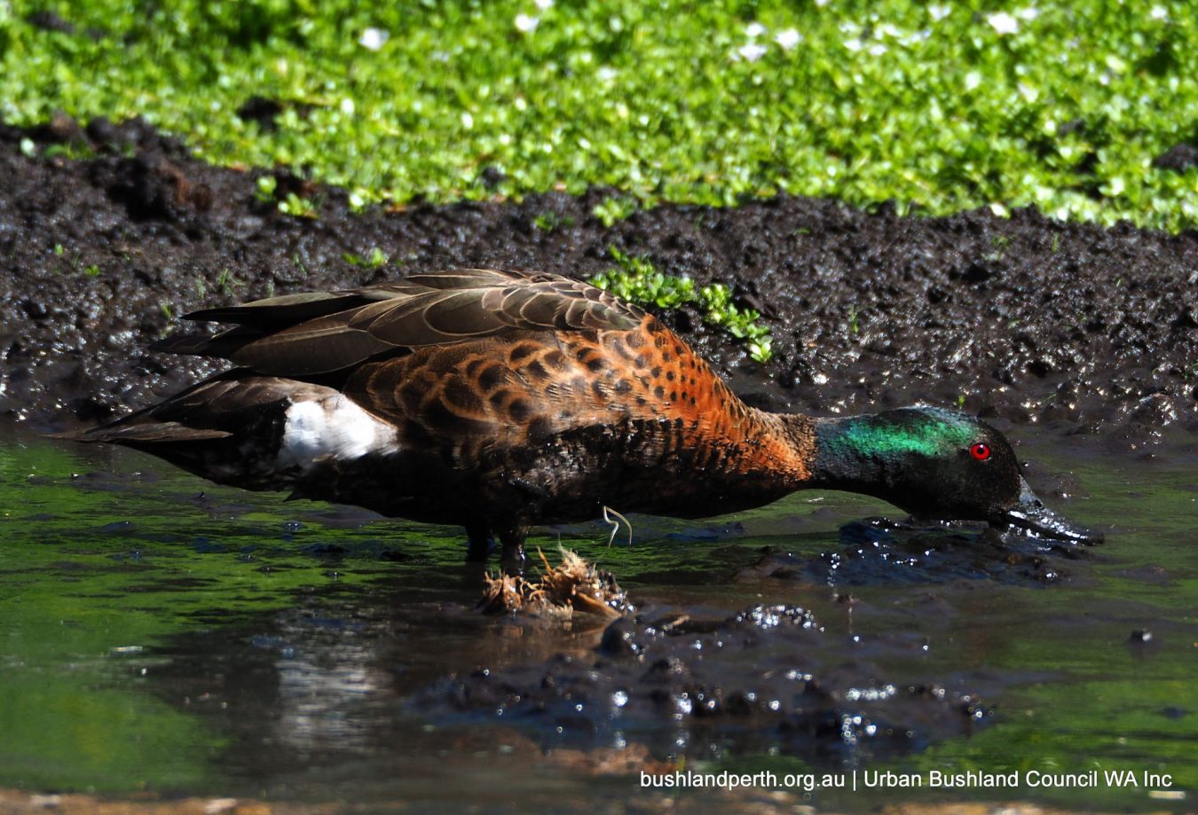
Australian Shelducks have bred at Baigup in recent winters. Photo: John Baas.
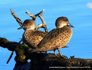
Grey Teal are always present. Photo: John Baas.
Australasian Shoveler; one of the less common ducks. Photo: John Baas.
Hardhead Ducks are breeding springtime visitors; this bird, a male. Photo: John Baas.
Hardhead Duck (female). Photo: John Baas.
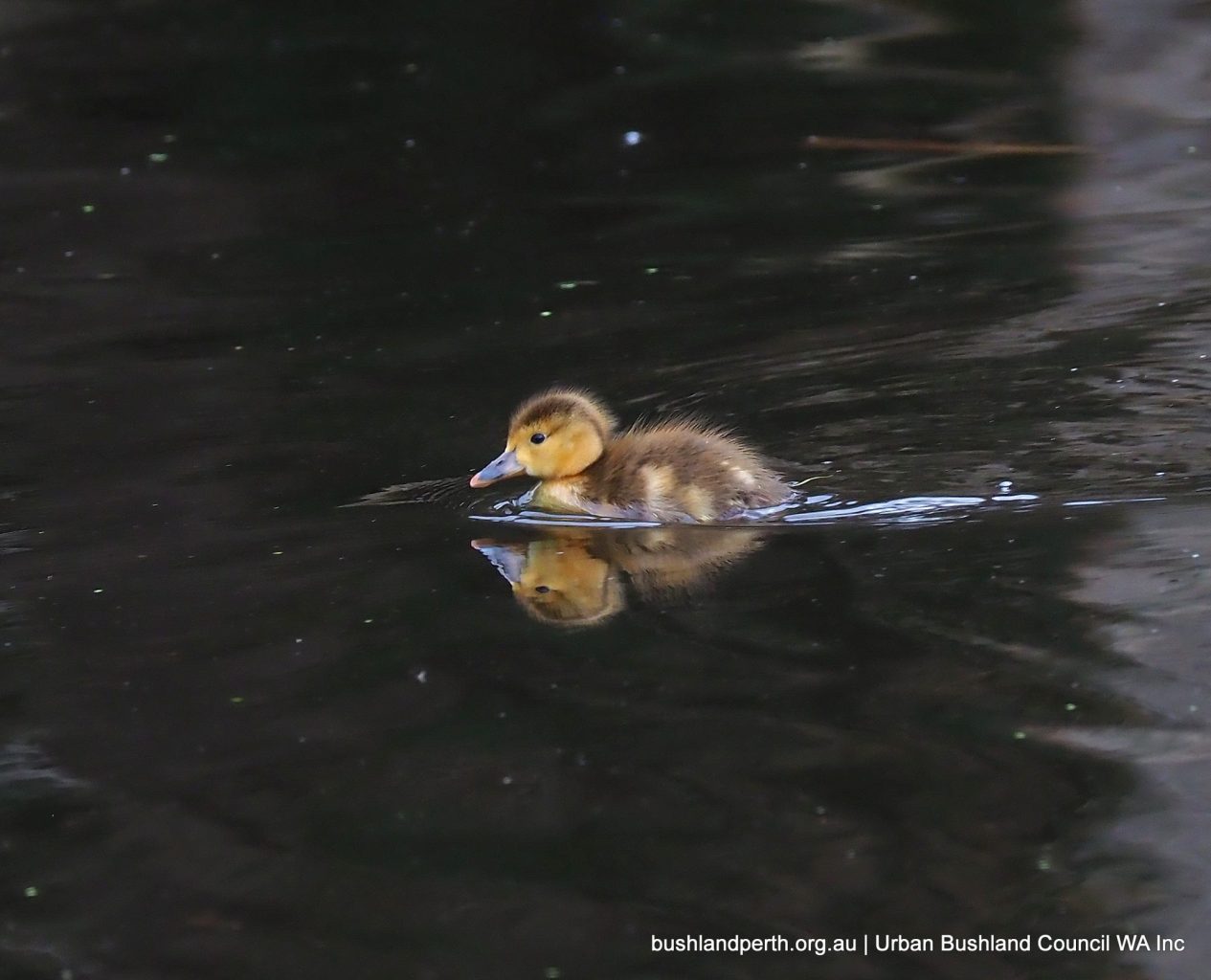
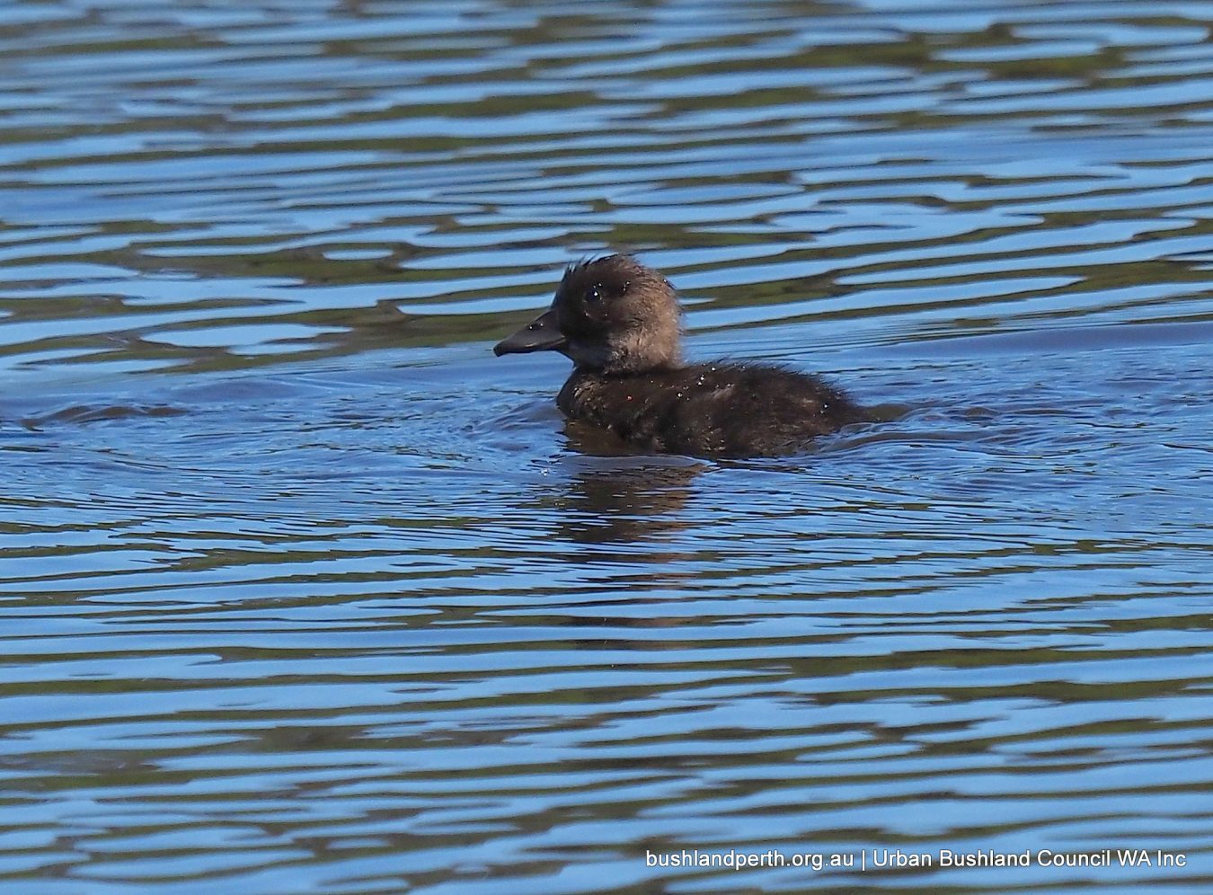
Hardhead Duck duckling. Photo: John Baas.
Chestnut Teal. Rare at Baigup. Photo: John Baas.
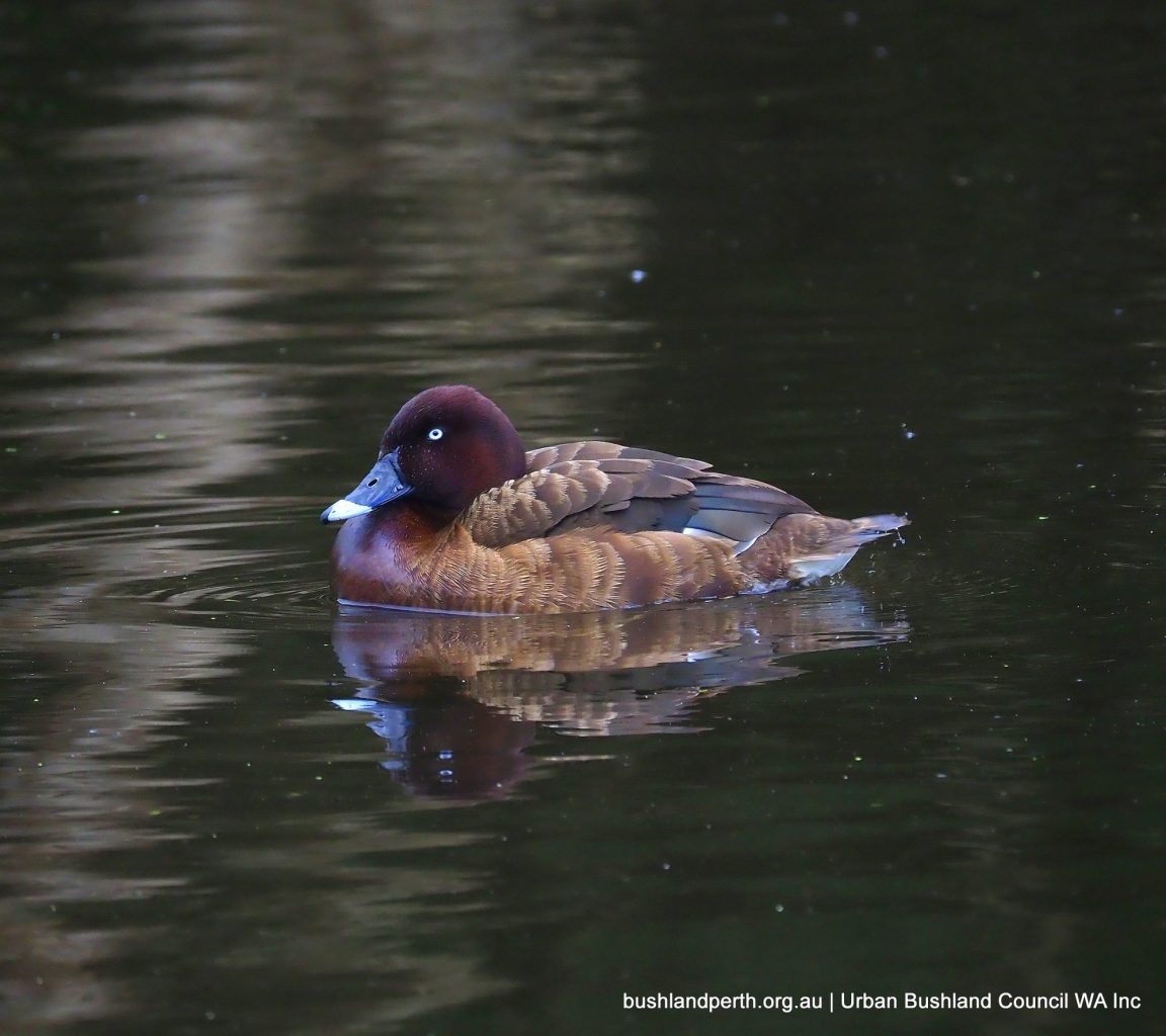
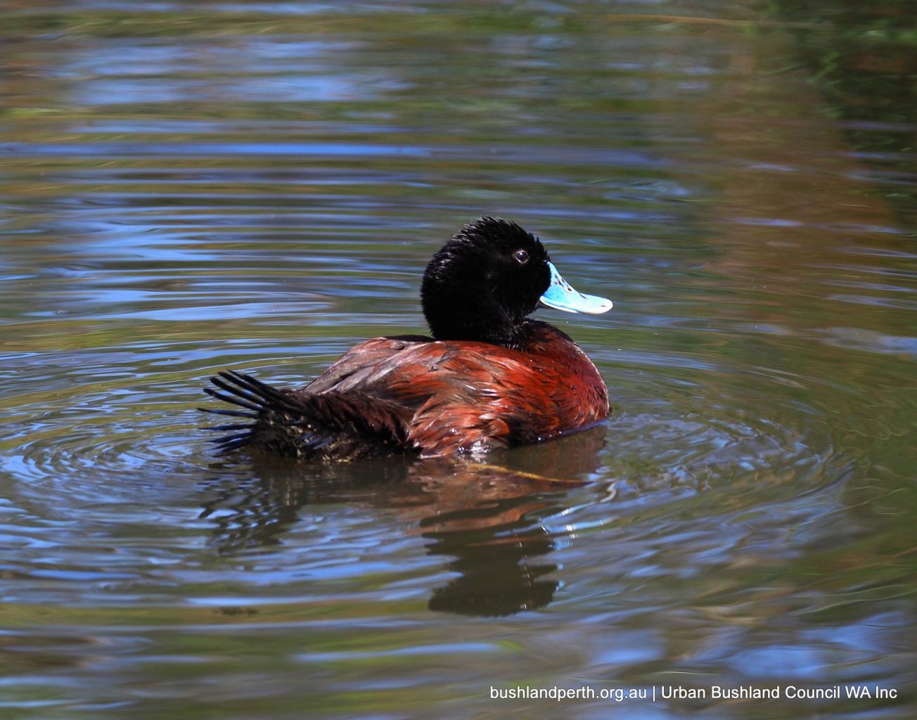
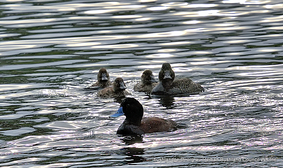
Blue-billed Duck. One of Baigup’s less common ducks, but pairs come in during spring to breed – see following image.. Photo: John Baas.
Blue-billed Duck – Photo: Mike Clarke.
Blue-billed Duck (duckling). Photo: John Baas.
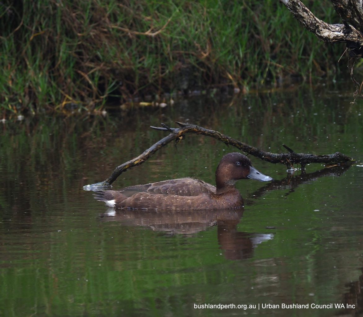
Freckled Duck. A generally very uncommon Australian endemic duck. Highly uncommon at Baigup. This bird the first seen in years. Photo: John Baas.
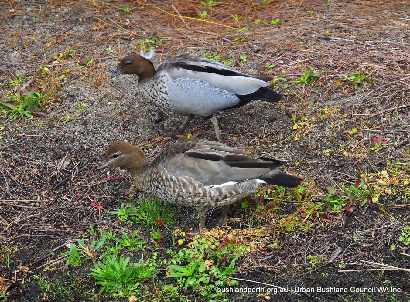
Australian Wood Ducks are one of Perth’s most common ducks, but for some unknown ecological reason, are uncommon at Baigup. These ducks are sexually dimorphic; the lower bird is the female. Photo: John Baas.
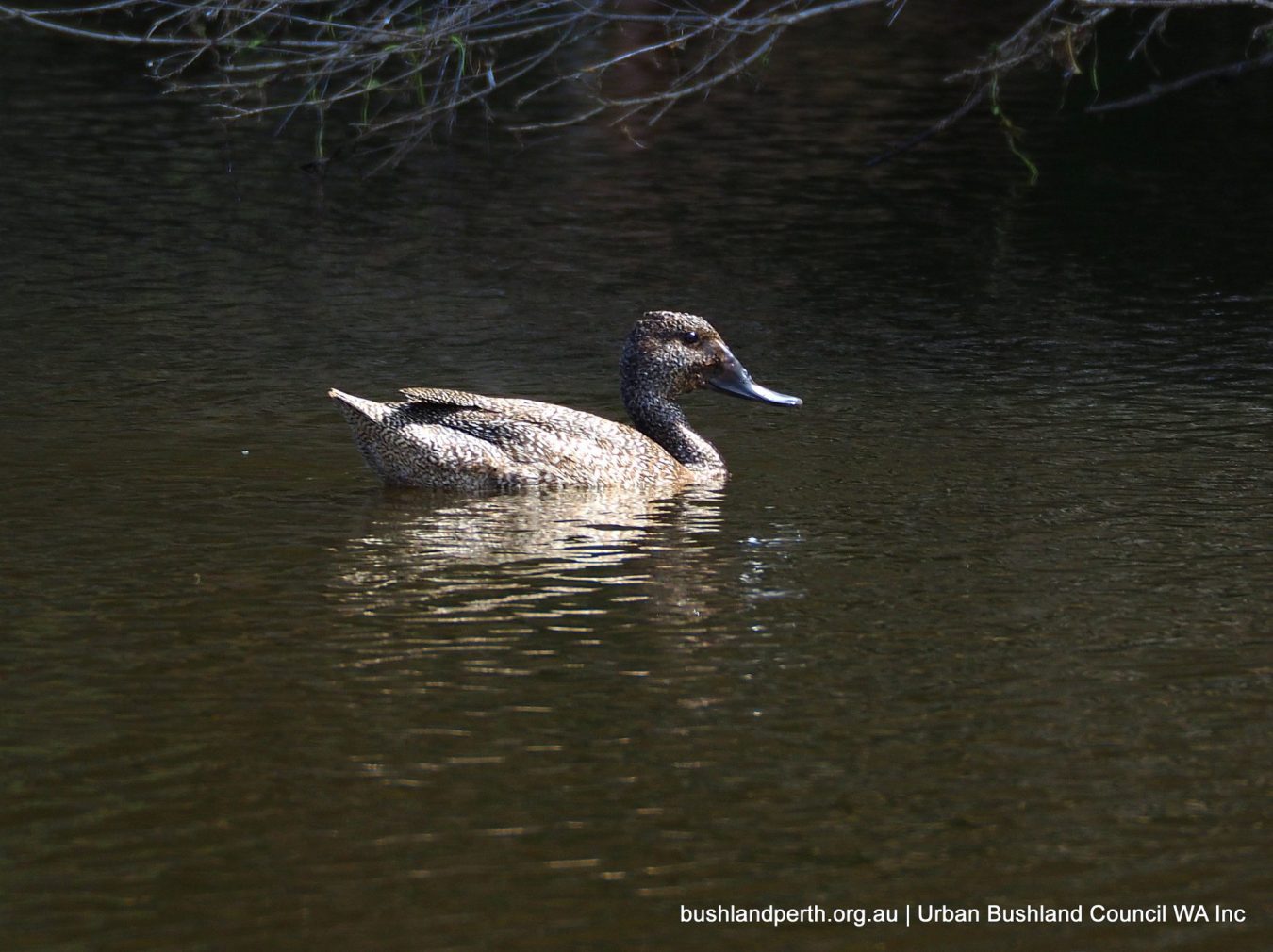
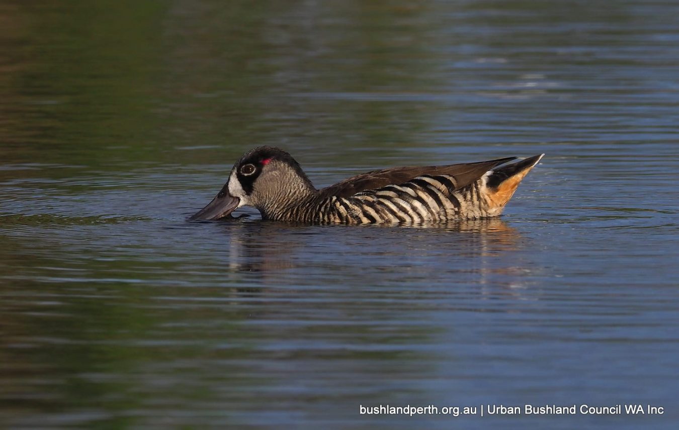
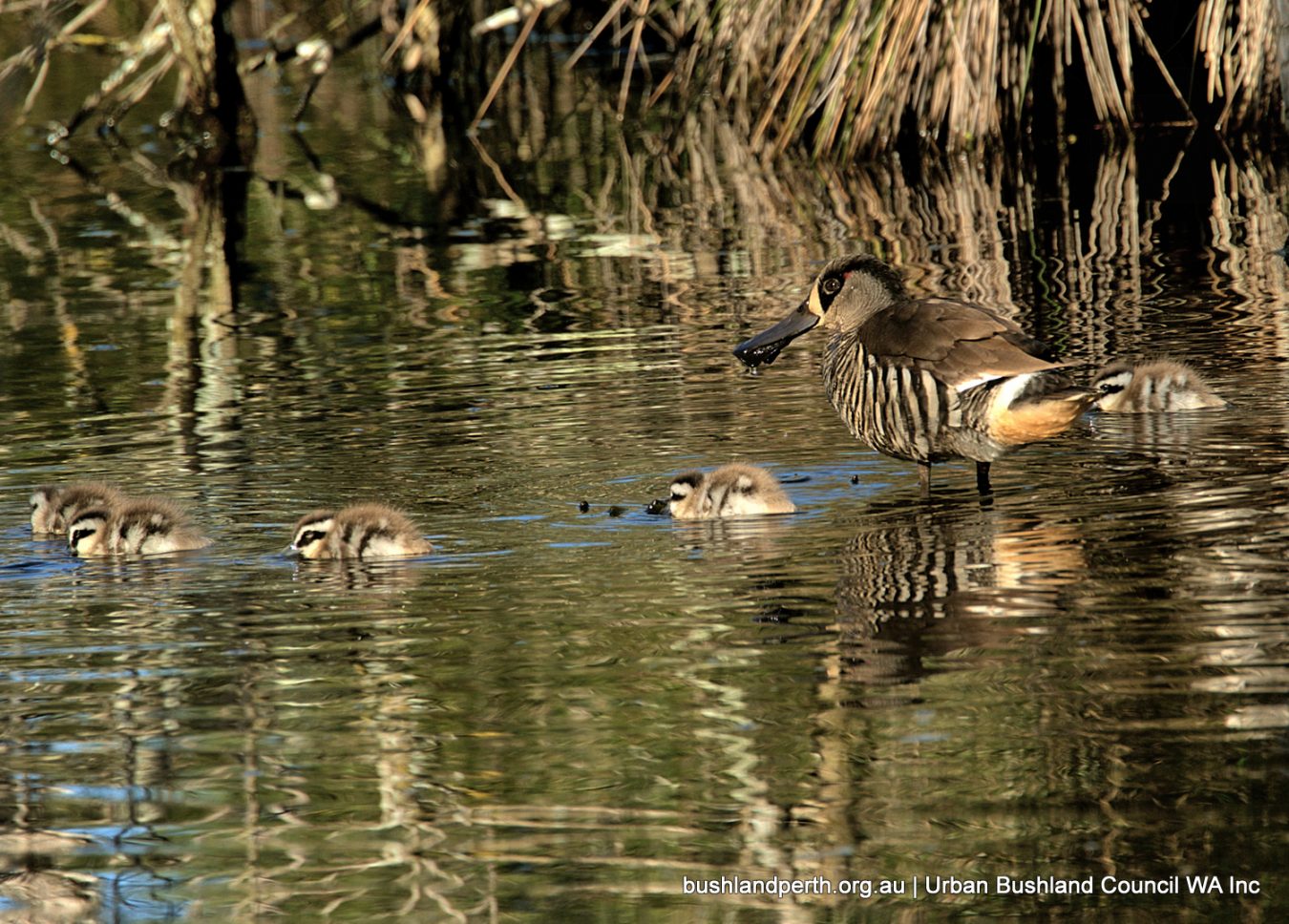
Pink-eared Duck. One of Australia’s ‘prettiest’ waterbirds. This species is uncommon at Baigup but a pair has bred in recent years – see following image. Photo: John Baas.
Pink-eared Duck with young: Photo – Mike Clarke.
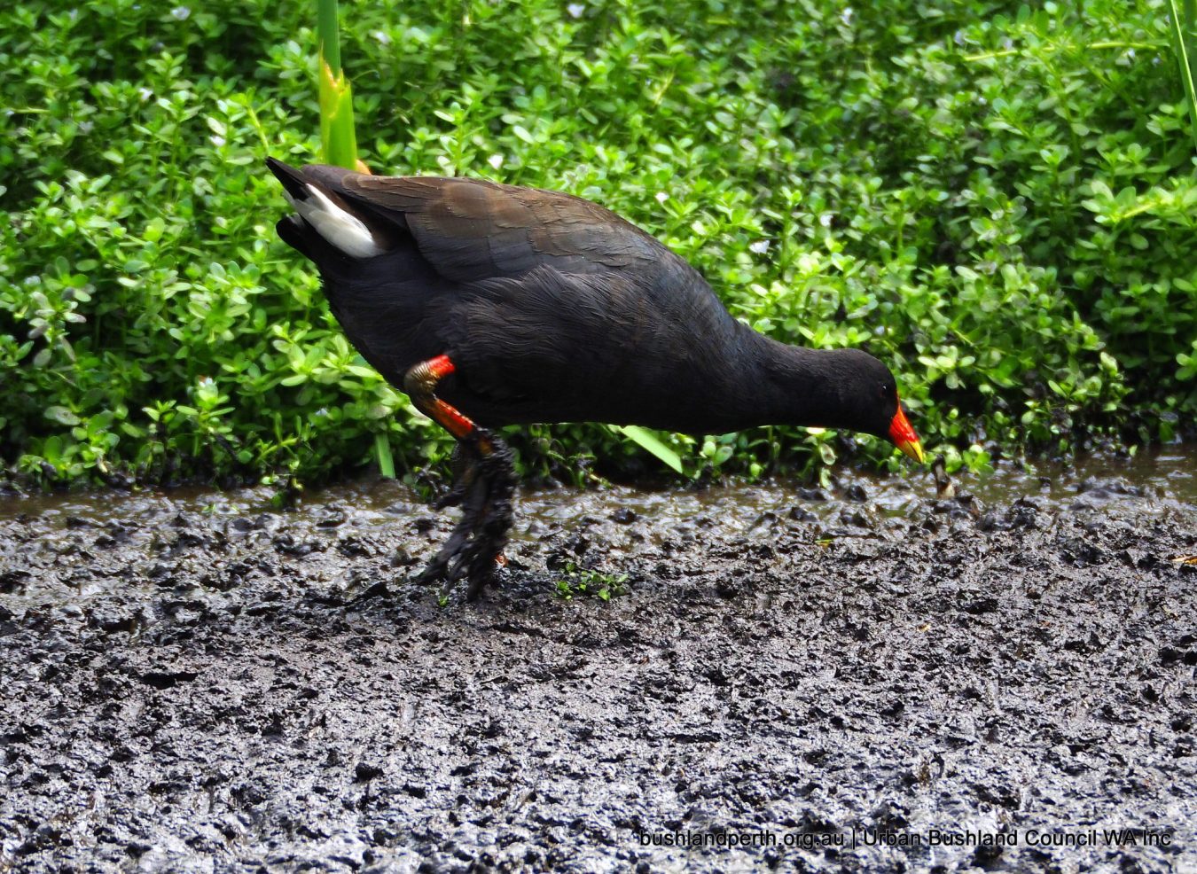
Dusky Moorhen is common and breeds at Baigup. Photo: John Baas.
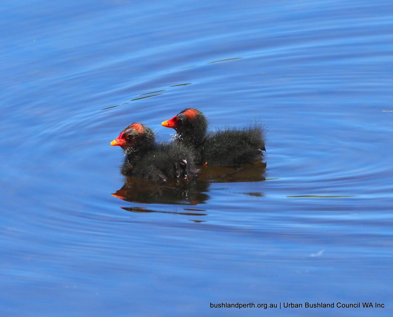
Dusky Moorhen chicks. Photo: John Baas.
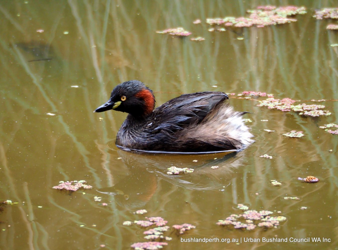
Australasian Grebe. Breeds at Baigup. Photo: John Baas.
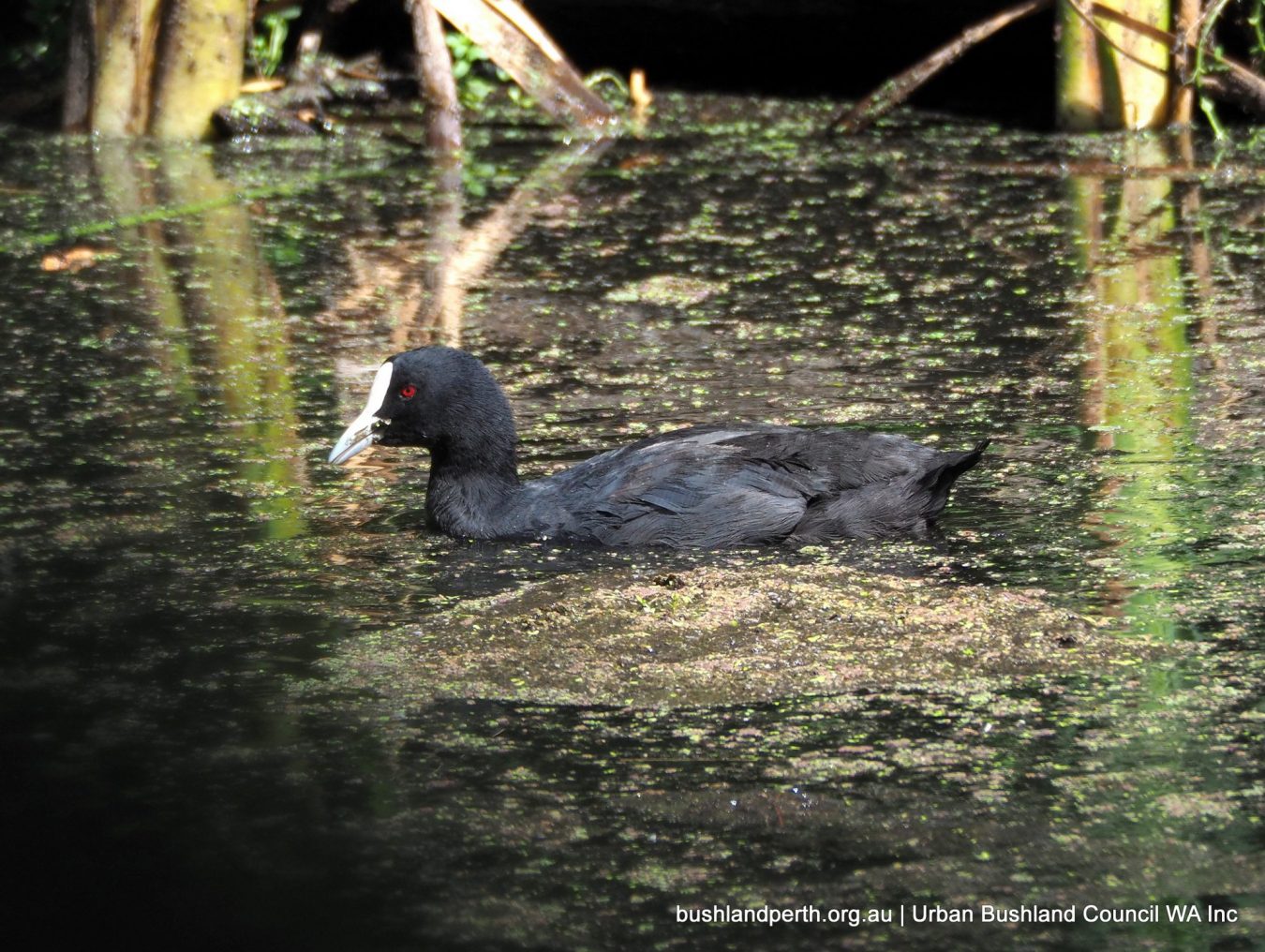
Eurasian Coot. Common; breeds at Baigup. Photo: John Baas.
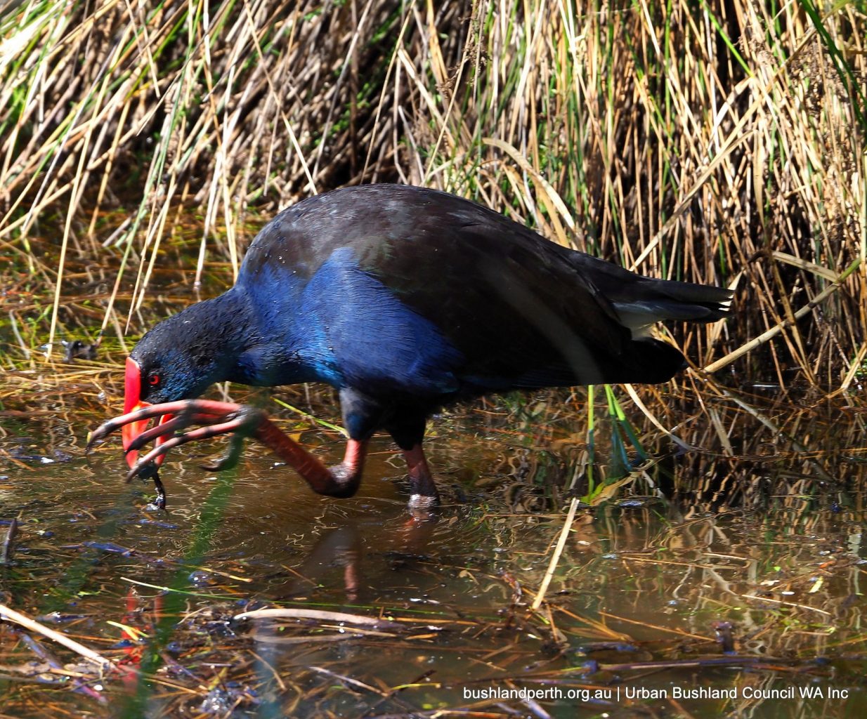
Australasian Swamp-hen. Common; breeds in the Reserve. Photo: John Baas.
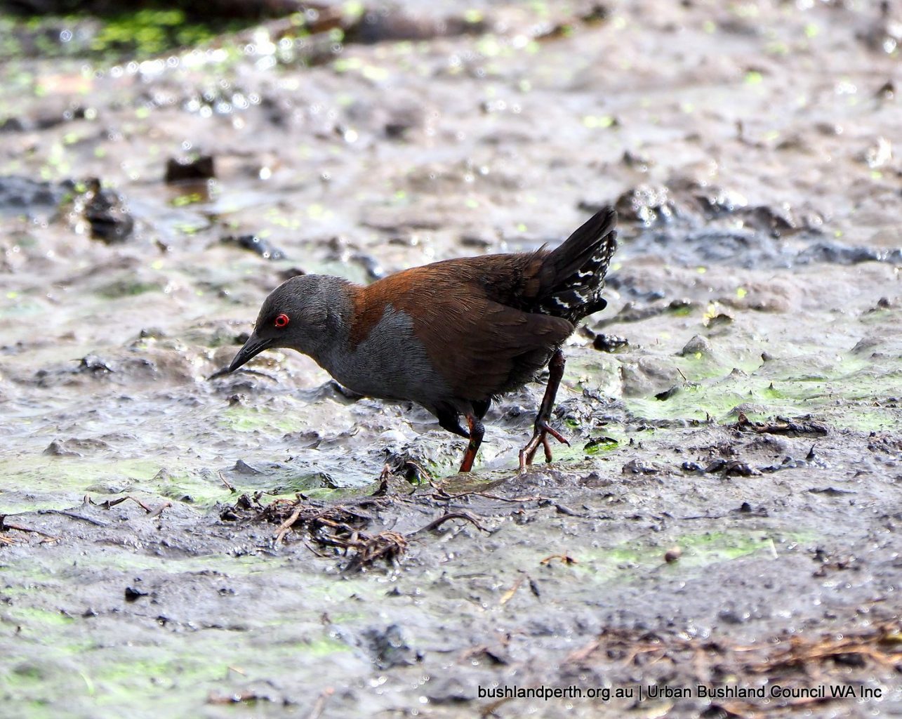
Spotless Crakes are resident but notoriously hard to observe. Best chance is waiting very quietly watching the edge of the reed beds on the mud flats. However, sightings have become even more infrequent with the successful vegetation re-generation. Photo: John Baas.
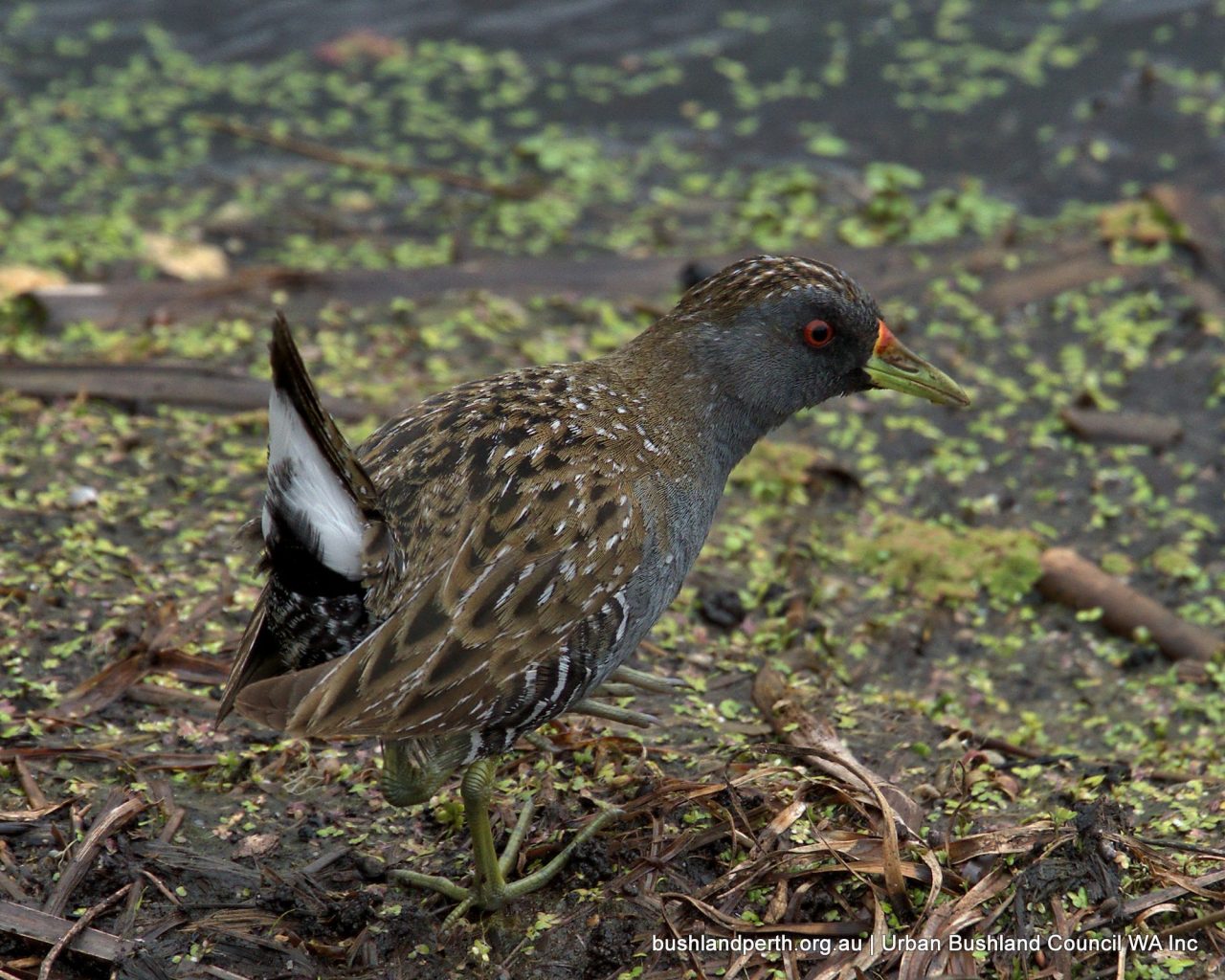
Australian Spotted Crake. First sighted late 2013; now apparently resident, following numerous observations. Photo: Mike Clarke.
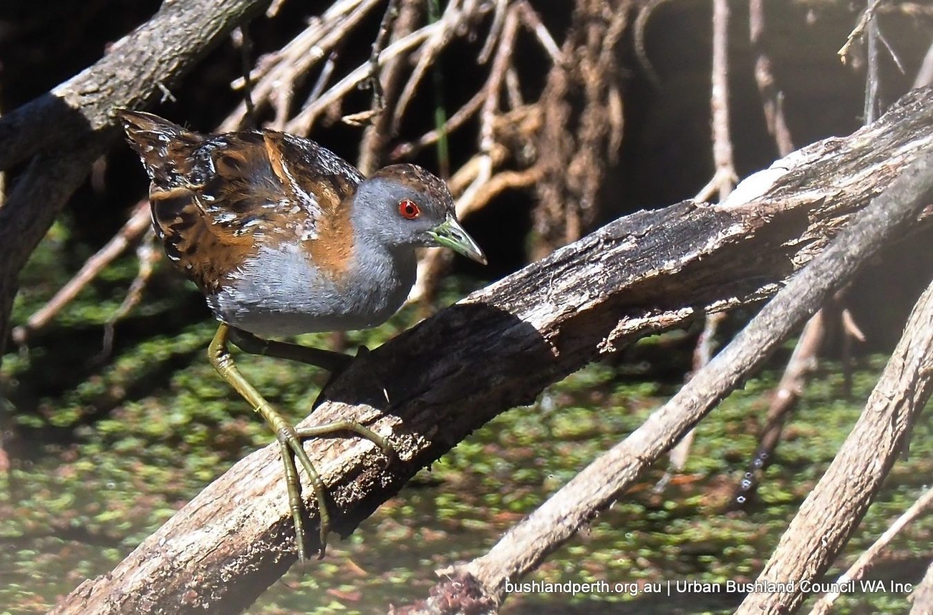
Baillon’s Crake. Widespread in Australia but not commonly observed. First ever sighting at Baigup; January 2018. Photo: Ken Glasson.
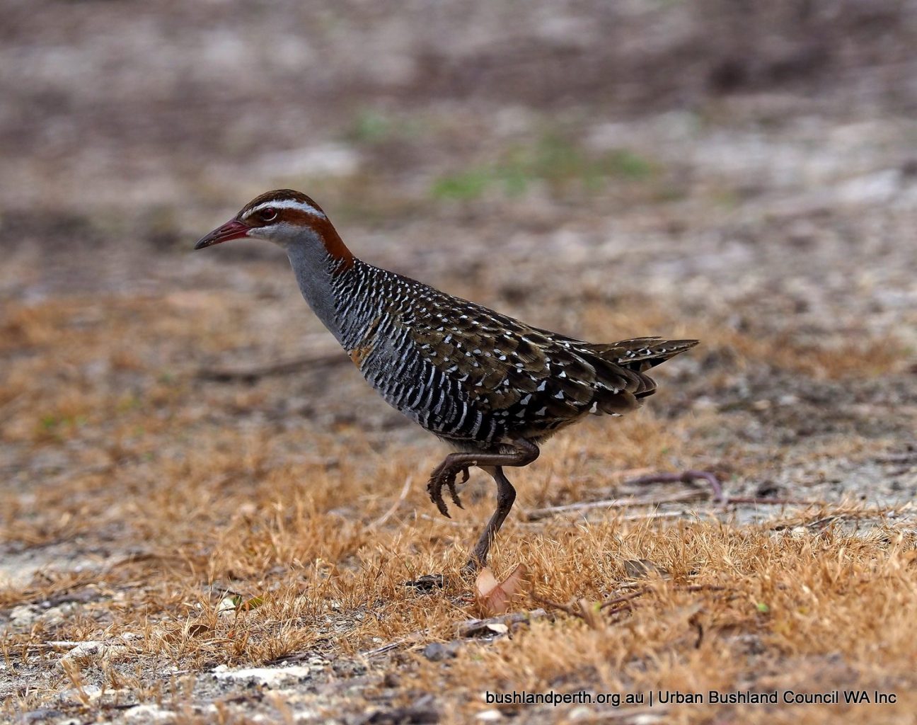
Buff-banded Rail. This bird is always present, but is hard to spot, generally being very wary. Possibly breeds at Baigup as a pair was seen recently. Photo: John Baas.
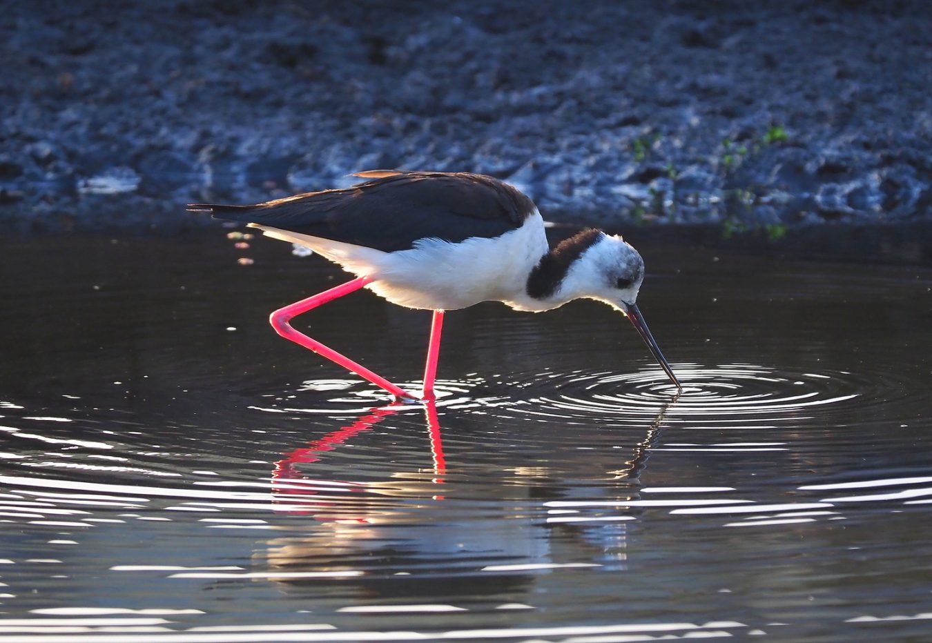
Pied Stilt. Pied Stilts are common at many metro locations such as at Lake Claremont or Herdsmans but this immature bird is only the second recorded at the Wetland; taken Apr 2019. Photo: John Baas.
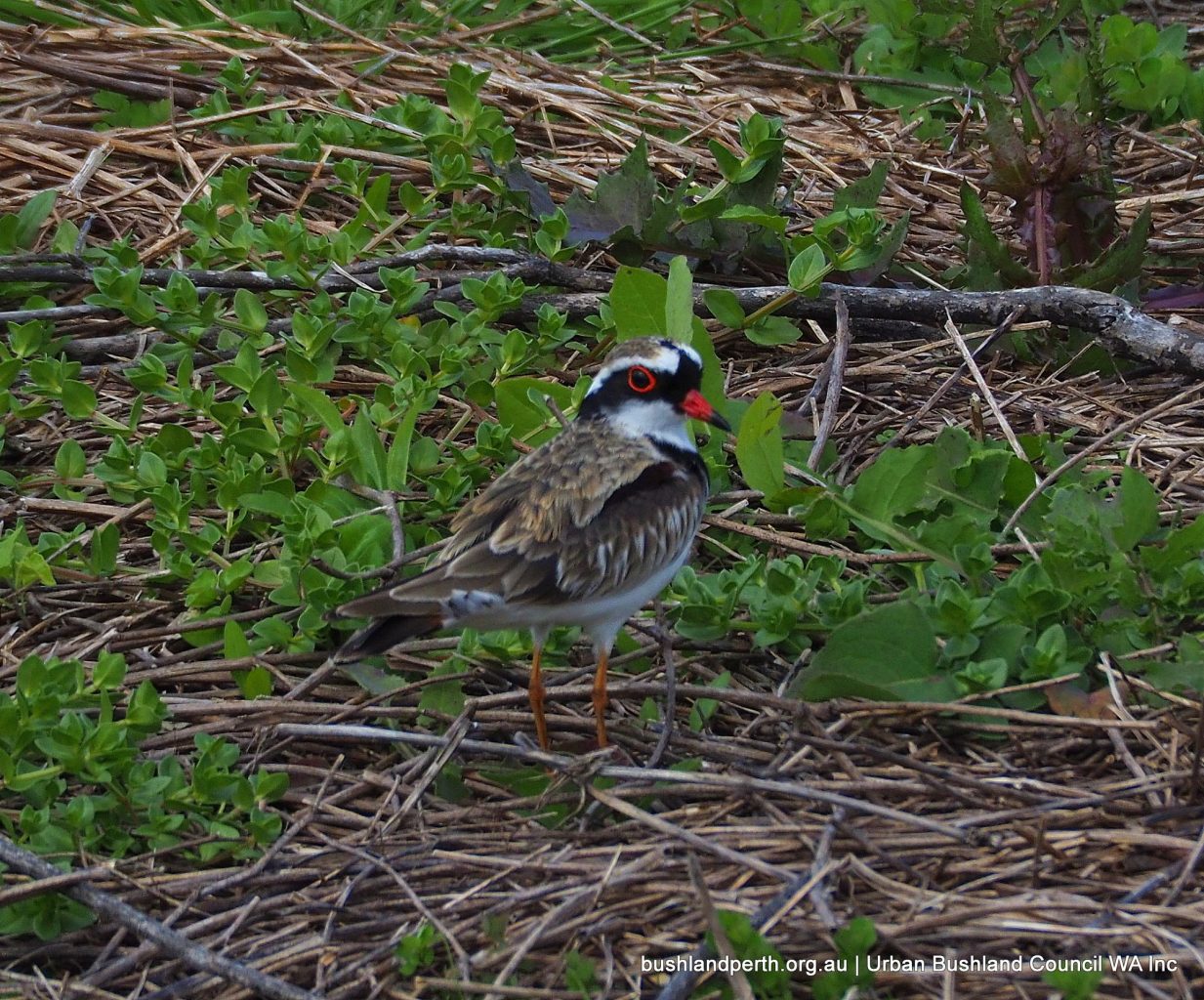
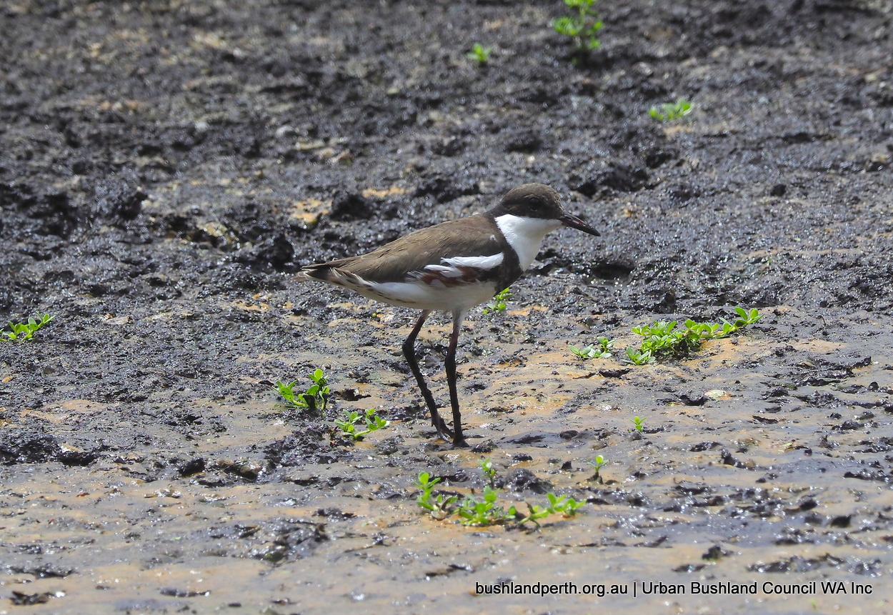
Black-fronted Dotterel; occasional visitor. Photo: John Baas.
Red-kneed Dotterel. Dec 2019 – first record for this species at Baigup. Photo: John Baas.
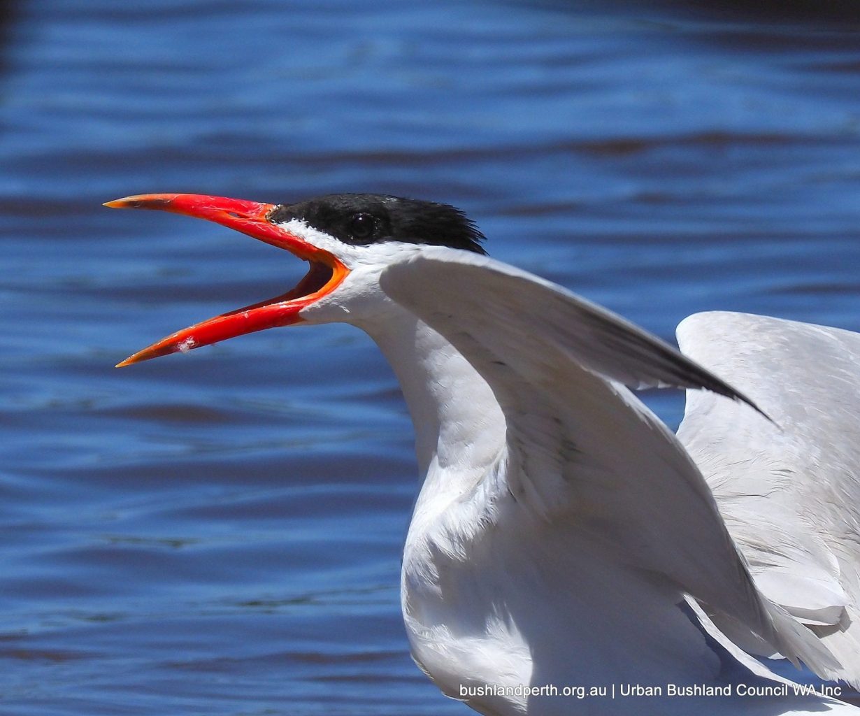
Caspian Tern. Image taken at River shore. Photo: John Baas.
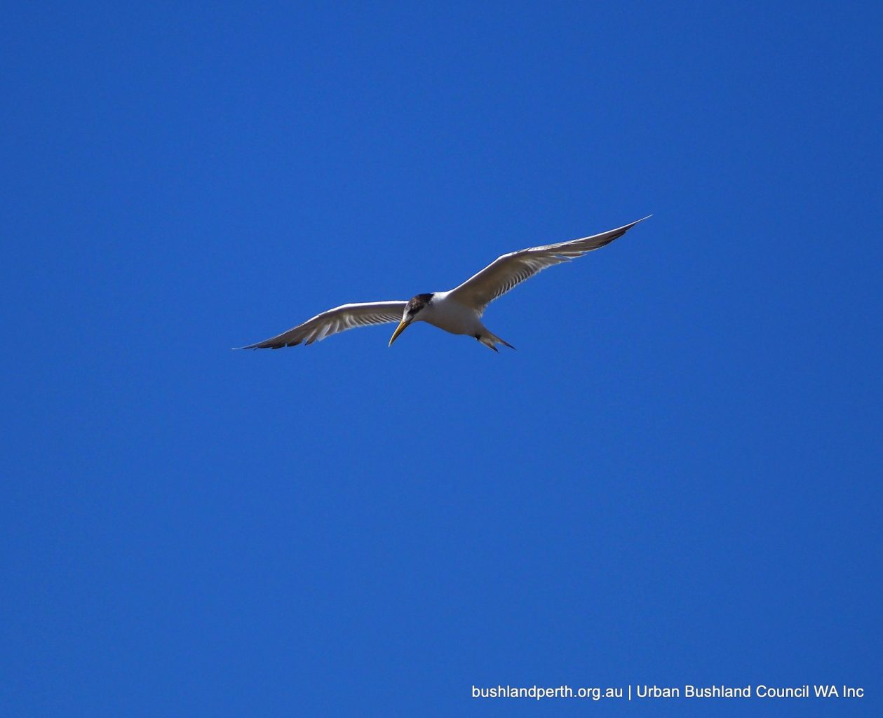
Crested Tern. Commonly seen fishing along the River. Photo: John Baas.
Baigup Bushbirds Gallery
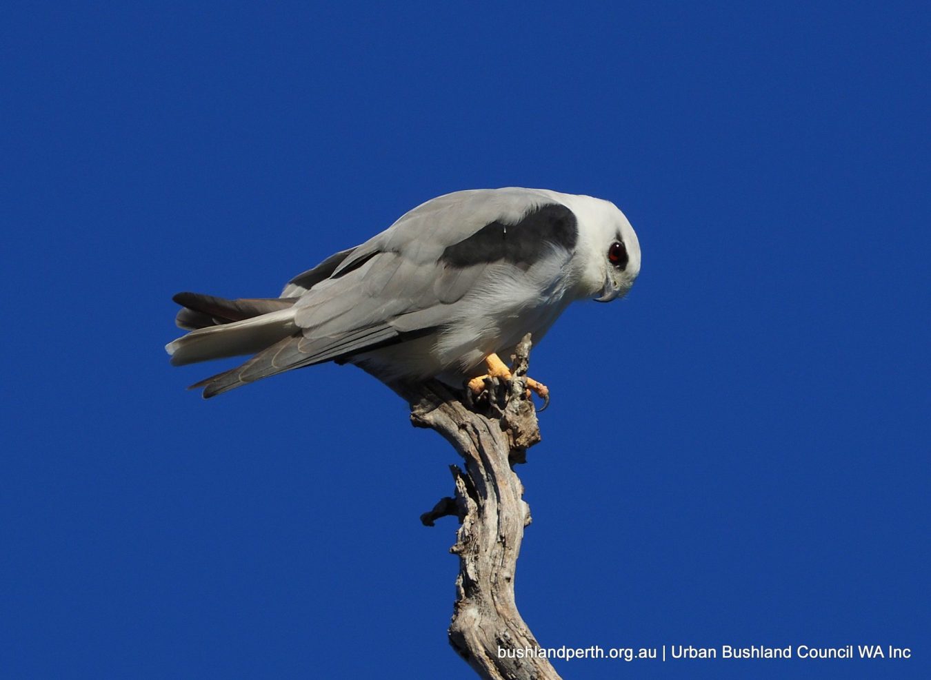
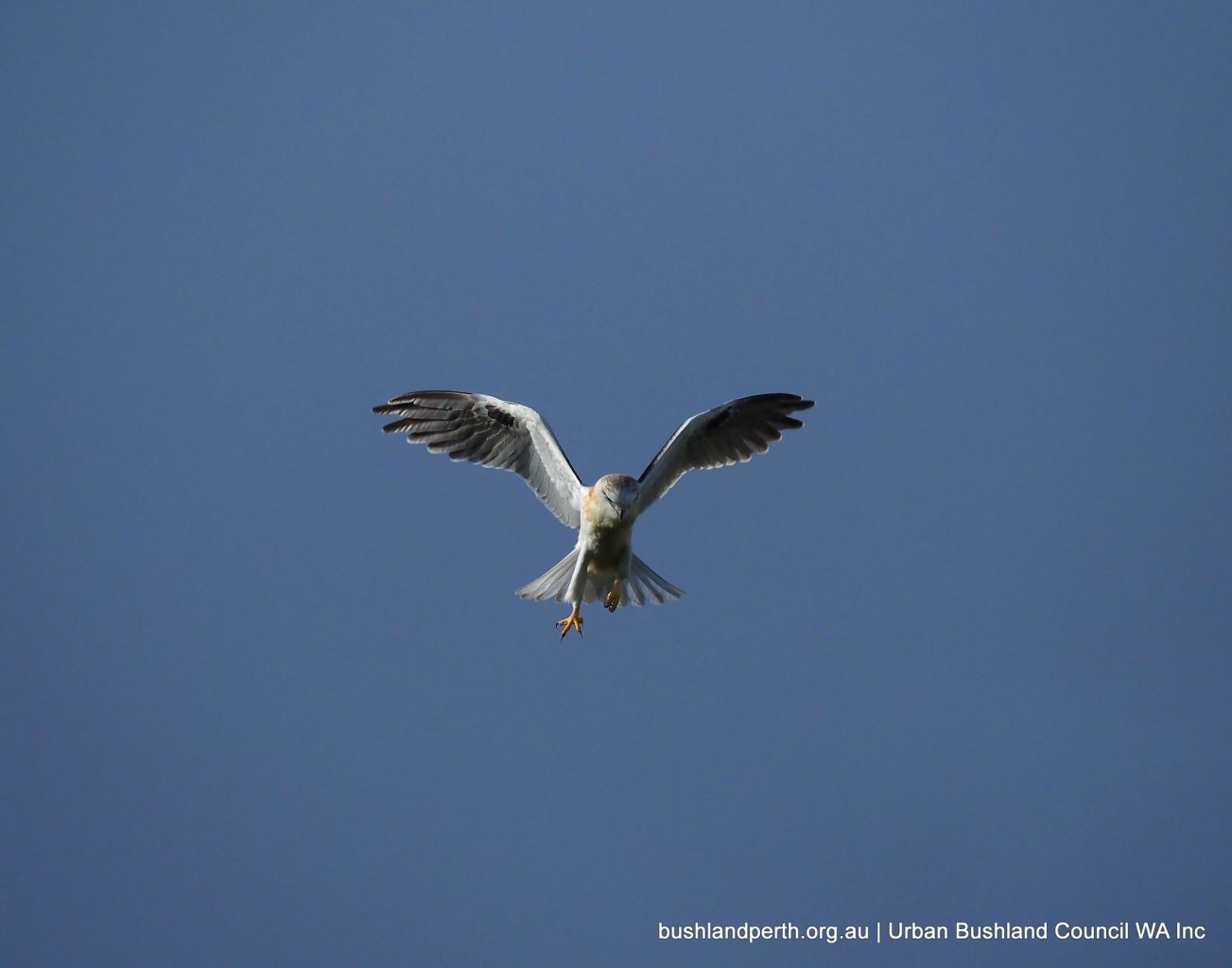
Black-shouldered Kite. Occasionally seen. Photo: John Baas.
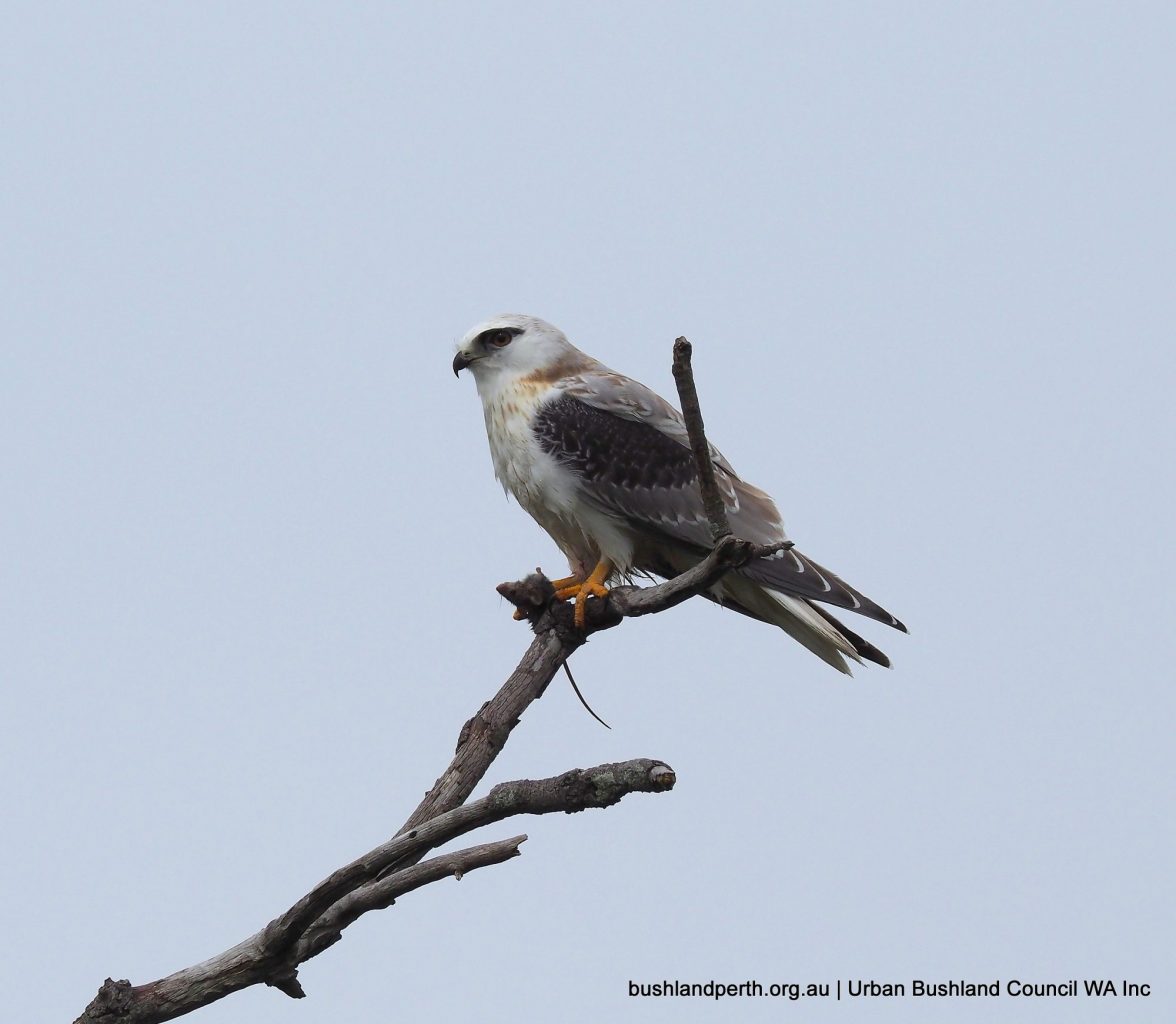
Juvenile Black-shouldered Kite with rat. Photo: John Baas.
Juvenile Black-shouldered Kite about to pounce. Photo: John Baas.
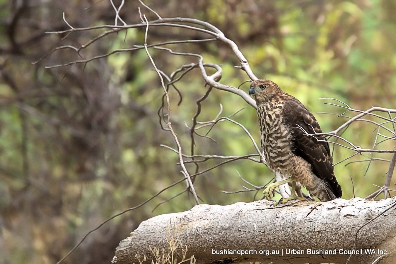
Brown Goshawk is usually present but is always hiding in ambush! Photo: Mike Clarke.
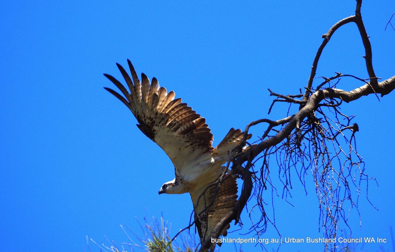
Eastern Osprey; often seen perching over the Swan on the She-oaks. Photo: John Baas.
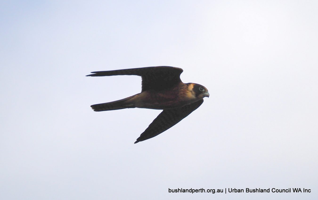
Australian Hobby is occasionally seen; mostly at the eastern end where it roosts in the adjacent Norfolk Pines. Unfortunately, the pic isn’t the best – taken in poor light near dusk. Photo: John Baas.
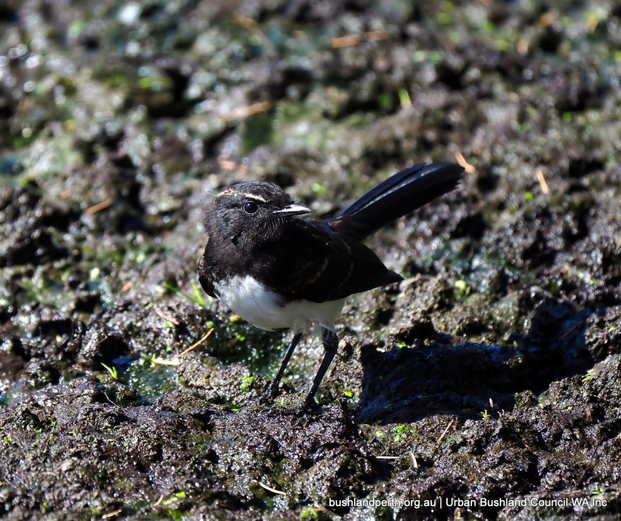
Baigup’s most common bushbird, the Willie Wagtail. This one a juvenile hawking on the mud. Photo: John Baas.
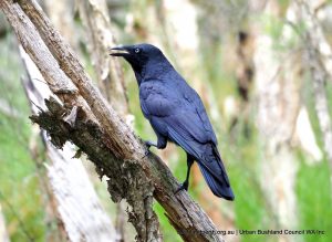
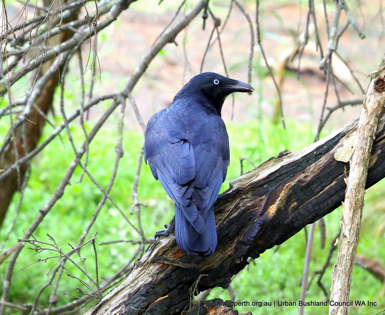
Australian Raven. Always present. Photo: John Baas.
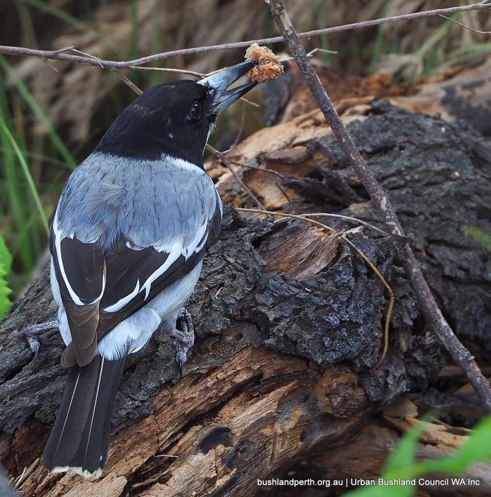
Grey Butcherbird. Often seen and heard ‘cackling’ in the eastern half of the Reserve. Photo: John Baas.
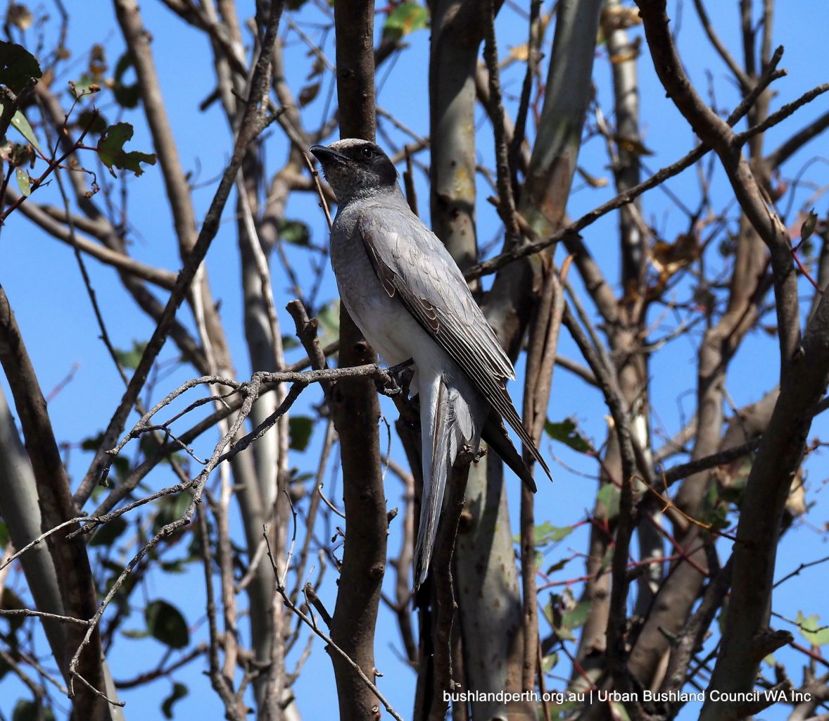
Black-faced Cuckoo Shrike. Frequently seen at eastern end. Photo: John Baas.
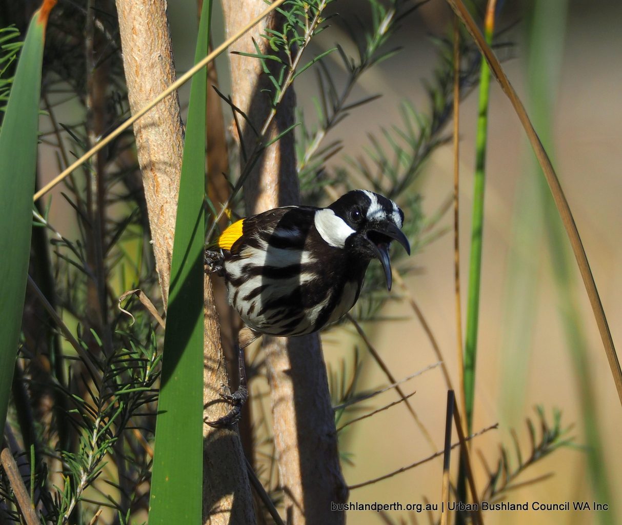
New Holland Honeyeater. Common all year round. Photo: john Baas.
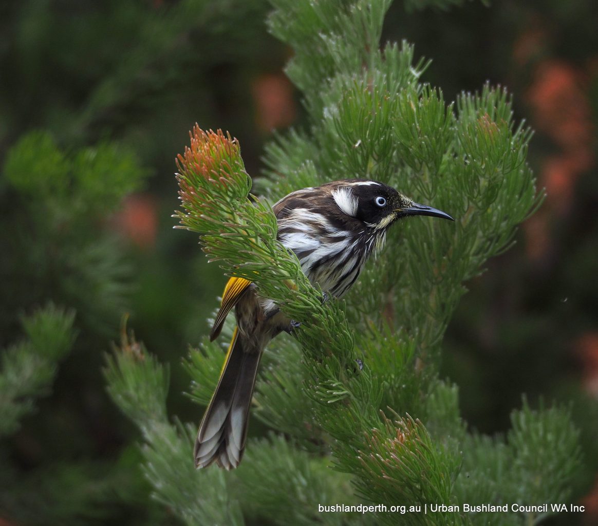
White-cheeked Honeyeater. These used to be common but have become less so following urban developments at Baigup. Photo: John Baas.
Singing Honeyeater. Common. Photo: John Baas.
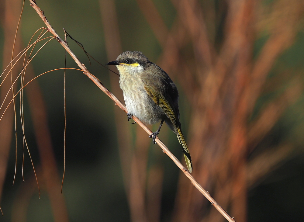
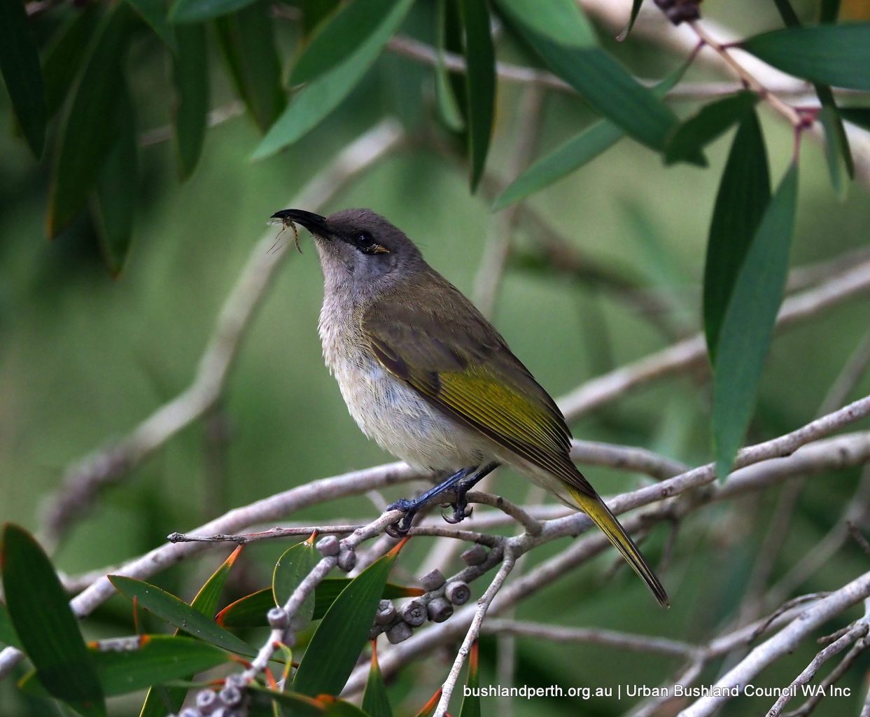
Brown Honeyeater. Fills Baigup with song all year round. Photo: John Baas.
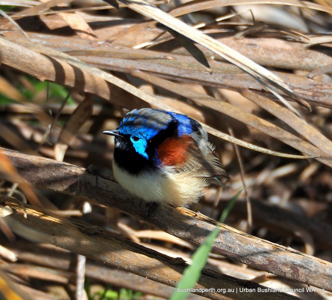
Male Purple-backed Fairy-wren. One family has been present over a number of years. Photo: John Baas.
Female Purple-backed Fairy-wren. Photo: John Baas.
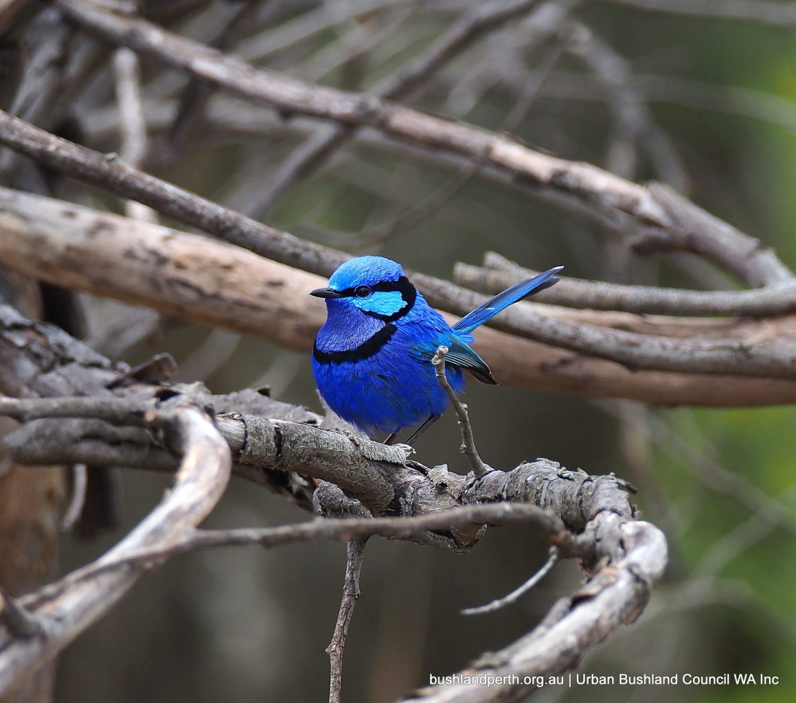
Splendid Fairy-wren. Only recently ‘moved in’. Photo: John Baas.
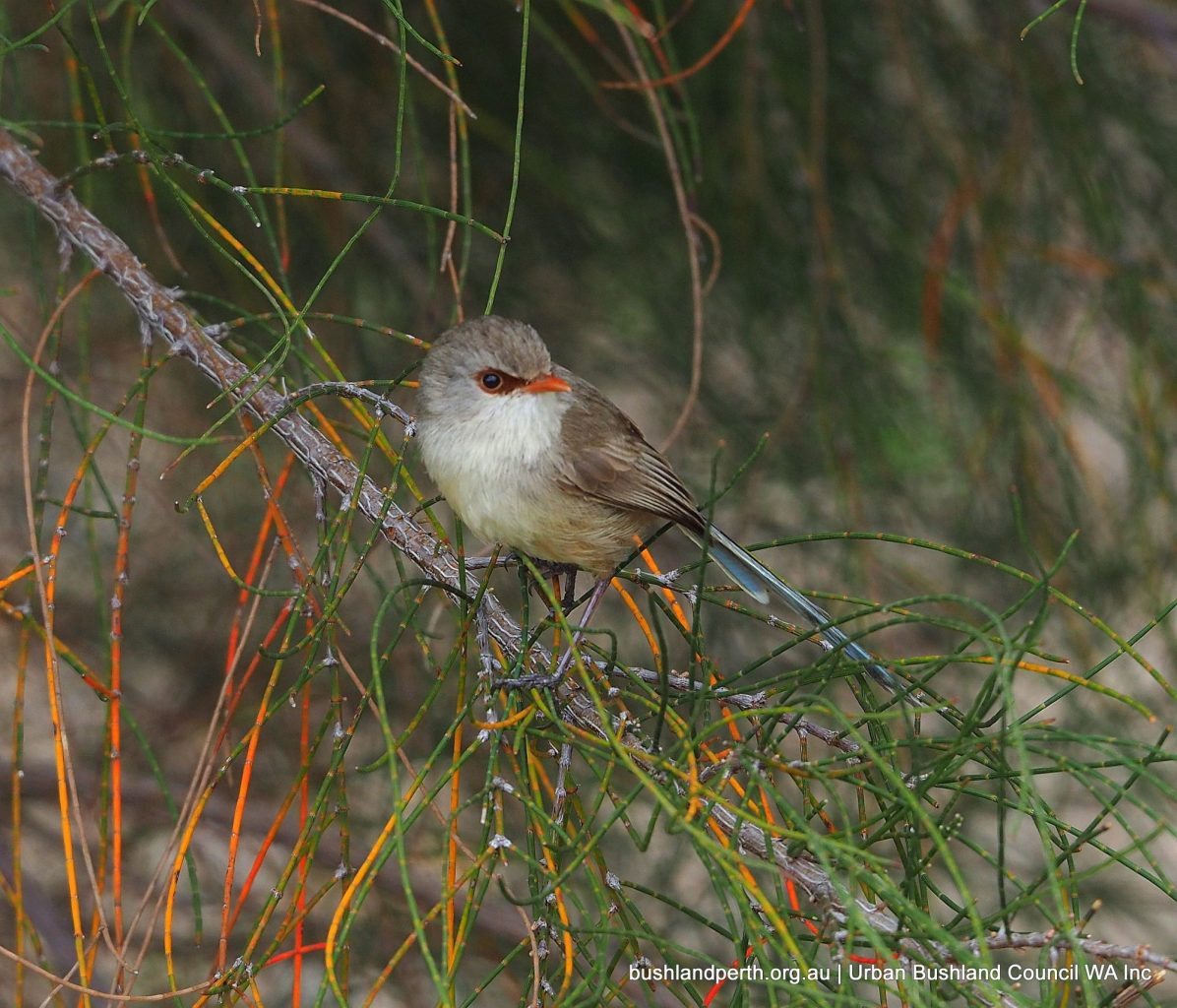
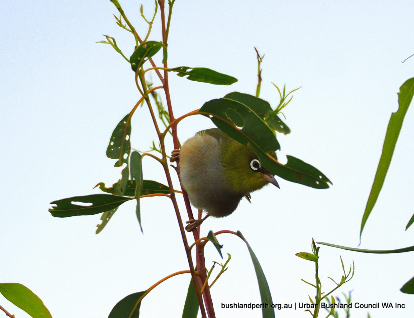
Silvereyes are always present. Photo: John Baas.
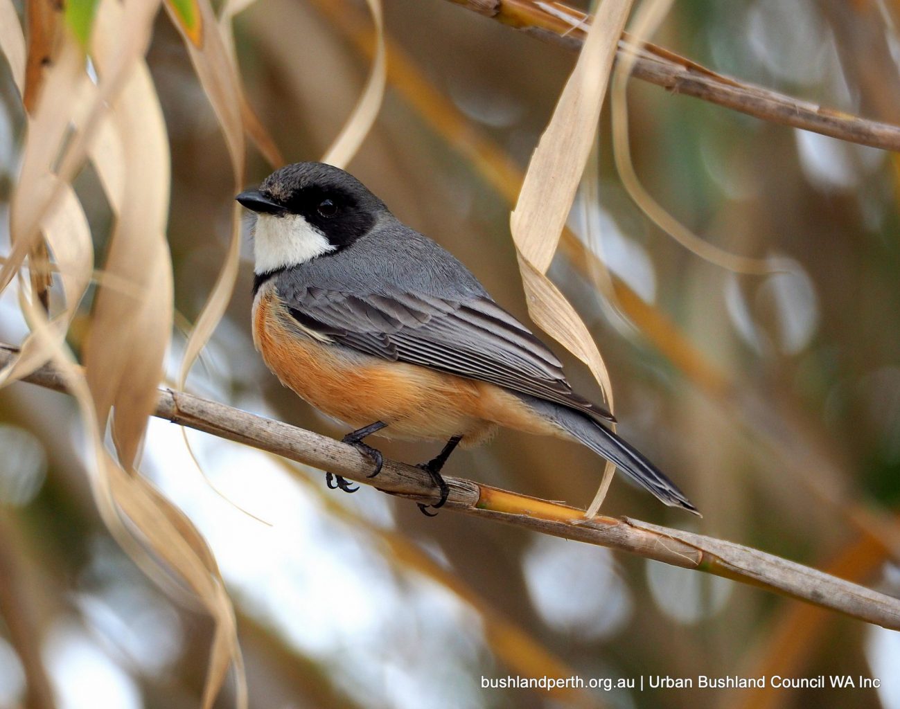
Rufous Whistlers are always heard calling. Photo: John Baas.
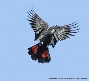
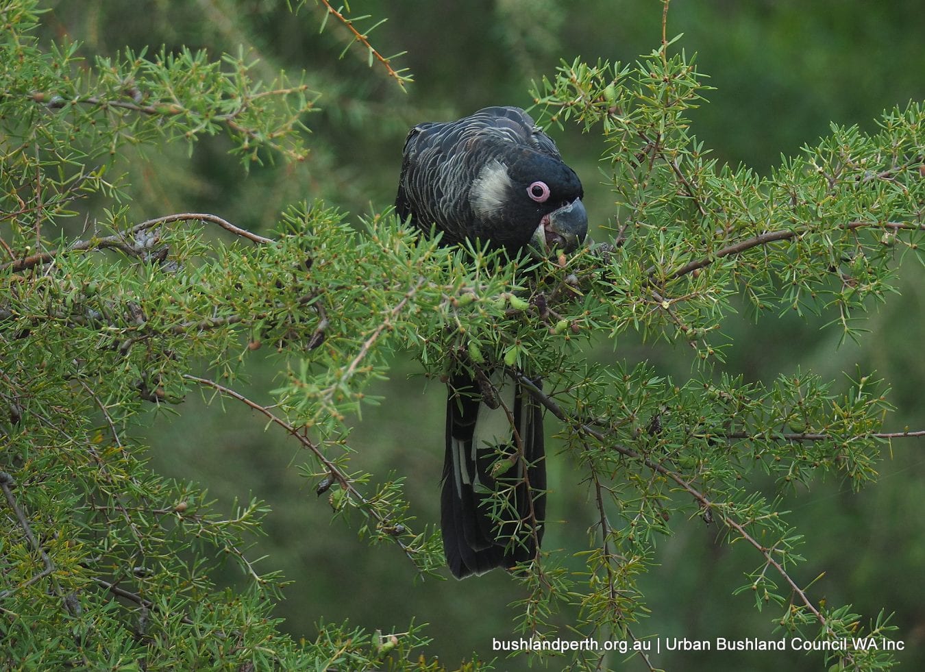
Carnaby’s Black-Cockatoo. Male (pink eye ring and dark bill) feeding on regenerated vegetation – Hakea varia, Variable-leaved Hakea. Carnaby’s are listed as ‘endangered’ by the International Union for the Conservation of Nature. Photo: John Baas.
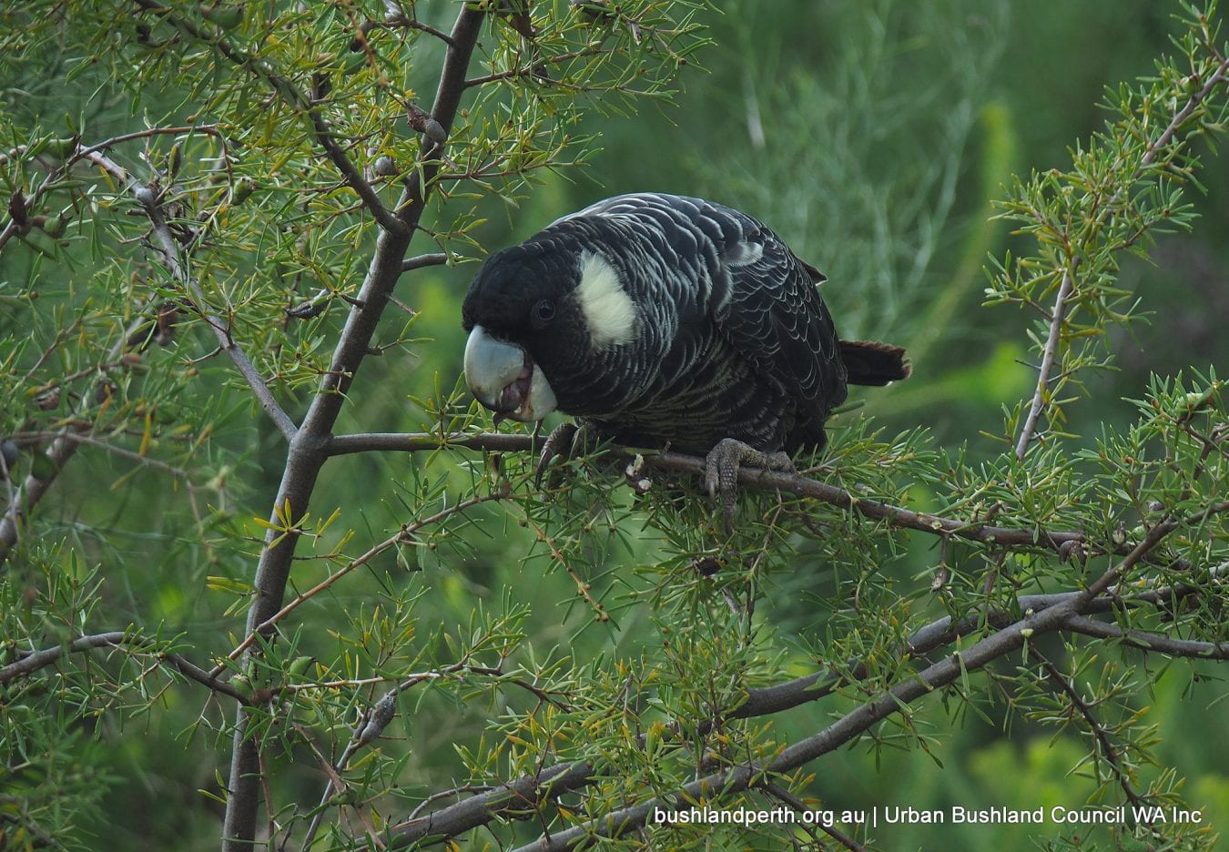
Carnaby’s Black-Cockatoo (female). This bird was one of a flock of twenty or more feeding on re-vegetation (Hakea varia) planted at the western end. Carnaby’s are threatened by loss of breeding habitat (mature trees with hollows); previously in the agricultural regions and more recently by relentless urban expansion. Photo: John Baas.
Rufous Whistler (female). Photo: John Baas.
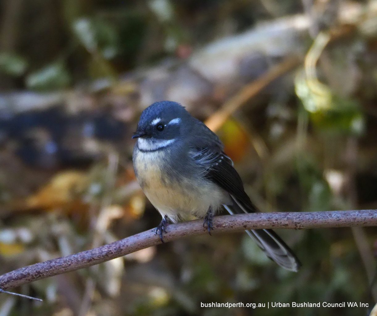
Grey Fantail. Frequently seen in the treed sections. Photo: John Baas.
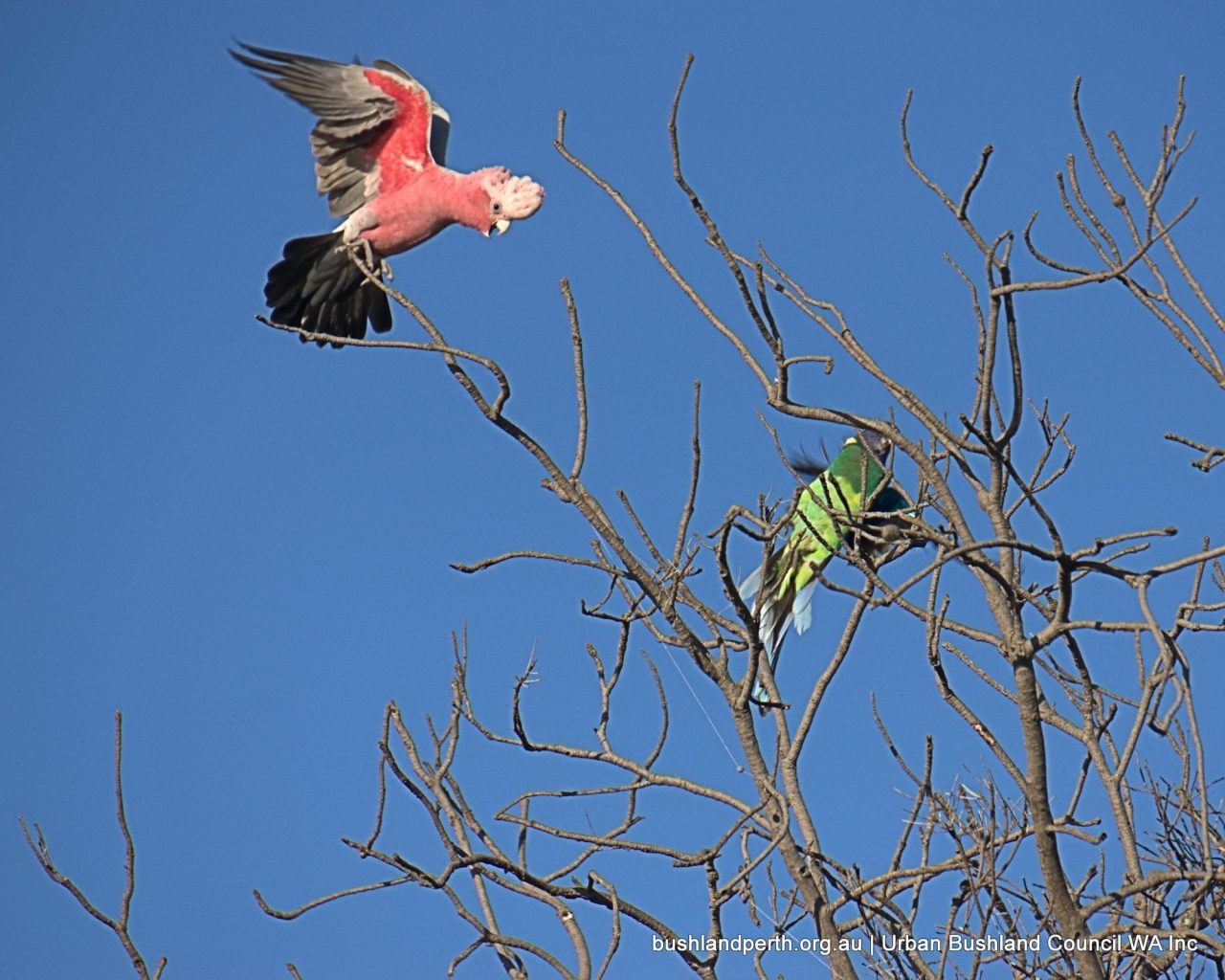
Galah scolding a Ringneck Parrot. Neither of these species is commonly seen at Baigup though both are common at nearby locations. Photo: Mike Clarke.
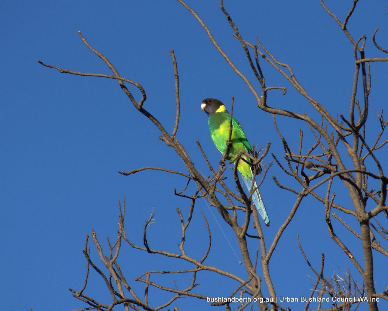
Australian Ringneck Parrot. Photo: Mike Clarke.
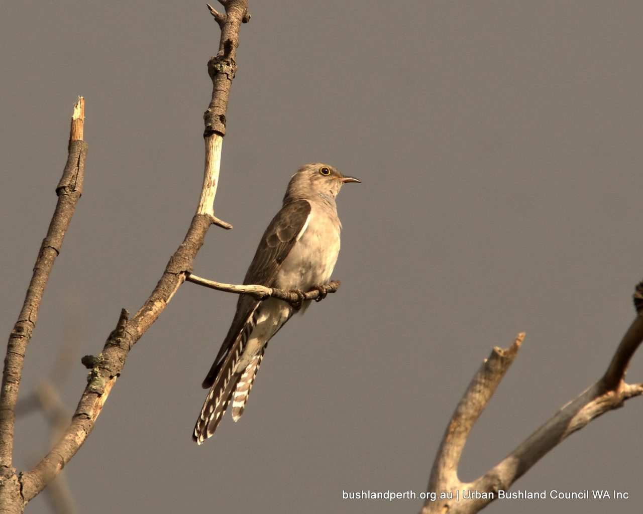
Pallid Cuckoo. Uncommon visitor in Springtime. Photo: Mike Clarke.
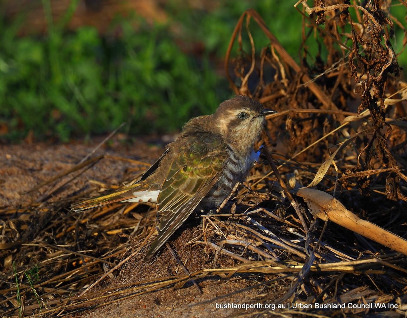
Horsefield’s Bronze Cuckoo. Uncommon visitor to Baigup. Photo: John Baas.
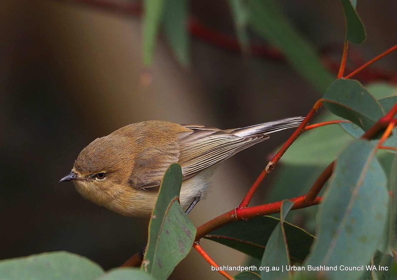
Western Gerygone. Usually associated with Weebills in Baigup’s Flooded Gums. Photo: John Baas.
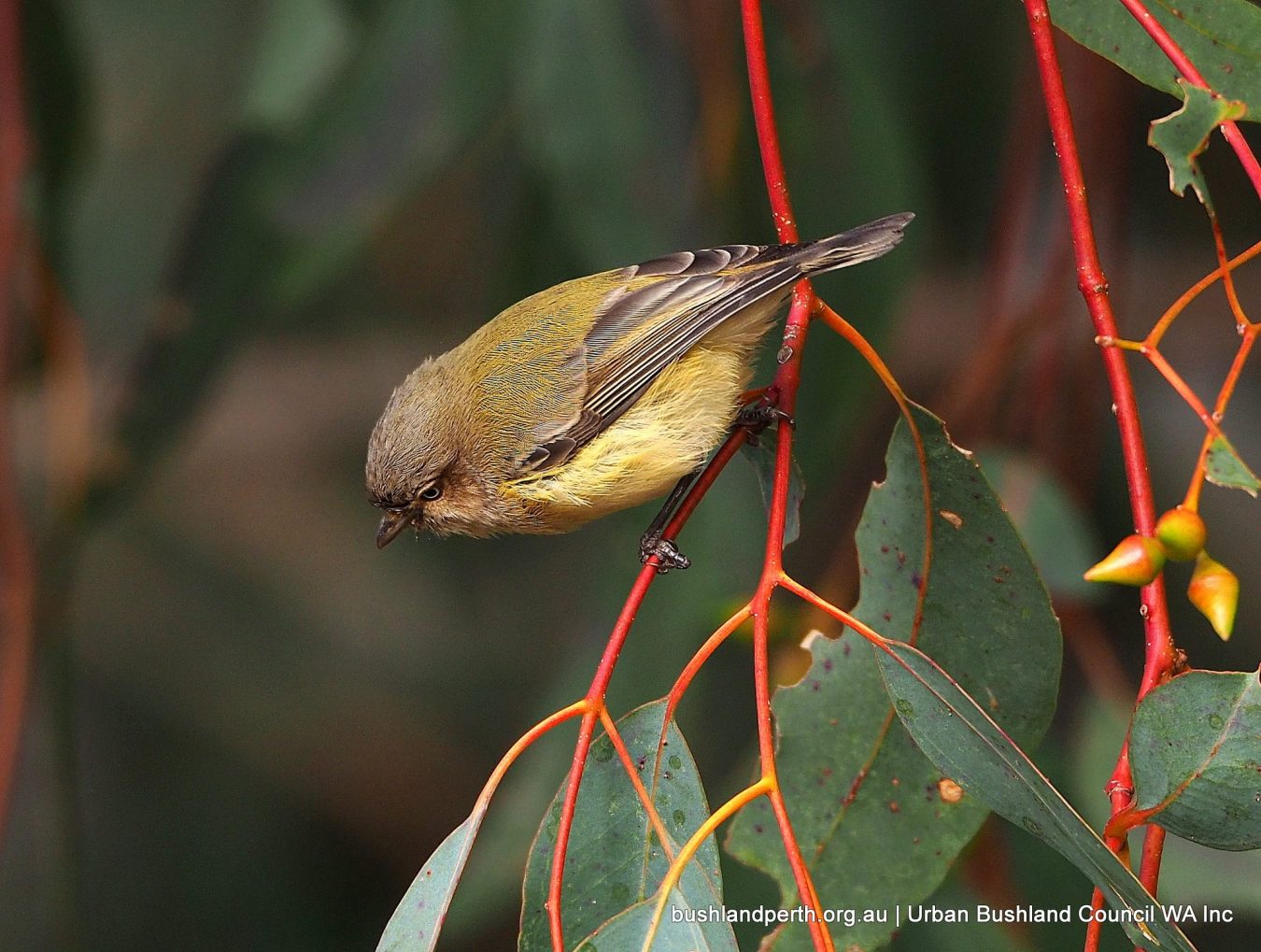
Weebill. Australia’s smallest bird. Not easily seen; high in the gums usually. Photo: John Baas.
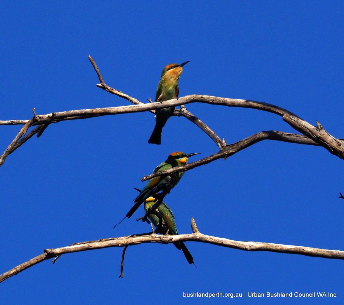
Rainbow Bee-eaters; summer visitors. Photo: John Baas.
Mistletoe Bird. Two species of Mistletoe are present on Baigup She-oaks providing an extended berry period from about January each year; bringing this species in in numbers. Photo: John Baas.
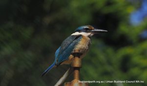
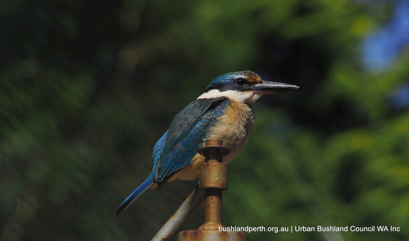
Sacred Kingfisher perched on gas infrastructure. Photo: John Baas.
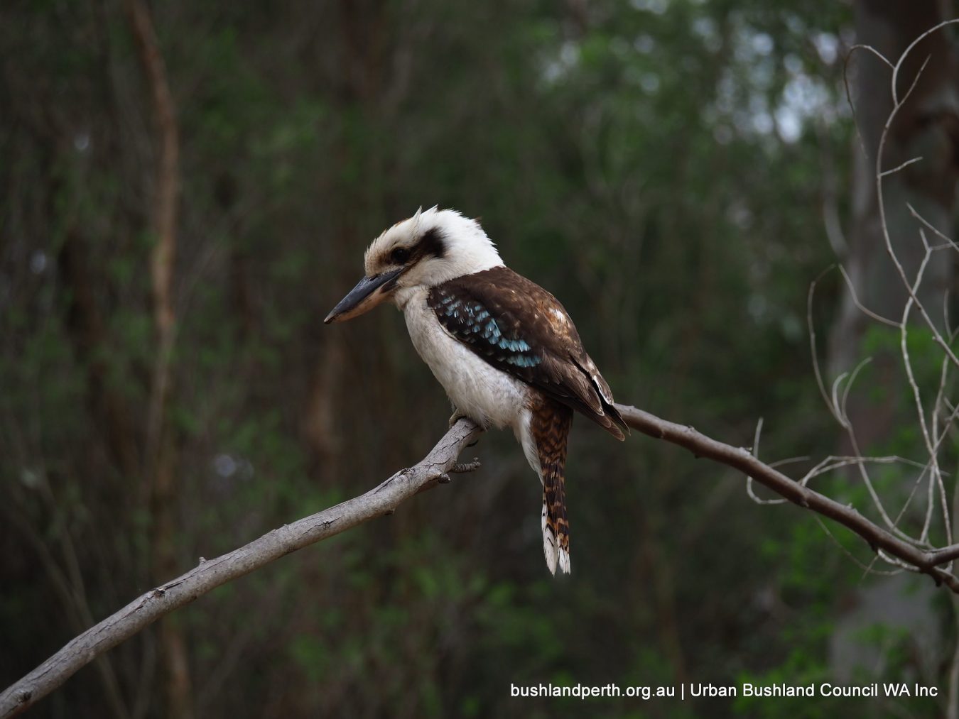
Laughing Kookaburra. Always present. Photo: John Baas.
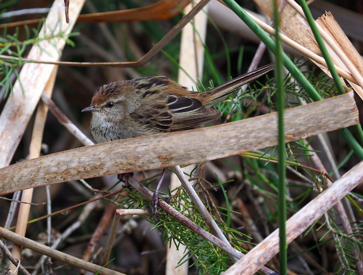
Little Grassbird. Always present but extremely furtive. LGB’s are one of WA’s most difficult to photograph birds. Their song is a mono-tonal ‘mournful’ three note call which is only heard in breeding season. Photo: John Baas.
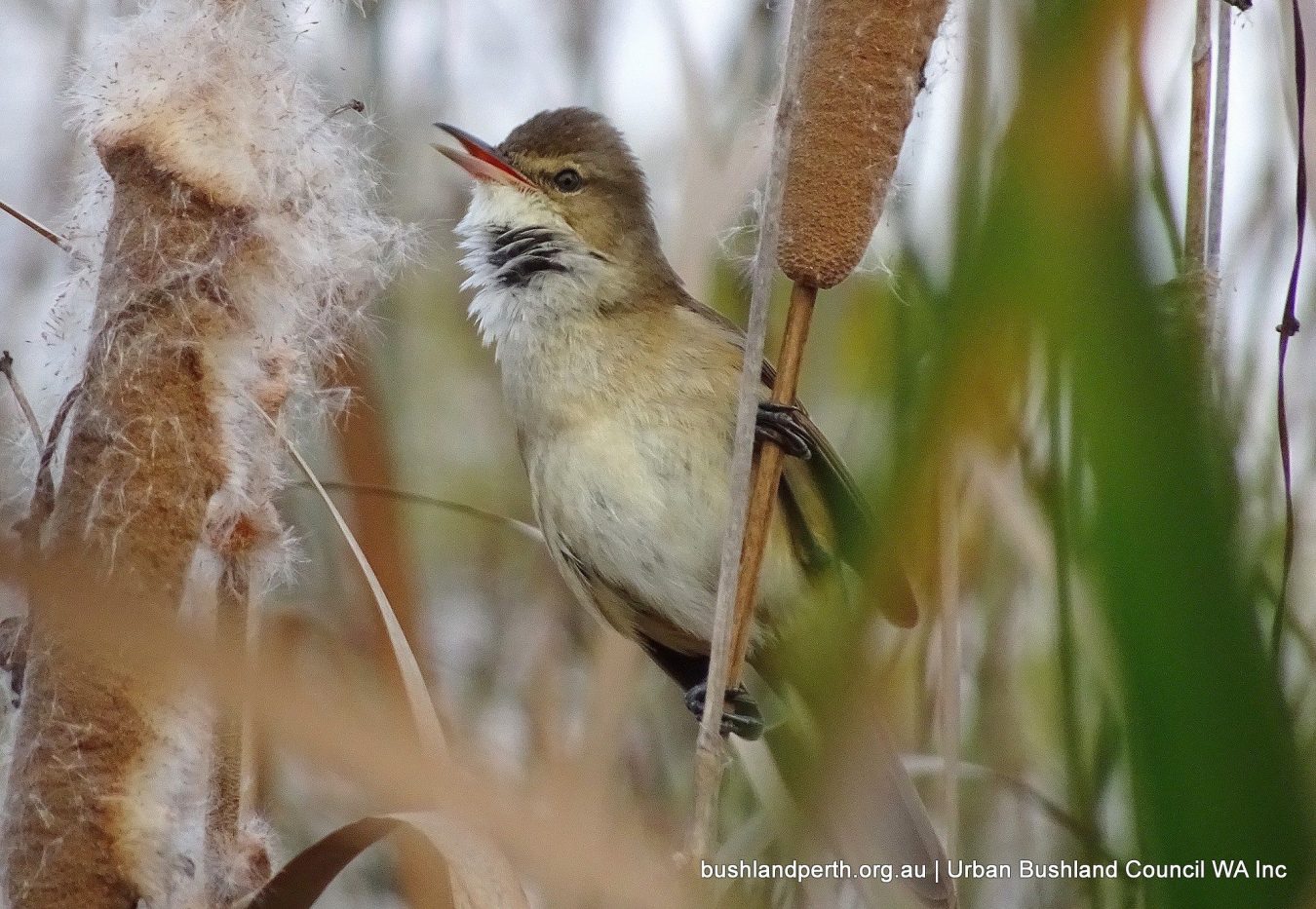
Australian Reed Warbler. Often heard; less frequently seen. Photo: Penny Lee.
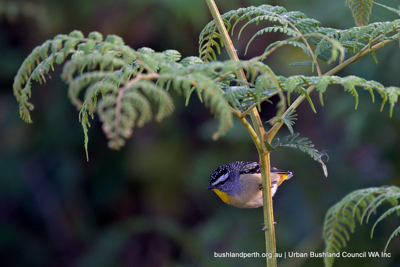
Spotted Pardelote. Only one ever sighting of this species – Apr 2017; possibly illustrating the importance of Baigup as a bird ‘staging post’. Photo: Mike Clarke.
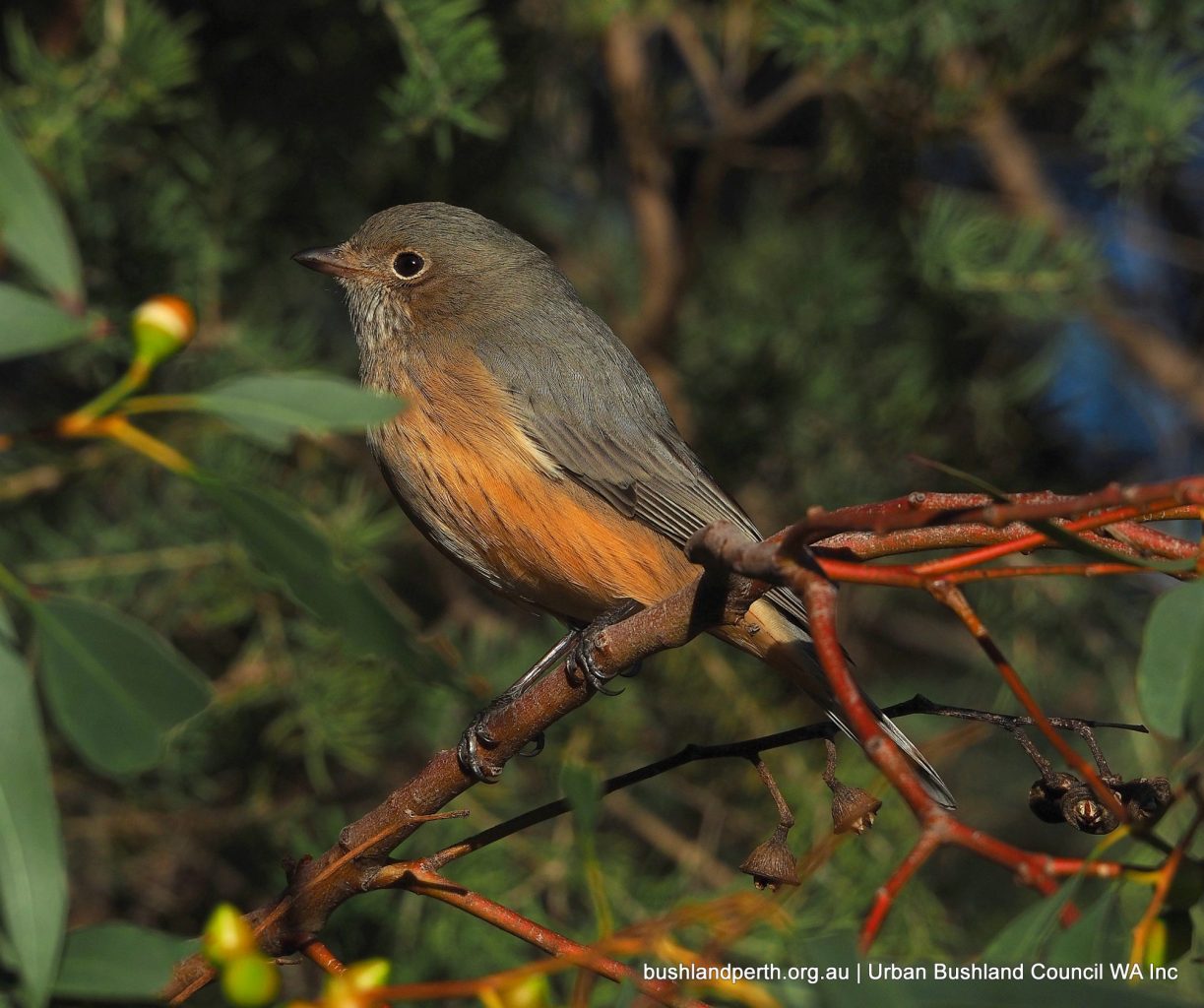
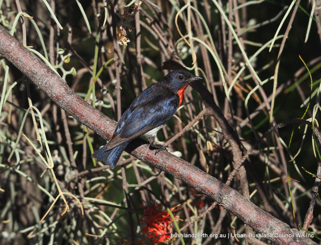
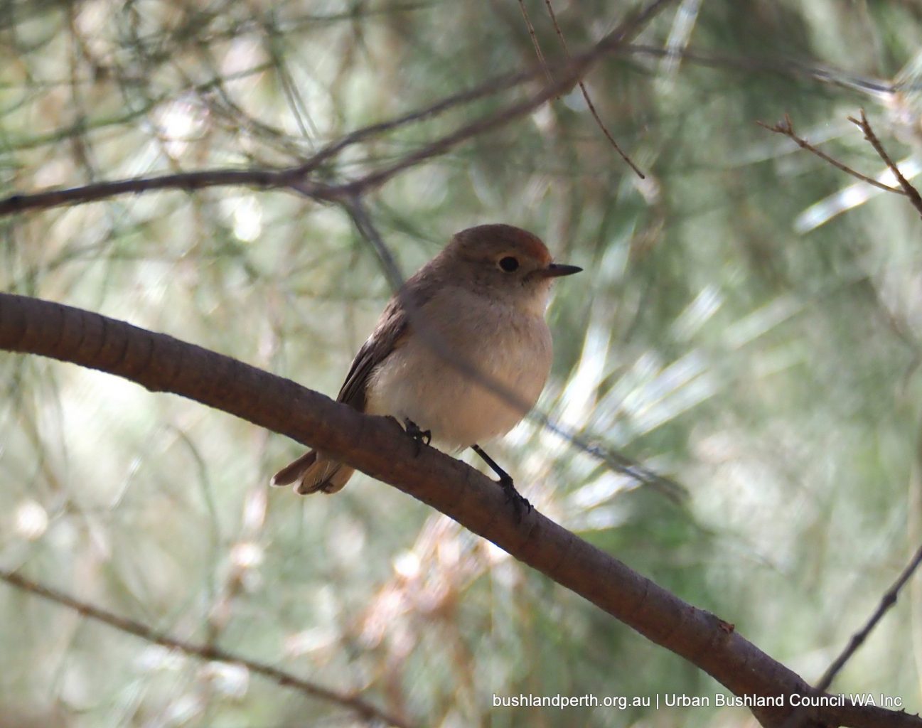
Female Red-capped Robin. Again, only one ever sighting of this bird – June 2017. Photo: John Baas.
Donations
Donations and support from the wider community help us to protect and campaign for our Urban Bushland.