
Treasure region: South of the River
Woodman Point Regional Park is one of the most fascinating places in the Perth metro, combining high order conservation values with equally high order heritage values.
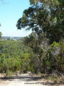
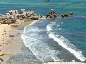
It is located on the coast 9 kilometres south of Fremantle and is mix of very scenic seascapes and woodlands in an area of 252 hectares. It is a Bush Forever site. The Park consists of a relatively narrow beach-ridge plain that extends to a peninsula formed as a result of sediment accumulation.
Woodman Point, and its associated offshore tombolo, separates Owen Anchorage from Jervoise Bay and also marks the northern extent of Cockburn Sound.
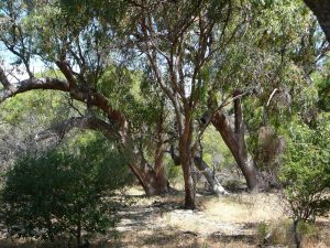
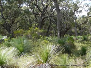
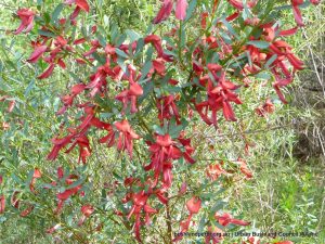
The Park contains a wide variety of ecosystems including shrubland, heath and scrub, and Quindalup woodlands. This includes tracts of undisturbed coastal vegetation, including tuart (Eucalyptus gomphocephala) , Rottnest cypress (Callitris preissii) and Rottnest tea tree (Melaleuca lanceolata) (identified as a threatened ecological community). The Woodman Point vegetation communities are also permanently listed on the Register of the National Estate. Importantly, some parts of Woodman Point have not suffered fire disturbance for over 100 years and are therefore benchmark examples of the floristic composition before European settlement in the early 1800s.
Woodman Point Regional Park is accessed from Cockburn Road. Start your visit to Woodman Point from either the northern end at John Graham Recreation Reserve or from the southern end via Woodman Point View Drive. See p39 of the Management Plan for details.
Birds at Woodman Point
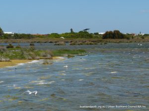
The Park provides a range of habitats that support local and trans-equatorial migratory birds plus many bushbird species. The coastal foreshore at the western extremity of the headland is an important breeding ground for local species, as well as a roosting and feeding area for local and transequatorial migratory species.
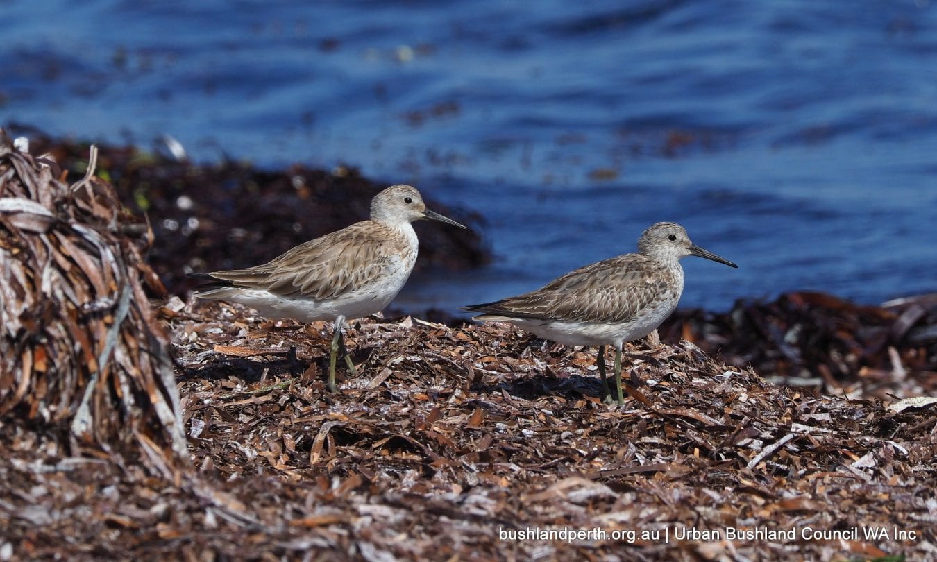
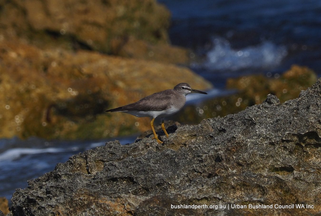
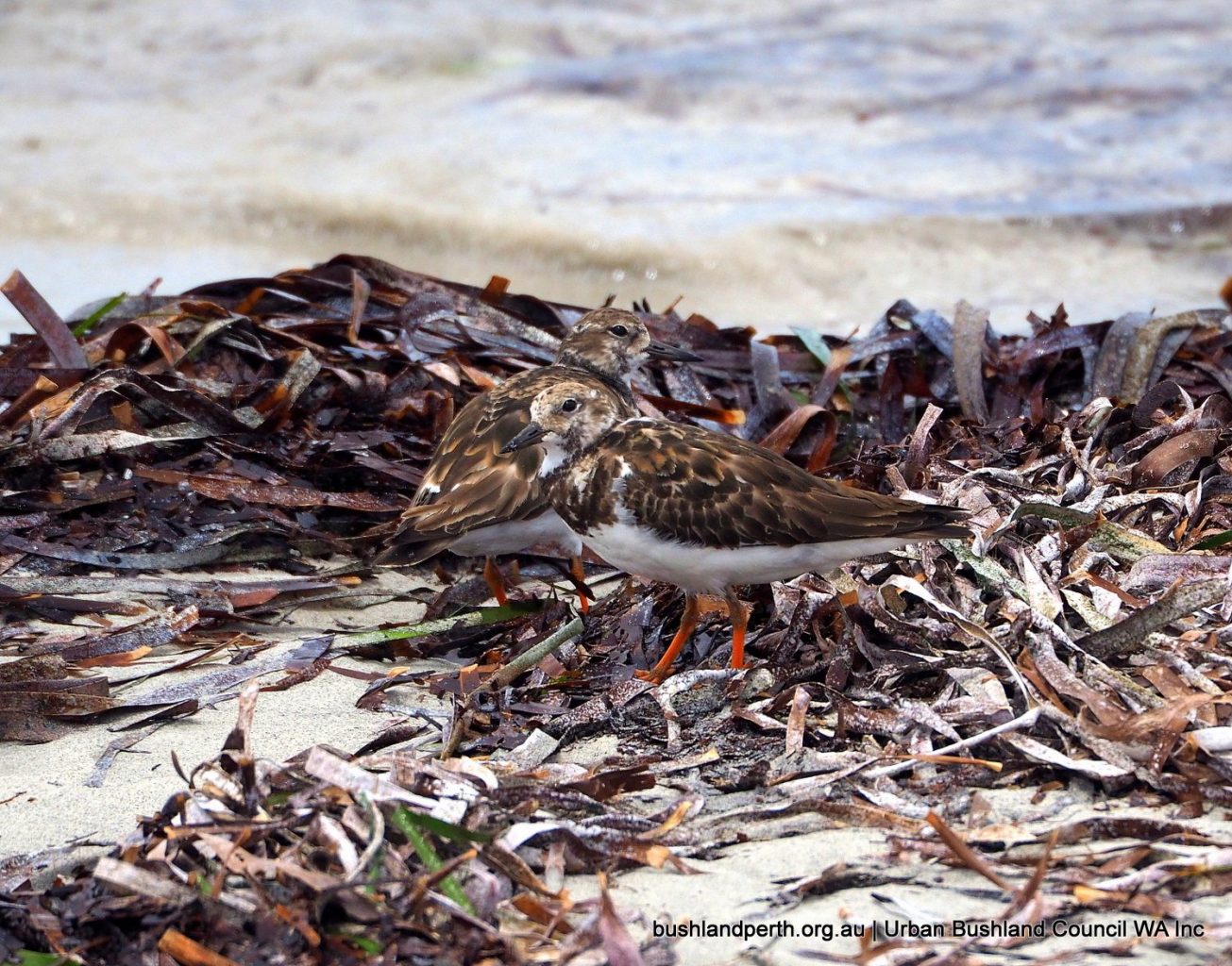
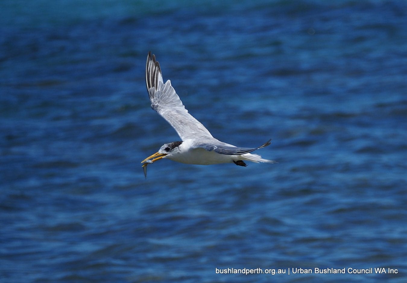
Over a hundred species have been recorded at Woodman Point. Of these, 36 species are shore-birds and other waterbirds.
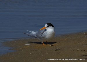
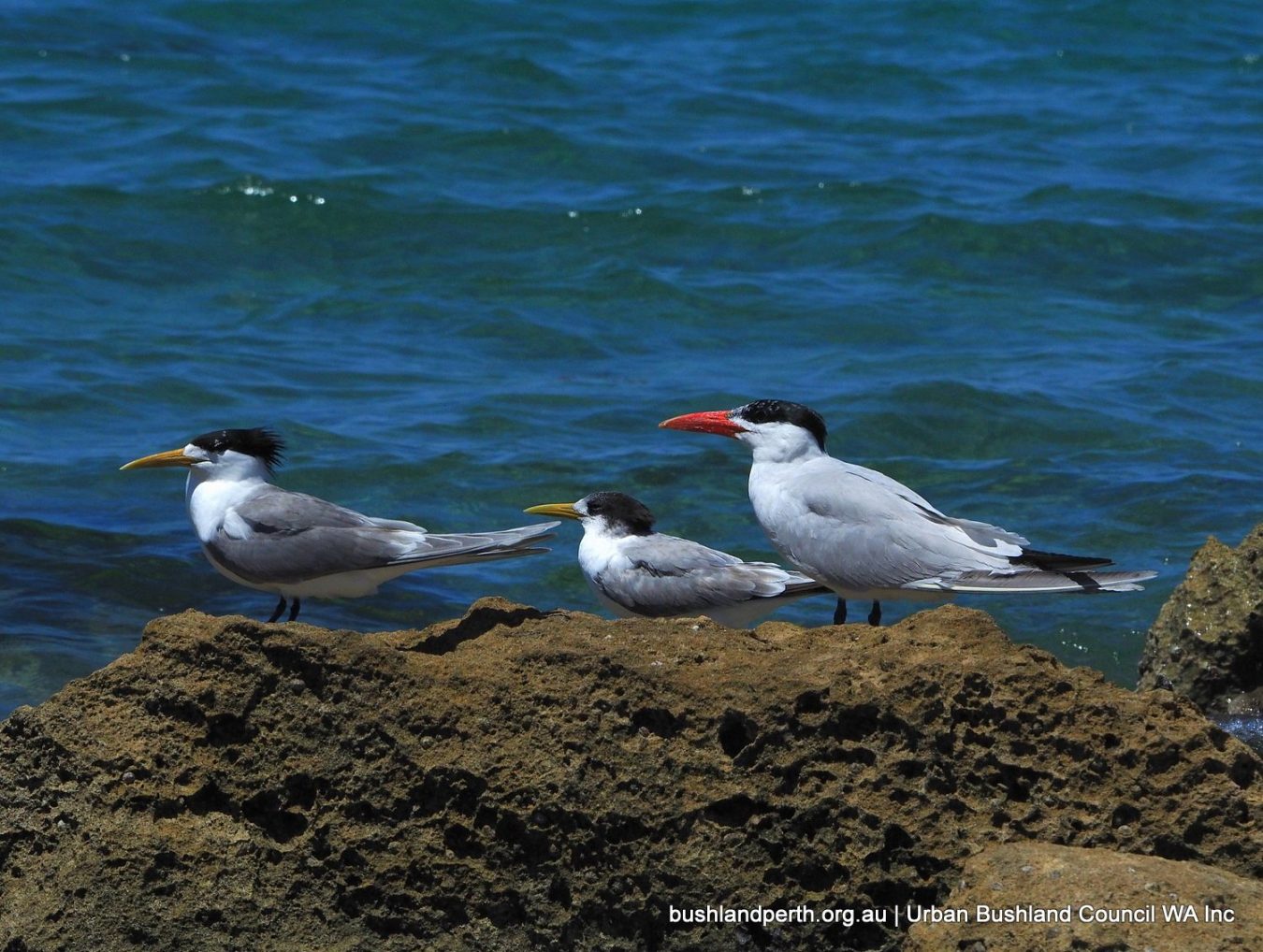
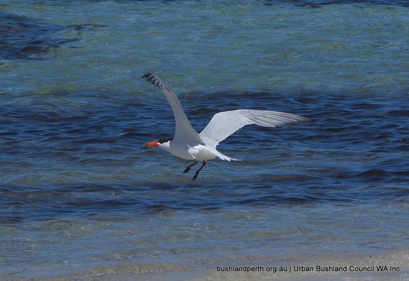
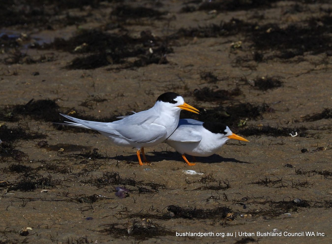
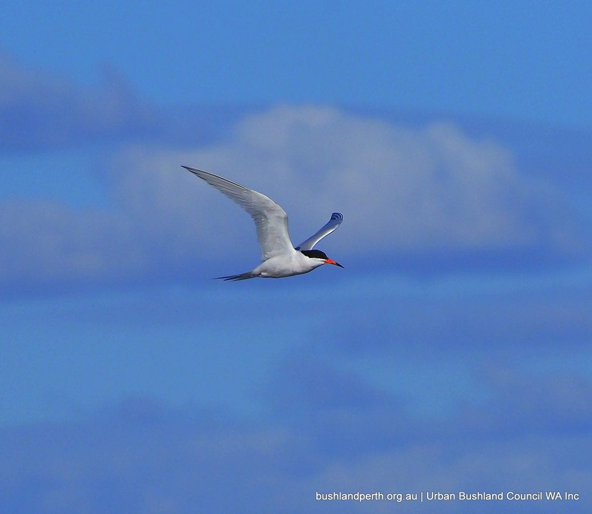
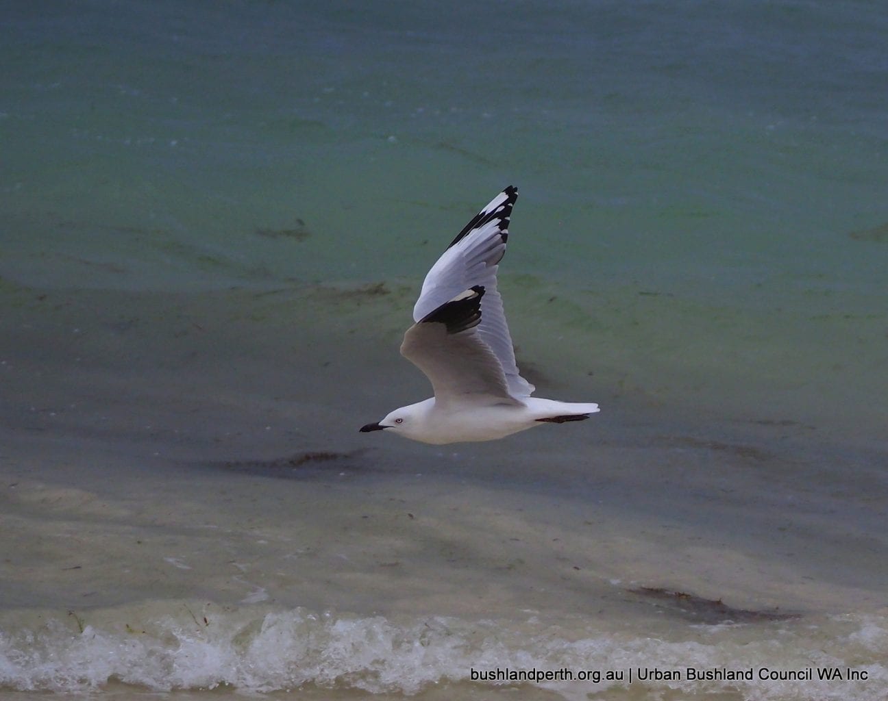
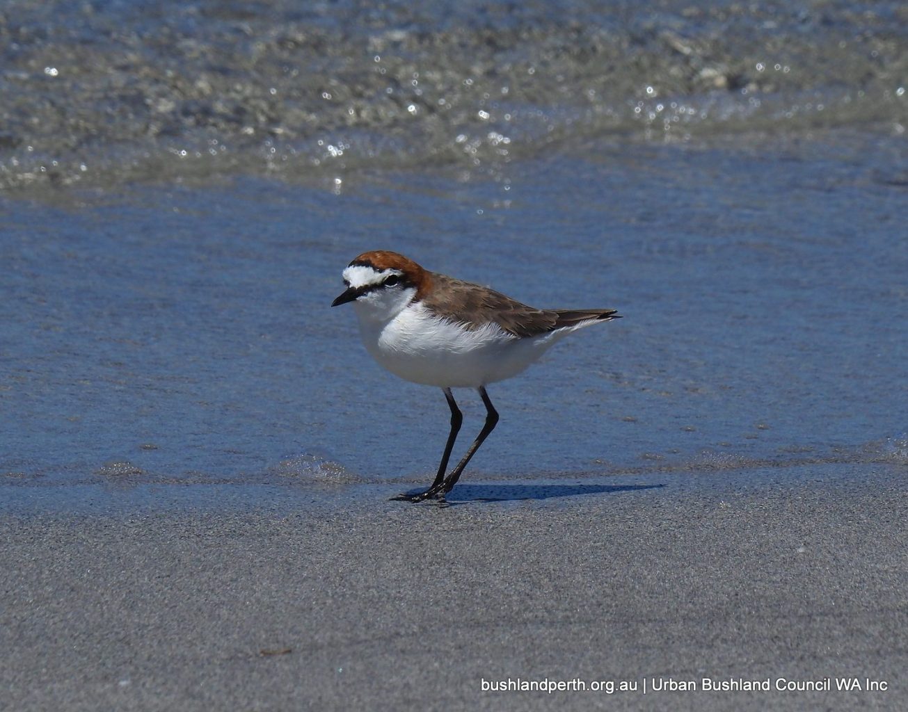
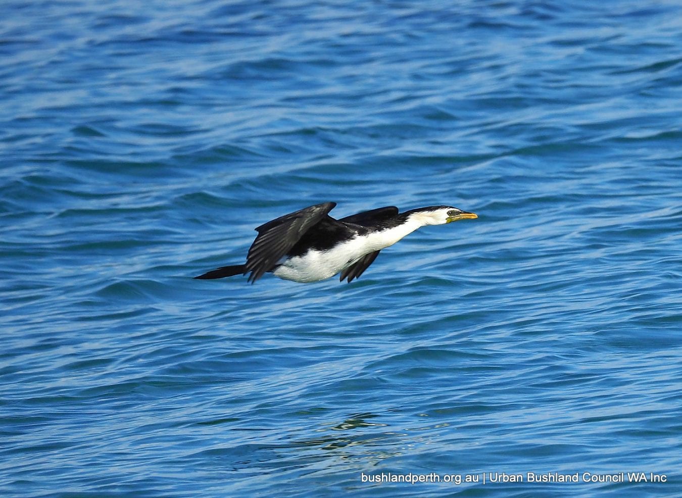
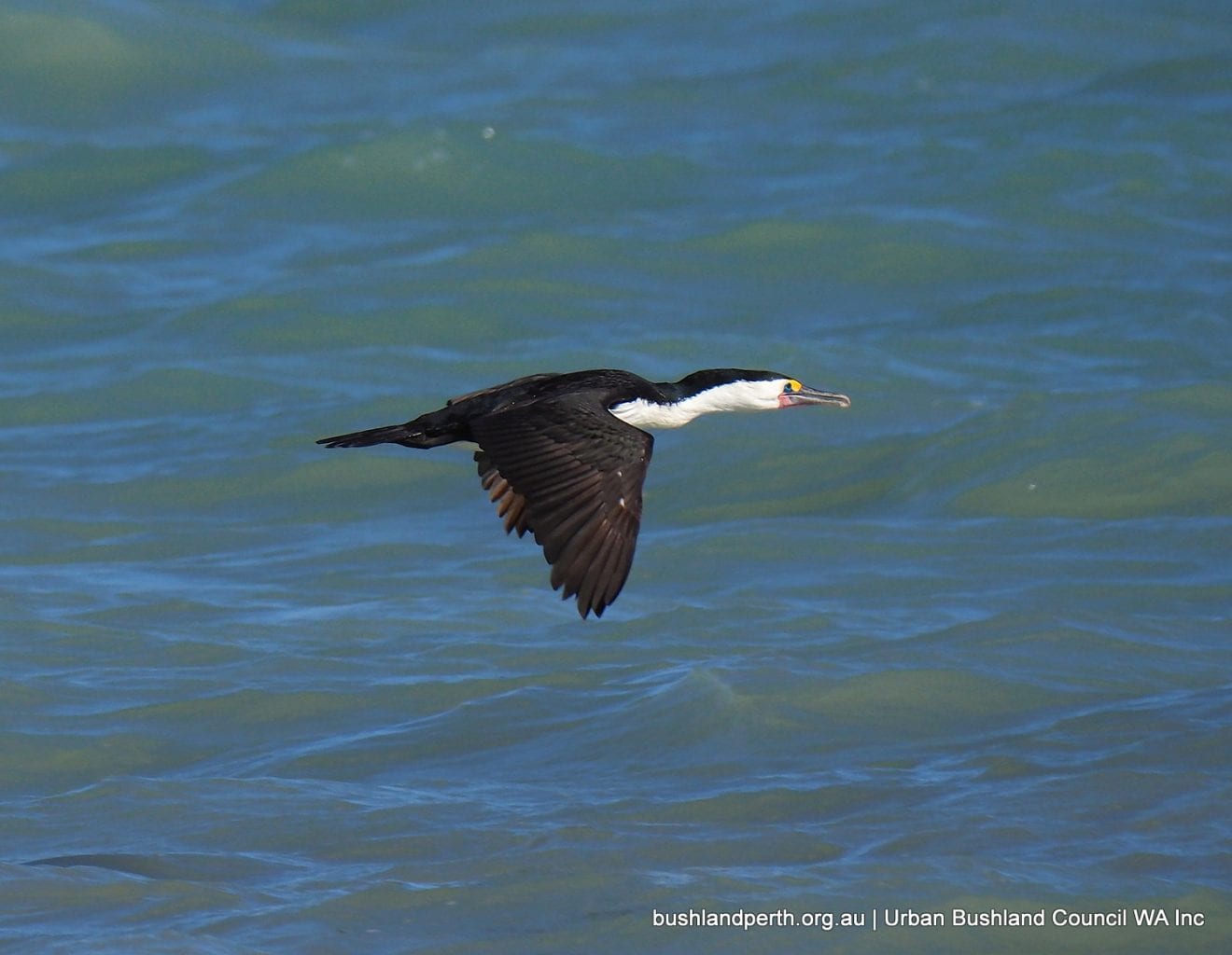
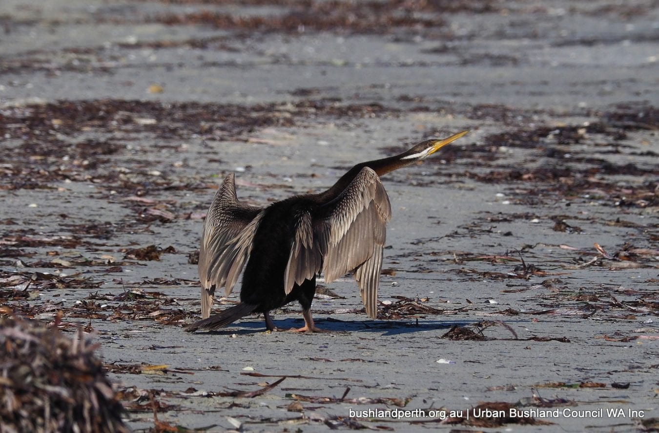
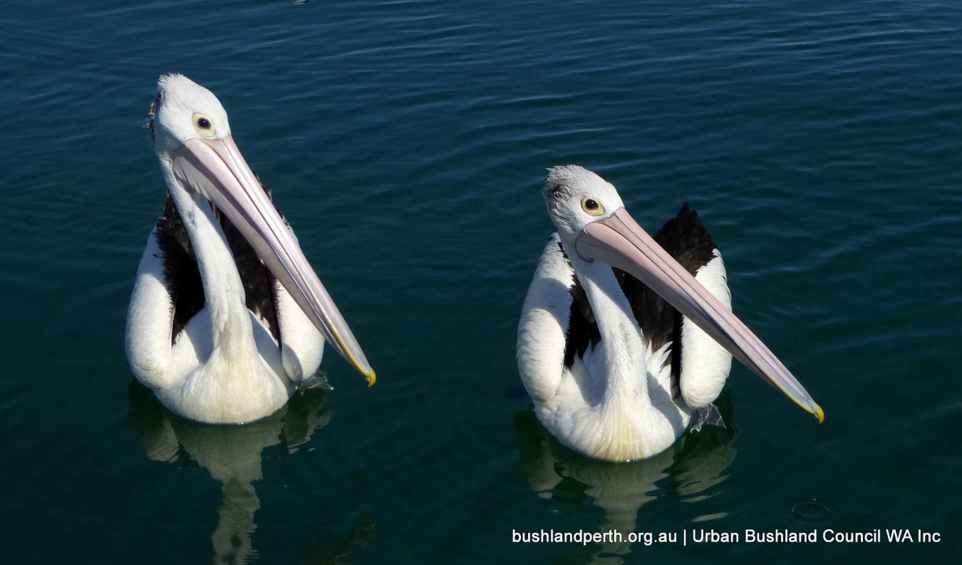
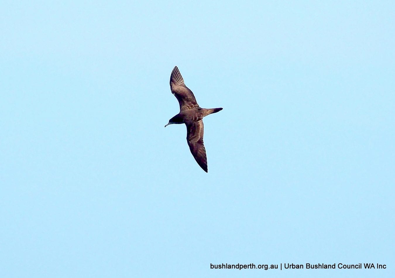
Common shore-birds include Caspian Tern, Crested Tern, Fairy Tern, Pied Cormorant, Little-pied Cormorant, Australasian Darter, Australian Pied Oystercatcher, Red-capped Plover, Australian Pelican. Occasionally seen near shore is Wedge-tailed Shearwater.
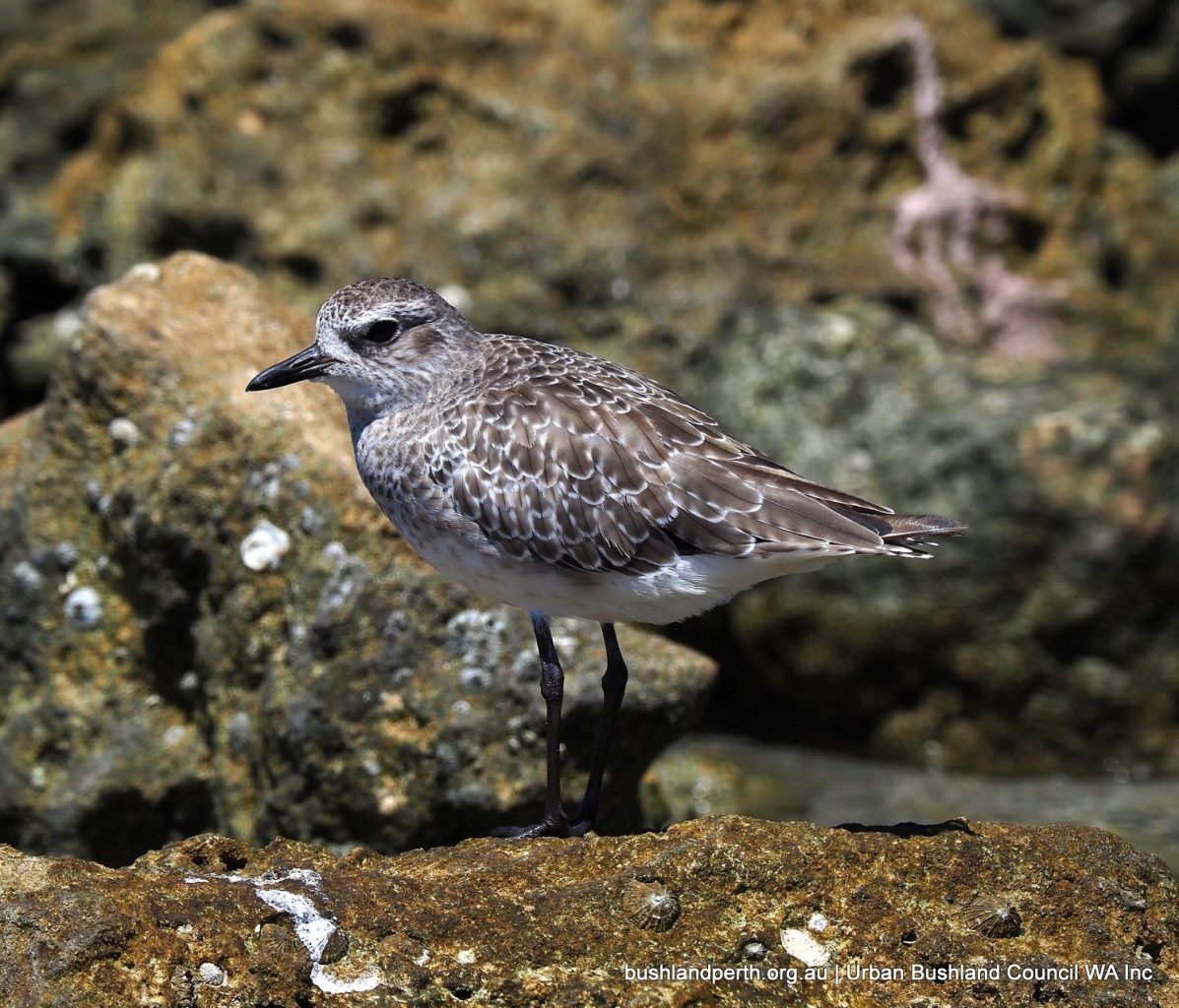
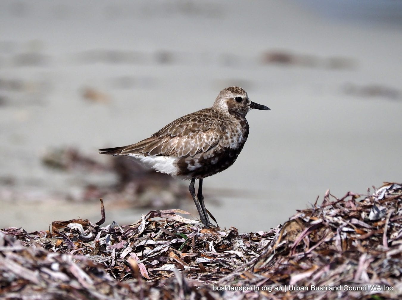
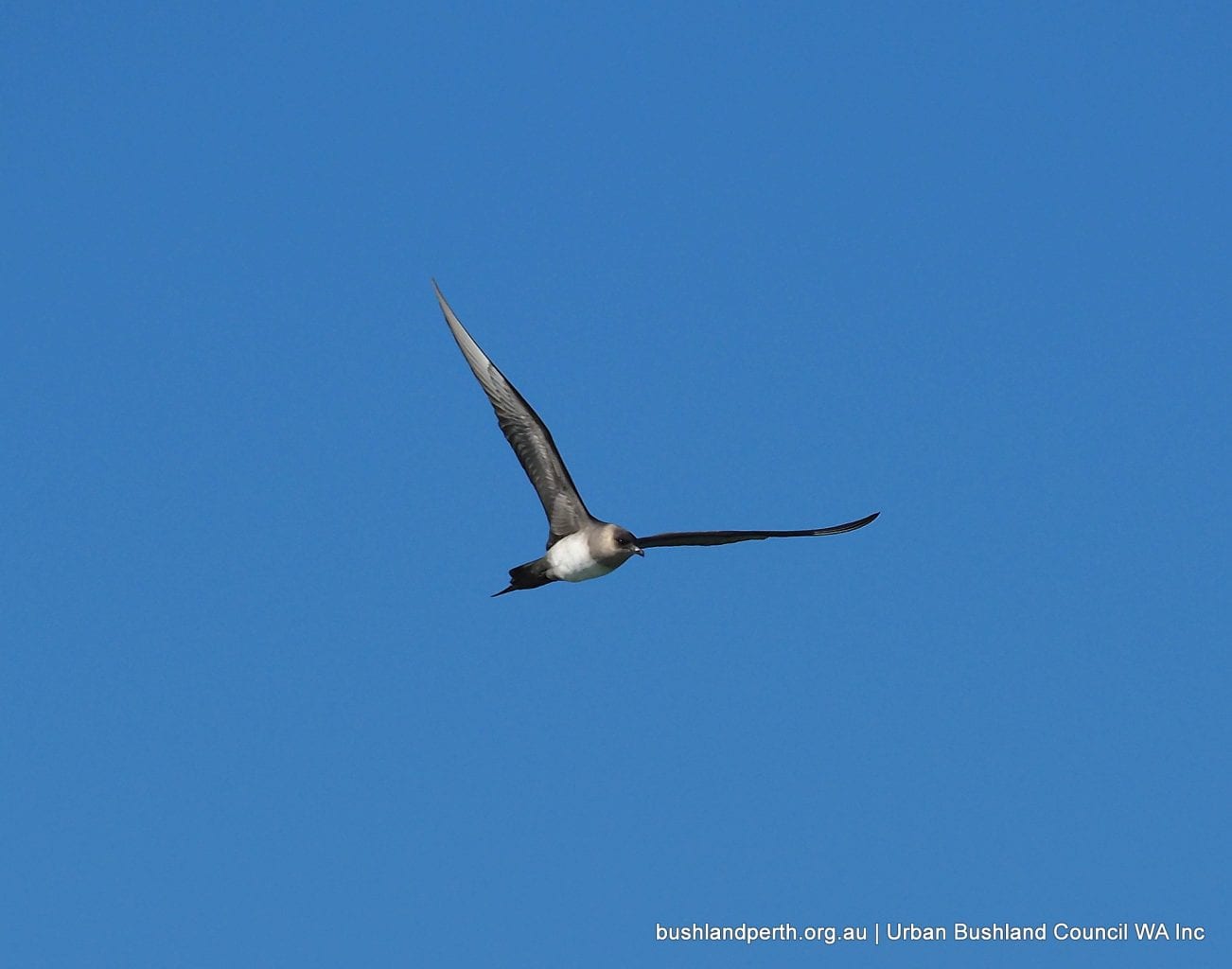
Trans-equatorial migratory birds are regular November to April visitors in low numbers including Grey Plover, Red-necked Stint, Ruddy Turnstone; also occasionally seen are Grey-tailed Tattler, Great Knot, Red Knot. These birds are listed under the Japan-Australia Migratory Birds Agreement, the China-Australia Migratory Birds Agreement, and the Republic of Korea Migratory Birds Agreement. Arctic Jaeger is frequently seen offshore in April on its return migration to Arctic regions.
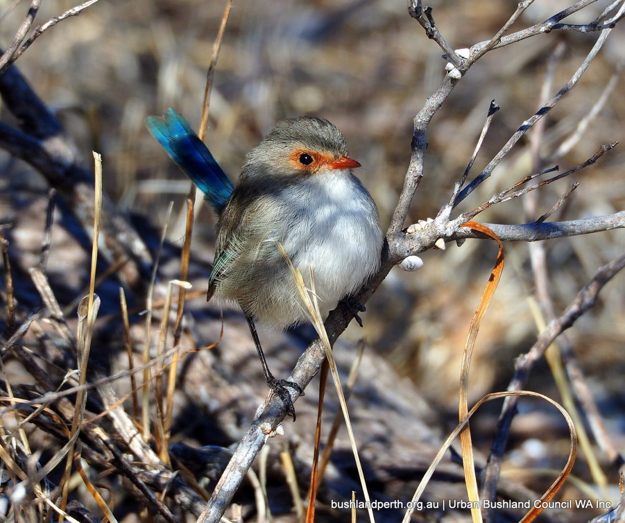
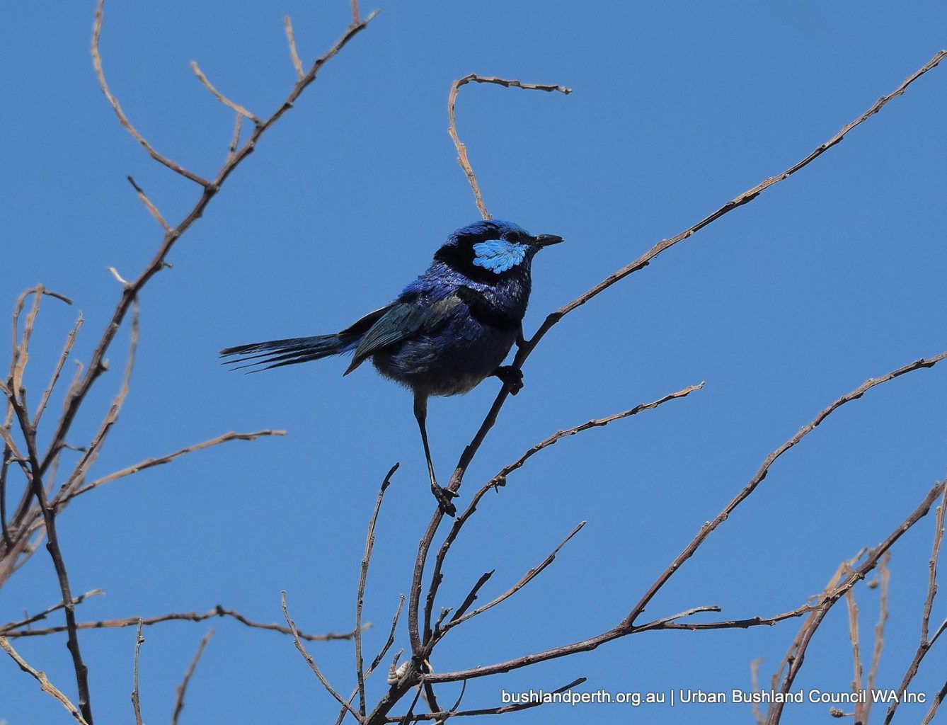
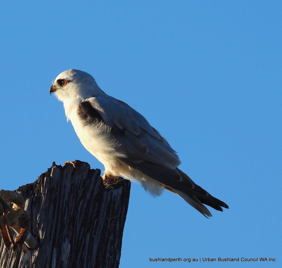
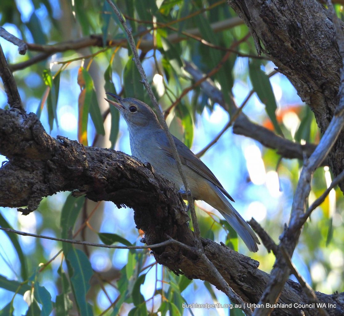
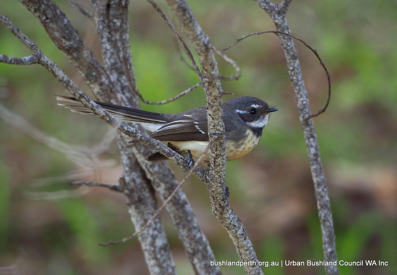
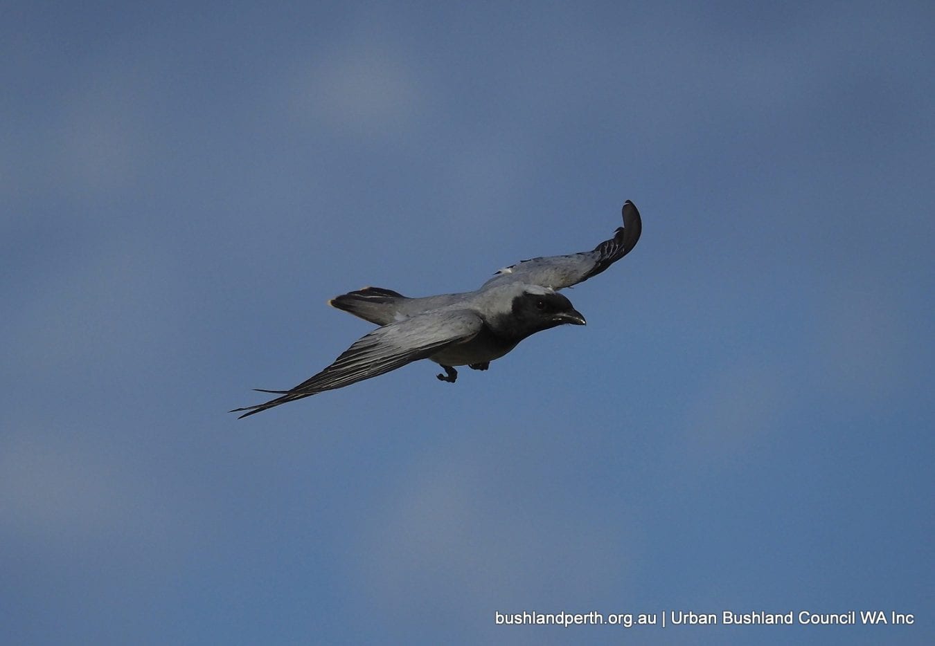
Bush-birds present in the Park include Weebill, Inland Thornbill, Spotted Scrub-wren, and Splendid Fairy wren. A population of Golden Whistlers is very significant owing to the scarcity of the species within bushland areas in Perth. The tall Tuart trees present at the Park also provide nesting sites for Brown Goshawks which breed infrequently on the Swan Coastal Plain.
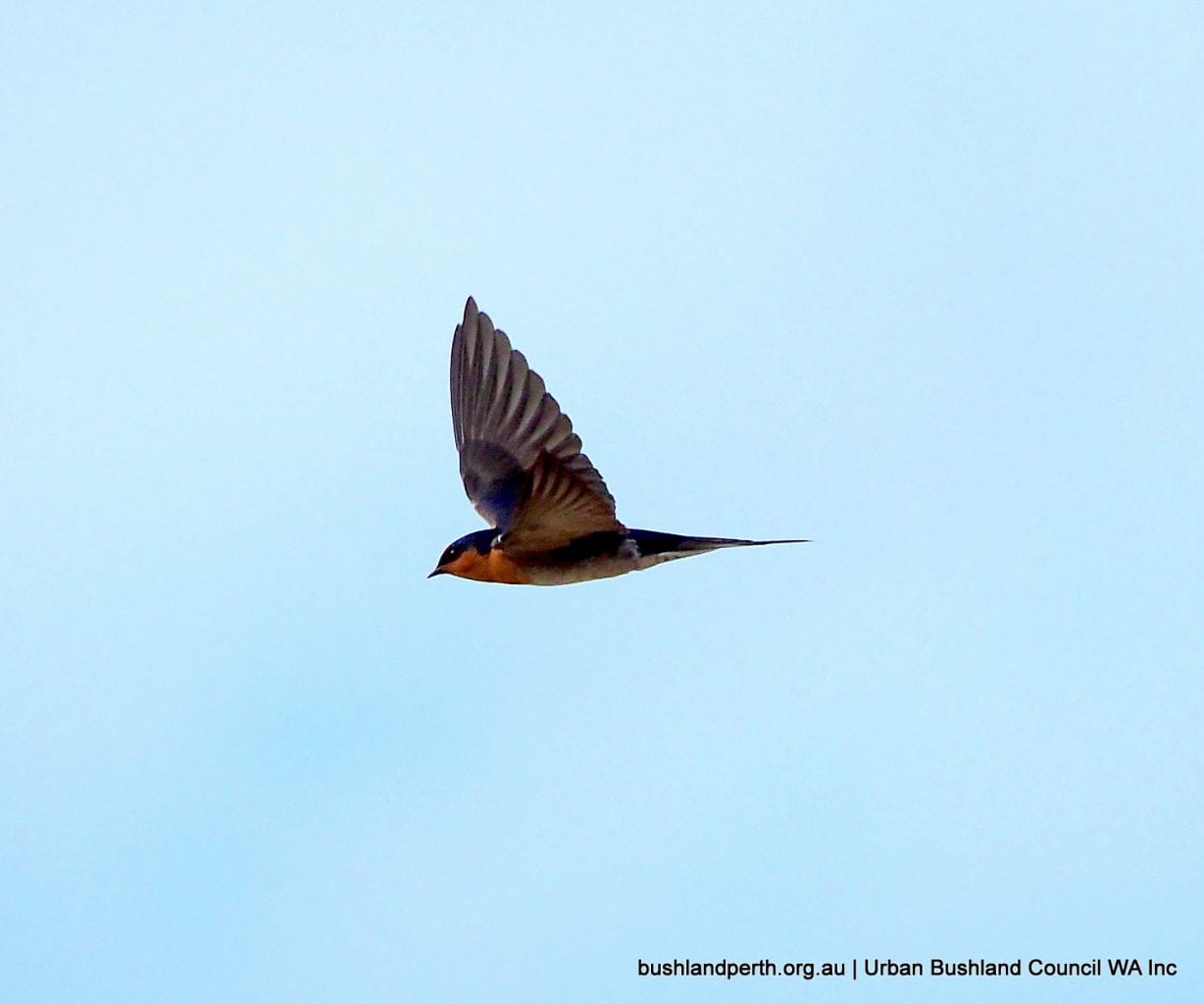
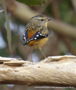
The birds depicted in the Gallery below were photographed at Woodman Point.
Landform
The Quindalup Dune System is the main geomorphic feature of the Park.
The landform of the Park is characterised by gently undulating coastal dunes and swales. The beach ridge formation that constitutes Woodman Point was formed during the Holocene period (over the last 7,000 years). Sand was preferentially deposited at Woodman Point where the shelter of off-shore islands and reefs reduced wave energy. Over time the triangular piece of land, called a tombola or beach ridge plain, was transformed into a promontory.
Cultural Heritage
There was a large Aboriginal presence in the Cockburn district during the early 1800s, prior to European settlement. Artefacts and rock engravings found in the district reflect the use of the land by Aboriginal (Nyoongar) people.
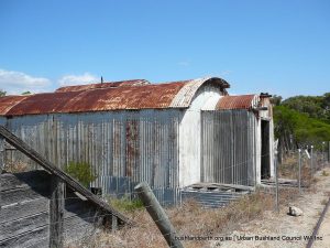
Woodman Point is also historically important for European settlement, and includes the former quarantine station, crematorium and gravesites, railway link to Fremantle, explosives magazines and jetty, as well as the naval shed and groyne.
The former munitions magazines and the former quarantine station (Woodman Point Recreation Camp) are permanently listed on the State Register of Heritage Places.
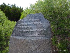
A granite plinth commemorates the historic failed Clarence Settlement venture of 1829, the year that Western Australia received its first British settlers. In that first year, 40 of the settlers died of scurvy, dysentry and other illnesses, and six from childbirth.
Recreational Values
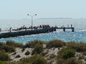
Woodman Point Regional Park is a very popular beach-side area that provides boating access to Cockburn Sound and Owen Anchorage. Picnic and barbecue facilities are extensive.
Source of Information
The material presented here is partly sourced from the Woodman Point Regional Park Management Plan 2010.
Bush Forever Site Map (Download). Bush Forever Description (Download). Bush Forever Species List (Download).
Rockingham Lakes Regional Park is a network of environmentally significant lands containing coastal, wetland and upland ecosystems. It crosses the unique Rockingham-Becher Plain, from the coastal promontories of Cape Peron and Port Kennedy, to the wetlands of Lakes Cooloongup and Walyungup.
This area is significant for its geomorphic landforms because the distinct parallel sand ridges indicate the positions of former shorelines, providing a record of sea level changes over the past 7,000 years.
Wetlands have formed in between the sand ridges, and these are also significant because they form part of an evolutionary time sequence and support unique vegetation communities.
The Becher Point Wetlands are listed as wetlands of international significance under the Ramsar Convention.
The park also contains significant flora and fauna, including two ‘threatened ecological communities’: sedgelands in Holocene dune swales and thrombolites at Lake Richmond.
In addition, the woodlands and wetlands around Lake Cooloongup, Lake Walyungup, Tamworth Hill, Tamworth Hill Swamp, Anstey and Paganoni Swamps are important remnants of ecosystems that were once widespread on the Swan Coastal Plain.
This Park is set in a rapidly growing urban area and contains a great range of superb walking and nature appreciation opportunities.
Vegetation
The vegetation communities in the Park represent a sequence from west to east; from coastal shrubland, permanent and ephemeral wetlands, to Quindalup woodlands including stands of tuart, jarrah and marri. This diversity of vegetation has high conservation value.
The wetland ecosystems of the Park serve as a refuge for a diverse bird population, including transequatorial migratory birds that are protected under international agreements and the EPBC Act 1999. See ‘resources’ for comprehensive eBird birdlists.
Endangered Carnaby’s Black Cockatoos have also been sighted in the Park.
Seven Key Areas of Rockingham Lakes Regional Park
There is a wealth of excellent walking in this Park – Refer to pp 73-76 of Appendix A of the Rockingham Lakes RP Masterplan In particular, Cape Peron and Lakes Cooloongup and Walyungup offer a wide diversity of habitats.
Caution: The walks are graded as easy. However, the two Lakes walks in particular comprise a series of track options and are not signed. Care needs to be taken to avoid becoming lost.
Cape Peron
Cape Peron is remarkable for its breadth of coastal recreation opportunities and its scenic views. It is a Bush Forever site and is bounded on the south by the Shoalwater Islands Marine Park.
The exposed southern shore of the Cape combines rugged limestone cliffs and reefs with sandy beaches, while the northern shore is more sheltered.
The Cape’s accessibility and high scenic value make it a favourite sightseeing destination, plus other popular activities such as fishing, walking, diving, swimming and windsurfing. Cape Peron has a fragile coastal environment that can pose risks for visitors.
Lake Richmond
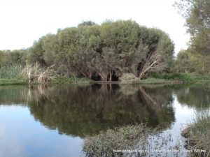
Lake Richmond is a perennial freshwater lake that is perched about one metre above sea level, and is up to 15 metres deep. The Lake evolved from a marine embayment and historically contained saline water. Lake Richmond is an an important ecosystem for thrombolites and waterbirds. It is a Bush Forever site. Lake Richmond is excellent for walking, bird watching and nature observation. A walk trail borders part of the lake, and leads to a boardwalk on the northern shore.
Picnic tables and a barbecue are located in the north-west corner of the reserve.
Lake Cooloongup
Lake Cooloongup is a visually and spatially dominant feature of the Rockingham landscape. It is a Bush Forever site.
Lakes Cooloongup and Walyungup are both shallow, saline lakes that were once connected to the ocean. The water levels in both of these wetlands are dependent on groundwater flows and rainfall, with depths ranging from 0.5 to 3.5 metres (the deepest areas being in the permanent pools of Lake Walyungup).
The lake, with its sparsely vegetated margins and surrounding woodlands, offers opportunities for trail-based recreation in a natural setting of high scenic quality. There are informal walking tracks through the woodlands north and west of the lake with pedestrian access gates at several locations on the reserve perimeter.
The Google Earth image placemark (see images below) is sited at the southern gate on Safety Bay Road.
Lake Walyungup
Lake Walyungup is an extensive landmark, highly visible from adjoining roads and the Perth – Mandurah Railway. It is a Bush Forever site.
As urban development in the area continues, it will likely be an important remnant rural landscape. The north-east corner of Lake Walyungup is cleared, former farm land.
The Google Earth image placemark (see images below) is sited at the pedestrian access gate is on the reserve northern Safety Bay Road perimeter.
Tamworth Hill and Tamworth Hill Swamp
Tamworth Hill is located immediately east of Lakes Cooloongup and Walyungup and east of Mandurah Road.
The Tamworth Hill area is notable for its diversity of landform and vegetation. At 76 metres Australian Height Datum, Tamworth Hill provides for scenic viewing and a short stretch of strenuous walking. The relatively good condition of the Tamworth Hill woodlands, as well as the presence of a significant kangaroo population, offers opportunities for nature study.
Anstey and Paganoni Swamps
Anstey and Paganoni Swamps are located south of Port Kennedy and east of Mandurah Road. Both are Bush Forever sites.
Anstey Swamp is a densely vegetated area that is visible from Mandurah Road. The inaccessibility of the Swamp enhances its natural character. Paganoni Swamp incorporates a variety of landforms and vegetation communities, making it an interesting and attractive bushland setting.
Port Kennedy Scientific Park
Port Kennedy Scientific Park contains a sequence of geomorphic and wetland features that provide a record of sea level and shoreline changes and wetland evolution.It includes the Becher Point Wetlands Ramsar Site. It is a Bush Forever site.
The Park has been reserved for the purpose of conservation of flora and fauna. Scientific research, science education and low impact recreation are consistent with the requirement to protect the wetlands and are considered suitable uses for this area.
Resources.
Lake Cooloongup, Lake Walyungup and Adjacent Bushland, Hillman to Port Kennedy are Bush Forever reference sites.
Bush Forever Lakes Site Map. Bush Forever Lakes Description. Bush Forever Lakes Species List.
Bush Forever site descriptions for the other locations are here.
The material presented on this webpage is largely sourced from the Rockingham Lakes Regional Park Management Plan.
Birdlists: Cape Peron Lake Richmond Lake Cooloongup Lake Walyungup Tamworth Hill Paganoni Swamp Port Kennedy Scientific Park Port Kennedy/Long Point
The Queens Park Regional Open Space (map download) is 12 kilometres south of the Perth CBD along Welshpool Rd in Queens Park, Welshpool and East Cannington and contains 19ha of remnant of Banksia/Marri bushland.
It is located on the eastern part of the Swan Coastal Plain where alluvial clays originating from the Darling Plateau meet grey Bassendean sands blown in from the west. This soil type supports the Southern River Vegetation Complex and is the last remaining reserve of this type in the City of Canning. All of the bushland in the Queens Park Regional Open Space has been given bush forever status; recognising the importance of retaining Southern River Vegetation Complex bushland and its conservation value.
A wetland has been constructed near to Station St, East Cannington, from a Water Corporation drain surrounded by highly degraded land. Not only does this provide a solution to excess water runoff, it also provides a habitat for local wetland animal species. An island was left in the lake and this has been used by swans to nest and raise their young.
Values
There are walking tracks through two easily accessible areas of bushland; one can be accessed from Wharf St, Queens Park, the other from Station St in East Cannington. Both of these areas hold beautiful, species-rich vegetation, including rare and endangered and priority flora. While spring is the most spectacular season for wildflowers, there is something special to be found all year round.
More than 200 native plant species have been identified in these two areas of bushland. And new species are being added to the list every year. More than 60 bird species have been observed; with the endangered Carnaby’s Black Cockatoo using the area to feed and the migratory Rainbow Bee-eater nesting.
The Queens Park Regional Open Space contains the Bush Forever sites: #283 Queens Park Bushland and #424 McDowell St Bushland.
Access
Access is easiest from Station St between Welshpool Rd and Luyer Ave.
Source of Information
Courtesy of Friends of Queens Park Bushland.