Lesmurdie Falls

Lesmurdie Falls - Mundy Regional Park.

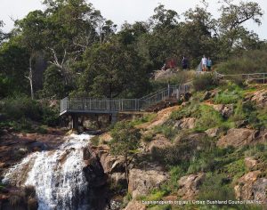
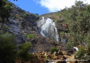
Lesmurdie Falls in winter and spring is one of Perth’s most popular leisure destinations.

Stunning views over the Swan Coastal Plain are available from lookout platforms which are a short walk from the picnic area on Falls Road.

The main picnic area (above the head of the Falls)  contains a large car park, three large picnic tables with shade, toilet facilities and rubbish bins.  Disabled access is available to toilets and picnic tables. The lower level carpark has basic picnic facilities only.


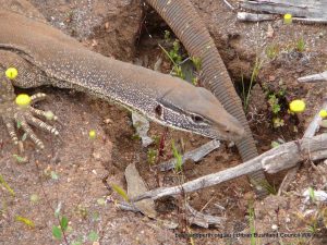
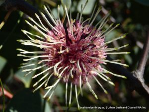
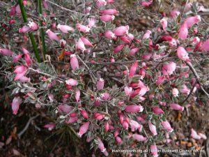
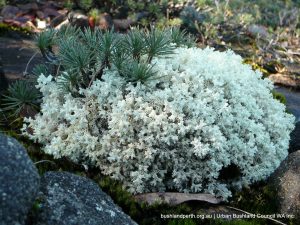
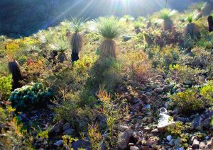
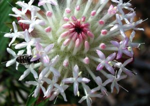
The area is especially popular in Spring when the falls are flowing and wildflowers are on display.

Several walk trails are available from here of varying degrees of difficulty, Including:

Lesmurdie Falls - Mundy Regional Park.

The Falls Trail. 640m return, Class 2, allow 30 min.

The Shoulder Trail. 1.5km return, Class 3, allow 1hr.

The Cascade Trail. 300m return, Class 3, allow 30 min.

The Foot of the Falls Trail. 2km return, Class 3, allow 1hr.

The Valley Loop Trail. 3km return, Class 3, allow 2hrs.

Please take your own drinking water as there is none available at this site. (Information above is adapted from the DPaW website).

Resources

Trails WA has extensive information on Lesmurdie Falls walks.

Visit the Life of Py page.

Visit the Weekend Notes page.

eBird birdlist.

Access

The main access to the upper Falls is via Falls Road as shown on the map. However the bottom of the Falls can be easily accessed from Palm Terrace, at the end of which lies the lower level picnic area. Refer to main Park signage image.


Wandoo Heights Nature Reserve

Wandoo Heights – A Pocket History

Wandoo woodland.

Wandoo Heights is an absolute delight in springtime!

This property is a unique bush landscape on the Darling Escarpment situated 13km from Midland, comprising two lots totaling 22 hectares. Wandoo Heights is part of an original block of 4,000 hectares on the Upper Swan, granted in 1830 to George Fletcher Moore the Advocate General for the Swan Colony.

Because of its general unsuitability for farming, Wandoo Heights was not cleared in the early days thus much is still in its virgin state, as would have been observed by the early botanists in the 1820’s. In 1960 the property was acquired by Miss Olive Gear and Mr Harry and Adela Hyde. Unfortunately Mr Hyde drowned two years after the purchase of the property.

Undaunted, with the help of volunteers, Olive and Adela maintained the property in its pristine condition whilst at the same time improving access to enable the extensive range of wildflowers to be observed without damaging the environment.

Silky Hemigenia.In 1988 the property was entrusted to the City of Swan as it was becoming too difficult to manage effectively. The deed charges the City with maintaining Wandoo Heights as a flora and fauna reserve for present and future generations.

Dieback has recently been identified in Wandoo Heights. Prior to entry ensure all vehicles and footwear are free of soil. Please keep to the paths, take only photographs leave only footprints.


Source – City of Swan Brochure –   Wandoo Heights Walk Trail.

Wandoo Heights has been identified as a key component of a future Darling Ranges Regional Park.

Access

Access to Wandoo Heights is controlled via locked gates. To have the gates opened, contact the City of Swan on 9267 9267.

Serpentine National Park

Gould's Goanna.

Serpentine National Park is located on the edge of the Darling Scarp, 49 km south east of the centre of Perth and 28 km inland from Rockingham and to the east of the South West Highway. It is a Bush Forever site. Download the Serpentine NP Bush Forever site description here.

The Serpentine River and its tributaries flow through and drain much of the Park.  Normally the Serpentine River, Gooralong Brook and Carralong Brook remain flowing all year round, while all other streams generally flow from May to November.

The Serpentine Falls waterfall is a key feature of the Park and lies within an incised valley at the base of the Darling Scarp, on the western edge of the Park.

Enclosed forests, the spectacular grandeur of the deeply incised Serpentine River valley, panoramic vistas over the Swan Coastal Plain, granite outcrops, open woodlands, rock pools combine to make the area attractive to visitors. Great bush walking opportunities abound; in particular the Kitty’s Gorge walk, and Gooralong Campsite provides a very pleasant camping environment at the Jarrahdale end.

Landforms

Sea Urchin Hakea.

Serpentine National Park is sited on the western edge of the Darling Plateau, an ancient plateau composed mainly of granite rock with dolerite intrusions and capped with laterite. Past weathering has created a number of distinct landscapes, namely lateritic uplands, minor valleys, major valleys and scarps.

The landscapes can be grouped into landform mapping units based on topography. The Park’s soils are influenced by the granite bedrock and physical geological processes.

Within the Park, the soils are sharply divided into those that are developed on site from either dolerite or granite. Plant communities are closely linked to landforms and soils.

Vegetation

One of the Park’s most distinguishing features is its diverse vegetation structure, ranging from jarrah-marri forest to wandoo woodlands, scarp heath lands and specialised granite outcrop communities. The vegetation complexes at the edge of the Darling Scarp and the Swan Coastal Plain are of particular interest as they continue to be under threat from urban and rural development outside of conservation areas.

Dramatic seasonal changes occur to the Park’s natural and surrounding landscapes: the spectacular wildflower display of spring, the golden browns of the dry pastures contrasts with the grey green of the forest during summer, and the greening of autumn grasses after the first rains. Winter rains turn the dry stream beds and the trickle of the Serpentine River to a foaming torrent below the towering granite outcrops.

Birds at Serpentine National Park

Forest Red-tailed Black Cockatoo.

Of the 100 bird species known to occur on the Darling Scarp, over 70 have been recorded within the Park.

Carnaby’s Black-Cockatoo (Calyptorhynchus latirostris) and Baudin’s Black Cockatoo (C. baudinii) are threatened species declared to be specially protected under the Wildlife Conservation Act 1950.

Access

The major access route to the Park from Perth and the south-west of the State is by the South West Highway, which runs just to the west of the Park, along the base of the Darling Scarp.  The Park can then be accessed from either the Serpentine Falls end of the Park, from Falls Road off the South Western Highway (just south of Mundijong Road), or at the Gooralong Campsite end via Jarrahdale. It can also be accessed using the ‘Jarrahdale Scenic Drive’ which follows Jarrahdale Road and Kingsbury Drive. See p34 of the Management Plan (see below) for details.

Source of Information.

The material presented here is sourced from the Department of Environment & Conservation’s Management Plan:  Serpentine National Park 2000 – 2009.

John Forrest National Park

Astroloma serratifolium - Kondrung.

John Forrest National Park is one of Western australia’s oldest reserves, having been established in its earliest form in 1900. The park is located on the edge of the Darling Scarp, adjacent to the Great Eastern Highway, 25 km from the CBD of Perth and is accessed from the Great Eastern Highway.

Jane Brook flows through the centre of the park, and from vantage points, the edge of the Darling Scarp can be seen dropping away to the coastal plain.


Most of the park is laterite, but where streams have cut into the surface, rounded outcrops of granite or the more angular dolerite can be seen.

The Park is described in more detail here.

Vegetation

John Forrest National Park is set in jarrah forest still largely in its natural state. It is a Bush Forever site.

The uplands are dominated by jarrah and marri. The valley floor features flooded gum, swamp peppermint and paperbarks. On the valley slopes two smooth-barked trees, wandoo and powderbark, intersperse with jarrah and marri.  Smaller trees include bull banksia, sheoak and snottygobble.

The woodlands and forests of the slopes and scarp edge contain a rich understorey with calothamnus, hakeas, grevilleas, dryandras, pimelias, myrtles, sundews, trigger plants, acacias, kangaroo paws and blue lechenaultia.

A common feature of the park is its granite outcrops fringed by heaths. As the soil becomes shallow, annuals and herbs abound, with sundews, orchids and resurrection plants growing through the moss swards.

Conservation Values

Borya on Lichen.

John Forrest National Park is very important for conservation and includes a range of flora and fauna where species are gazetted as threatened and where other species are limited in their distribution.  The flora and fauna are representative of the ecological ecotone between the Swan Coastal Plain and the Darling Plateau.

Download the  JFNP Flora and Fauna Guide.


Recreational Values

John Forrest National Park has significant cultural and recreation value to the community.  It is an area rich in Aboriginal culture and also has significant heritage value for the State with relics associated with the east-west rail route including the tunnel, bridges, embankments and station remnants.

John Forrest National Park has many visitor faciliies and great walking opportunities abound; in particular the Eagle’s View Walk. Download the Park’s walk guide.

Sources of Information

The material presented here is largely sourced from the Department of Environment & Conservation’s Management Plan:  John Forrest National Park 1994 – 2004.     The Plan provides much greater detail than the brochure download available above.

Bush Forever Site Map   (Download)      Bush Forever Description (Download)    Bush Forever Species List (Download)

eBird birdlist.

The Friends of John Forrest National Park look after this place.

Ellis Brook Valley Reserve


Early morning.

Ellis Brook Valley is located twenty kilometers south east of Perth. It is a large area of natural bushland straddling the Darling Scarp.  The scenery is dramatic with rugged ridges each side of the valley. The ‘Sixty Foot Waterfall’ plunges from the top of the scarp after winter rains. The spring time wildflowers are diverse and spectacular. A large number of bird species can be found in the valley.


Park history and Values

Pimelea spectabilis.

Ellis Brook Valley is part of the Banyowla Regional Park. The name Banyowla (pronounced ban-yow-la), recognises Banyowla, a Nyoongar elder at the time of colonial settlement. The history of Banyowla’s people is linked with the name of Captain T.T. Ellis, recognised by the naming of Ellis Brook, which runs through the Valley. Ellis, the Superintendent of Mounted Police, died from injuries sustained in the infamous Pinjarra massacre of 1834, in which Banyowla’s people were involved.


Ellis Brook Valley is renowned for the richness of its flora and fauna with: 550 species of flowering plant, nearly 100 species of birds, 9 species of frogs, and 8 species of native animals.

Ellis Brook flows seasonally from about June to October, depending on rainfall. The best time for wildflowers is from August to October, but a visit at any time of the year will reward the keen observer.

Bushland Appreciation

Ellis Brook Valley has four great short walks ranging from easy to only moderately difficult: The Sixty Foot Falls trail, the Blue Wren ramble, the Eagle View trail, and the Easy Walk trail.

Links

Friends of Ellis Brook Valley

Source of Information

The material presented here is sourced from City of Gosnells Ellis Brook Valley Information Brochure.

Images are courtesy of Friends of Ellis Brook Valley.

Donations

Donations and support from the wider community help us to protect and campaign for our Urban Bushland.

Make a donation

newsletter Signup

Get the latest news and key events delivered to your inbox.

Become a Member

We are a peak environmental group in WA. One of our key strengths is our amazing group and individual members.

Become member
Location

Urban Bushland Council WA Inc

2 Delhi Street, West Perth, WA, 6005

(08) 9420 7207 (please leave a message)