Mundijong Road and adjacent Reserves

Mundijong Road Reserve

Bobtail Skink

Mundijong Road Reserve is unique. Comprising 36 hectares only, it is nevertheless twelve kilometres long! This highly unusual long, narrow composition has resulted from its history as being part of the original railway alignment between Jarrahdale and Rockingham which served the Jarrahdale timber cutting and milling operations until the 1940s.

The line, built in 1872, was decommissioned in the 1950s and the rails and sleepers removed, this part of the alignment being re-allocated to the conservation estate and being allowed to revegetate.


Extending from Duckpond Reserve, a small triangular bush remnant at its western end, to Watkins Road Nature Reserve to the east, the Reserve provides an extensive and rare vegetation transect of the Perth Coastal Plain lying over the Bassendean Sands soil formation.

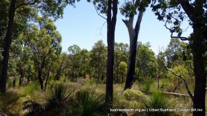
Unfortunately, being so narrow, and lying in a sea of agricultural properties, the Reserve is significantly impacted by weed invasion at many points. Nevertheless, in many parts of its length the original vegetation is substantially intact and, as such, provides a key reference to the original vegetation which lay across the Sands, in an area where now so little original structure remains. The vegetation here is dominated by tall Marri (Corymbia calophylla) with an understorey of banksia and rich low heath. The best condition vegetation in the Reserve extends east from Kargotich Road. Weed invasion is now being held at bay by the untiring efforts of the Serpentine Jarrahdale Landcare Group.

From the Management Plan

Kingia - Cardup Reserve.

The Reserve has extremely high conservation, scientific and educational values. Namely:

Recognised as being one of the only two intact transects of native vegetation that span the various plant communities that run east-west across the Swan Coastal Plain.

Duckpond Reserve is the only ‘Boyanup’ soil type with remnant vegetation remaining on the Swan Coastal Plain.

Contains four threatened ecological communities. Two of these are ranked as Endangered.

These community types and the generally intact condition of the vegetation afford the reserve regional significance and the reserves are a Bush Forever site.

The reserve together with Soldiers Road Flora Reserve form a corridor of bushland from Byford to Duckpond Road and also connect with Byford to Serpentine Rail/Road reserve (Bush Forever sites 350 and 365), increasing its significance as a conservation reserve.

Contains ten species of threatened plant taxa, 74 taxa that are characteristic of the eastern side of the Swan Coastal Plain and at least 12 taxa that are endemic to the eastern portion of the plain. 

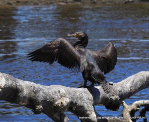
The reserve has recreation value for activities such as walking, bird watching and picnic site and is part of a Flora Road Circuit.

Watkins Road and Cardup Nature Reserves, and Brickwood Reserve

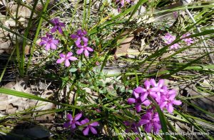
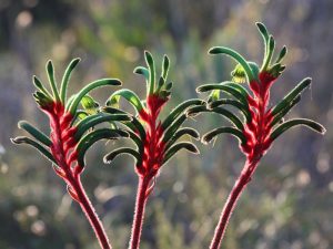
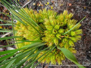
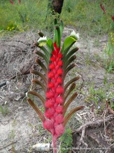
These are also relatively small in area, between about 40 to 80 hectares each, but each holds large patches of excellent condition vegetation within their boundaries. They are a delight to walk in springtime with superb displays of flowers in season. Each contains the critically endangered community `Marri – Corymbia calophylla – Kingia – Kingia australis woodlands on heavy soils , Swan Coastal Plain` association; listed under the EPBC Act.

A series of Marri dominated plant communities (such as this community) occur on heavy soils between  Capel and Guildford. These communities are considered to have been some of the most extensive on the eastern side of the Swan Coastal Plain, but have suffered extensive clearing and are now regionally rare.

Brickwood Reserve is located on the edge of Byford, the main urban centre of the Shire of Serpentine – Jarrahdale. It is a popular recreation node within the Shire and it contains the Serpentine – Jarrahdale Recreation Centre. The Reserve is also recognised as having significant environmental features, including being a Bush Forever Reference Site and containing one of the largest and most intact examples of the critically endangered threatened Marri – Kingia ecological community, protected under Federal and State policies, on the Swan Coastal Plain.

Watkins Road and Cardup Nature Reserves are similarly located near the South Western Highway, west of, and close to, a major rail link. Their values are equally as strong as those identified for Mundijong Road, but they provide, as does Brickwood, better walking and nature observing opportunities.

Vegetation

Species unknown.

Structurally, the Reserves are characterised by:  

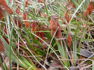
Uplands: Woodlands dominated by Marri – Corymbia calophylla and/or Jarrah – Eucalyptus marginata; Candle Banksia – Banksia attenuata, Firewood Banksia – B. menziesii and Bull Banksia – B. grandis. Woodland to Open Forest with scattered to co-dominant Western Woody Pear – Xylomelum occidentale and Christmas Tree – Nuytsia floribunda; Dwarf Sheoak – Allocasuarina humilis, Candle Hakea – Hakea ruscifolia, Buttercups – Hibbertia hypericoides low shrubland

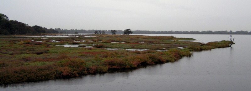
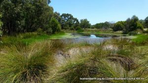
Wetlands and damplands: Moonah – Melaleuca preissiana low woodland; Swishbush – Viminaria juncea and Two-leafed Hakea – Hakea trifurcata tall shrubland,  Semaphore Sedge – Mesomelaena tetragona and Hypolaena exsulca sedgeland. Pericalymma ellipticum closed heath; Pithy Sword sedge – Lepidosperma longitudinale sedgeland.

Bush Forever

With Mundijong Road Reserve, these are Bush Forever Reference Sites (sites 321, 352 and 360 – follow the link for maps, species lists and site descriptions).

Resources

Brickwood Reserve Management Plan.

Mundijong Rd Reserve and Duckpond Reserve Management Plan.

Marri – (Corymbia calophylla) – Kingia (Kingia australis) woodlands on heavy soil – Interim Recovery Plan.

Access

Mundijong Road Reserve

Access anywhere along Mundijong Road.

Watkins Road Reserve

Access the walking track from the un-named road off Watkins Road, lying nearly opposite Rose Road. Refer to the map image below (Image Gallery) for access points.

Cardup Reserve

Enter at the Reserve trail head at the end of Redcliffe Road.

Brickwood Reserve

Park at the Recreation Centre and then walk to an area behind the BMX track (near the corner of the t-ball oval) to enter onto the firebreak. This will give  easy access throughout the northern portion of the reserve. There are also several minor access points  along the fence line adjacent to Turner Rd.  Please stay on the firebreaks as the area contains Phytophthora fungal dieback disease. There are no entries for access to the southern part of Brickwood.

Ken Hurst Park

Note: Ken Hurst Park is completely fenced and gated. Permission for access is not usually provided but the Friends of Ken Hurst Park occasionally conduct tours. Should you wish to join a walk please click on the link below for a KHP email contact.

Ken Hurst Park is a 53 hectare area of remnant bushland in Leeming bounded by  Roe Highway to the north; Leeming Road and Jandakot Airport to the south and the standard guage rail line through the centre.  It is about 20 km south of the Perth CBD and is accessed from Leeming Road.


It is a Bush Forever site. Download the KHP Bush Forever listing  here.

The Park’s landscape is Bassendean Sands of aeolian origin derived from the Bassendean Dunes geological unit and characterised by low dunes with fine to medium grained quartz sands, white to grey at the surface and yellow at depths and sandy inundated or waterlogged interdunal swales.

Bassendean sands are generally leached and quite infertile with shallow accumulations of organic matter in the swales and depressions.

Vegetation.

 The Park is extremely biodiverse with over 350 plants recorded across dryland and wetland landscapes.

The vegetation found on the ridges includes Candle Banksia (Banksia attenuata); Firewood Banksia (Banksiamenziesii) and Sheoak (Allocasuarina fraseriana).  On the dune slopes  are Candle Banksia, Firewood Banksia and Sheoak low open forest with scattered Prickly Bark (Eucalyptus todtiana) and Christmas Tree (Nuytsia floribunda).

The flats and wetland areas show a range of vegetation types.  There are areas of closed low heath consisting of Regelia (Regelia inops), Spiked Scholzia (Scholtzia involucrata), White Myrtle (Hypocalymma angustifolium), Spearwood (Kunzea ericifolia) with scattered Moonah paperbarks (Melaleuca preissiana).

There are also area of low woodland comprising Holly-leaf Banksia (Banksia ilicifolia) and a mixed open woodland consisting of Swamp Banksia (Banksia littoralis), Moonah, Christmas Tree and Jarrah (Eucalyptus marginata).

Other vegetation types include Moonah tall open scrub; a low open woodland of Moonah and Swamp banksia over Balga (Xanthorrhoea preissii) Shrubland and a mixed Banksia and Eucalyptus woodland.


Most of the bushland is in very good condition with smaller patches in the south-west and along the railway line in excellent or good condition.  The bushland supports a number of significant mammals including the Quenda and Western Brush Wallaby.  It also contains the largest population in the metropolitan area of the declared rare orchid, Caladenia huegelii and provides important habitat for endangered black cockatoos.

Access to Ken Hurst Park.

Note; Ken Hurst Park is completely fenced and gated. (refer here)  Permission for access is not usually provided but the Friends of Ken Hurst Park occasionally conduct tours. Should you wish to join a walk please click on the link below for a KHP email contact. 

Resources.

Sourced from Ken Hurst Park Management Plan – City of Melville.

Ken Hurst Park Management Plan Appendices.

Keith Lightbody’s Ken Hurst Park Image Gallery.

The Friends of Ken Hurst Park look after this Wonderful Place.

Hawkevale Bushland

The Campaign.

Prickly Conostylis.

This critical remnant bushland was preserved following an epic battle between environmentalists and ‘would-be’ developers in the mid 1990’s.

Excerpts from a talk by Vicki Laurie and Tony Fowler, Nature Reserves and Preservation Group, given at the UBC 2012  conference, outlining the campaign:

“Hawkevale Bushland is situated in the Perth foothills, near the corner of Kalamunda Road and the Roe Highway, in the High Wycombe area”.

Hawkevale Bushland had already been recognised as containing one of three most threatened plant communities remaining on the Swan Coastal Plain. There had been a DEP recommendation that 20 hectares, the best bush areas, needed to be conserved to maintain its environmental value”.

“The Urban Bushland Strategy has established a target of retaining 10% of the original bushland of each type of vegetation complex in the metropolitan area. It is estimated that only 8% of the vegetation type of which this land is part now remains.”

Winter Bell.

“Kings Park botanical expert Kingsley Dixon had noted Hawkevale’s remarkable plant diversity, including rare species, as “excellent to outstanding.” It was a “mini-Kings Park”, he said. He noted that a rare Smokebush, Conospermum undulatum, was growing all over the site. It was a declared rare flora (which means Minister’s permission is needed to clear land on which it lives)”.

“Ironically,  Hawkevale had “every conservation tick it could possibly get, and is identified by all government conservation agencies as deserving the highest priority for preservation. The government has set itself a target of saving a minimum of 10% of all bushland types in wider Perth; we are already below that here. And still Hawkevale can’t be saved in its entirety.”

“When the Hawkevale bushland has been recognised by every environment agency in government as worth preserving for posterity, it would be of great credit to your government if it could resolve the matter in favour of development on non-bush areas. So much native bush has been lost in the metropolitan area already; please help us conserve this beautiful twenty hectares“.

Mangles Kangaroo Paw.

“Today, Hawkevale is under the control of DEC, which does periodic work in it. A rare flora survey has just been completed. If you stand on a manicured lawn in the Hawkevale estate and look at the bush, it looks scruffy, neglected and uninviting – until you walk into it in spring. Kangaroo Paw stand shoulder high in thick colourful stands, in the midst of yellow Hibbertia, Lambertia multiflora, Star of Bethlehem (Calectasia narragara) and red Blancoa canescens. Some Banksia are several metres high and very old.

Read the complete talk here.

Hawkevale Bushland is a  Bush Forever site.

Bush Forever Site Description.

eBird birdlist.

Visiting Hawkevale.

Hawkevale Bushland is a Gem! However it suffers from undue road noise as it is located just under Roe Highway. So…the best times to visit the site would probably be during traffic quieter times such as public holidays and Sunday mornings.

Garvey Park River Walk

Great Cormorant.

This River walk along the south bank of the Swan River is a delight. Previously heavily degraded, adjacent environs have been, or are being, substantially rehabilitated. They usually abound with aquatic birdlife and the River shows its moods depending on the weather and time of day.

The walk featured here, between the Tonkin Hwy bridge and the formal Park grounds, is part of a much longer River shores walk.

Garvey Park River Walk is most easily accessed at the River end of Fauntleroy Ave.  However, an alternative access lies just west of the Tonkin Hwy bridge – see first Google-earth image in the Gallery.

From: City of Belmont: “Garvey Park is a major riverside reserve that contains significant areas of remnant foreshore vegetation and extensive revegetation areas. Limestone walk trails were installed in 2009 linking natural areas within the park. A history of environmental restoration projects is outlined below:

Coolgardie Drain to Living Stream and Garvey Park Floodplain

Coolgardie Drain to Living Stream and Garvey Park Floodplain is a Partnership project with Two Rivers Catchment Group, with funding received through the Swan Alcoa Landcare Program.
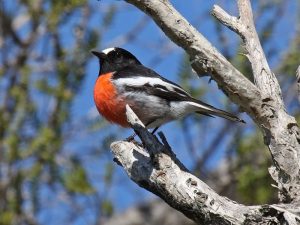
In 2001 and 2002, a 500 metre linear stormwater drain was converted into a living stream by sculpting and battering the banks to create a gentler slope and increasing the area available for wetland habitat. This also created the effect of a meandering stream, with open water areas to increase available fish breeding habitat and provide shallow areas for wading birds. 21,700 wetland and dryland trees, shrubs, sedges and rushes were subsequently planted in 2003.
Between 2004 and 2009, 4.6 hectares of floodplain was progressively revegetated with 70,900 tubestock, linking the Coolgardie Living Stream to a conservation category wetland to the south.
Carbon Neutral – Each year from 2005 to 2012, approximately 1,000 trees and 1,000 understorey plants were established as part of the Carbon Neutral Program. These trees sequester the equivalent amount of carbon generated by Council’s light vehicle fleet in one year. Over 4 hectares has been revegetated to date.

Part of the enhancement works.

Foreshore Stabilisation.   Partnership project with the Swan River Trust, with funding received through the Riverbank Program, Swan Alcoa Landcare Program, WAPC Area Assistance Grants and State NRM Program. Stabilisation works were implemented at Hilton Grove (Section 1) from 2009- 2011, involving  installation of a limestone rock revetment, coir logs and revegetation using local, native species.

Stabilisation works were completed at Section 4, a 200m stretch of foreshore extending upstream from Coolgardie Living Stream from October 2011- June 2012. Works included bank reprofiling, treatment of Acid Sulfate Soils, log brush mattressing, installation of erosion control fabric, rock rip-rap, placement of rocks and large woody debris and revegetation.

Garvey Park Created Wetland

A wetland was created in 2004 to capture stormwater from Tibradden Estate, improving water quality prior to it entering Coolgardie Living Stream and the river. The wetland provides important habitat for waterbirds and frogs”.
 Garvey Park has recently received a major facelift – view the new Masterplan here.

Activities

Garvey Park has extensive recreation facilities including play areas, BBQ’s and tables and benches.  A picnic would be a great base from which to undertake the walktrails available.  For instance, see walk option 1 and walk option 2.

Donations

Donations and support from the wider community help us to protect and campaign for our Urban Bushland.

Make a donation

newsletter Signup

Get the latest news and key events delivered to your inbox.

Become a Member

We are a peak environmental group in WA. One of our key strengths is our amazing group and individual members.

Become member
Location

Urban Bushland Council WA Inc

2 Delhi Street, West Perth, WA, 6005

(08) 9420 7207 (please leave a message)